World tour #2 – Days 52 – 70

Friday, 25 July, 2025 – Tuesday, 12 August, 2025

The route of days 52-70. We cycled 445 km and 10.800 vertical meters.

It was Friday morning, day 52; we were still in campground Sole in Turkey, and all of our luggage was neatly packed in boxes. We had two cardboard bicycle boxes, limited to 23 kilograms each, so we had to put a few heavier but smaller pieces (like pedals) into checked-in luggage. We had two cardboard boxes that we used for checked-in luggage, both limited to 23 kilograms, but we were way under the threshold, even after packing leftover weight from the bike boxes. Each of us had one of the side panniers as carry-on luggage—one was used for helmets and warm clothes, the other one for food and electronics. Finally, we both had small foldable backpacks as personal items on the plane. 

Since there wasn’t a direct flight from Istanbul to Quito, we had to take a transfer in Madrid and hope that all of our luggage would make it on the same plane. We bought airplane tickets 40 days in advance, and we paid around 800€ per person and 200€ per bike box (this was on the expensive side for the bikes; last year we paid 150€ per bike from Spain to California and 100€ from Mexico to Germany). We flew with AirEuropa, and we didn’t have any problems; the only downside was that the airplanes weren’t the newest.

At the campground we put all of the boxes in the camper van, and Primož’s parents took us to the airport, around 40 minutes away. Our flight was at 15:45, but we prefer to be early, so we were there at around 10 AM. We said our goodbyes and waved at the van as they left (they had almost a 2-day drive back to Slovenia ahead of them). We had to get an overpriced luggage trolley to put all of our boxes on, and then it was time to find out how wide all of the airport doors were on our way. 

What we saw for the first time was a security check before one could even enter the airport. They obviously weren’t looking for sharp objects or liquids, since we still had luggage for check-in with us, so it was probably for explosives and other dangerous items that are generally prohibited to take on the plane.

We had around 2 hours to spare before the check-in for our flight opened, and when it did, it was on the opposite side of the airport. Check-in went smoothly; we got our tickets for both flights (we could sit together only on the long-haul one), then we took all four of our boxes to the oversize luggage gate. After that, there was another security check, this one more thorough. Luckily we had our own food with us, because sandwiches there cost between 13 and 25 euros apiece.

Istanbul Airport.
Two cardboard boxes for bikes and two cardboard boxes for checked-in luggage.
We were two hours early at the airport.
Checking-in our lugagge and bikes; they all went to the special lugagge.
Nothing that some duct tape can't fix.
View from the airplane over France/Spain.

A bit over half an hour after going through security, the boarding started. Our first flight lasted 3 and a half hours, and we landed in Madrid at 18:30 locally. Our next flight was scheduled at 1:30 in the morning, so we had more than 6 hours before that boarding would start. Like last year, we had one Chipolo tracker (https://chipolo.net) that we put in one of the bicycle boxes, and it was telling us that at least that specific box arrived in Madrid. We just hoped that they all stuck together.

Strictly speaking, day 53 started while we were waiting for our second flight. Iris took a short nap on the airport bench, and when she woke up, the previously empty waiting area was full of people. It was more than half an hour before the boarding was about to start, and people were already forming a line to be among the first to board. When we saw how much luggage most people had as a carry-on, we joined them to not be among the last to board. We really didn’t want to have our bags with bike helmets or electronics checked in because there would be no more room in the overhead lockers.

At 1 AM we were sitting on the plane, and we had a hard time staying awake until the takeoff. Around 1 hour into the flight, we were woken up by the dinner serving (pasta or chicken?), then we went back to sleep. The whole flight lasted 10 hours and a half, and we slept until the last 2-3 hours. At 5:15 in the morning we landed at the Quito International Airport in Ecuador. Since our seats were close to the exit, we were amongst the first that got off the plane, and therefore we avoided the 45-minute wait for the passport check. But that didn’t matter much since we had to wait almost the same duration to get all of our luggage (luckily, all was there). The currency in Ecuador is the US dollar, and we paid 2$ to rent a luggage cart for the boxes.

Screenshot from Find Device showing Chipolo tracker in Madrid (with one of our bikes).
This is where special luggage came from at Quito airport in Ecuador.
2$ to rent a luggage cart.

We found a nice corner in the arrivals section of Quito airport, and there we started to assemble our bikes at 6:30. It took us 3 hours before we were ready to leave, and in the meantime, we were a nice entertainment for anyone who had a little bit of spare time. A few elderly gentlemen, in particular, approached us to take a look into the boxes. After we were ready, we packed all of the cardboard into one of the big boxes and threw it into a large container for trash outside the airport.

Going from sea level to 2300m in a day was a shock for us—the level of oxygen at that altitude is around 75% of that at sea level (see the graph below). As soon as we sat on the bikes, we were already breathing heavily, and we felt as if we hadn’t cycled for the last decade. And we were about to climb even higher from there.

We found a nice corner at the arrival section of Quito airport, and we assembled our bikes there.
Relative content of oxygen in the air at different altitudes, compared to the one at sea level.

We left the airport at 9:30 in the morning. Ahead of us was 50 kilometers and almost 1000 vertical meters to get to the hostel. Back when we made the reservation about a week ago, it seemed like a brilliant way to save 40$ for the ride to the hostel. When we sat on the bikes, not so much anymore. It took us over 6 hours to get to the hostel at 2850 meters. We started with a busy 2-lane road from the airport, then there was a nice bike path some of the way, which we really enjoyed, but the last part was complete torture. In the last 6 kilometers we climbed 500 vertical meters on a bad cobblestone road, and we had to push our bikes over half of that distance. We mostly blamed the lack of oxygen and low energy levels because we hadn’t eaten anything in the last 8 hours.

El Chaquiñán is a nice cycling route that follows an old railway to Quito.
Quito, the capital of Ecuador.
Many gates like this are located along El Chaquiñàn.
View up to Quito.
When we finally climbed up to Quito, the weather was completely different.

We finally got to the hostel at around 17:30, where we had a reservation for a private room for 3 nights at 25$ per night. It was a nice hostel with a common room (pool table, TV, kitchen, refrigerator), an outdoor garden (tables, chairs, hammocks, fitness), and a friendly owner and staff.

Colonial House Inn hostel in Quito.
And it's dinning room.
And a cozy garden.

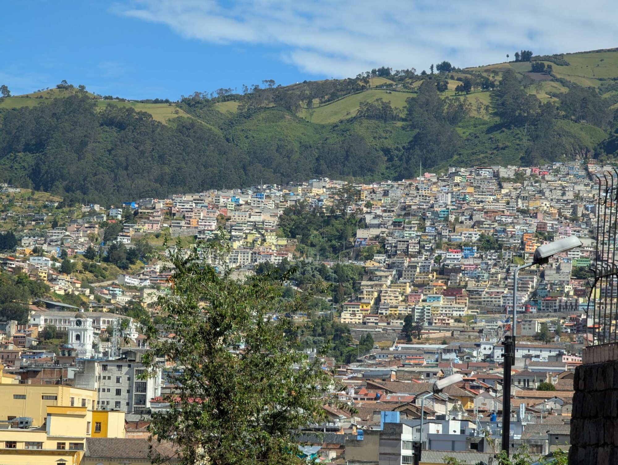
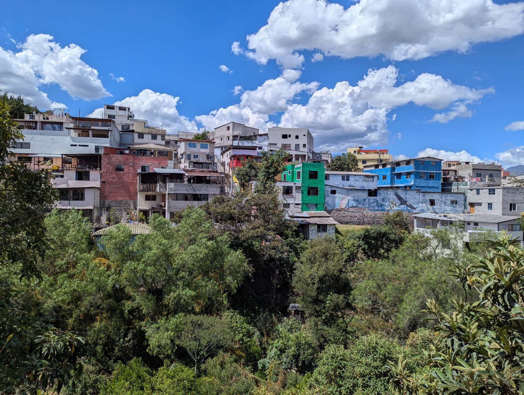
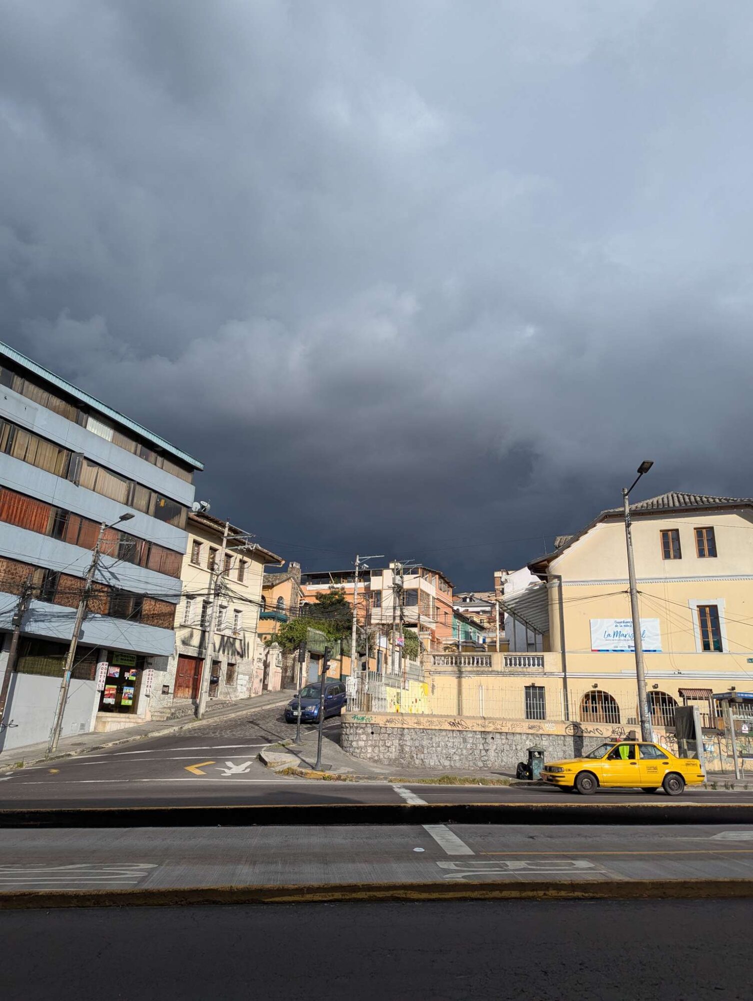
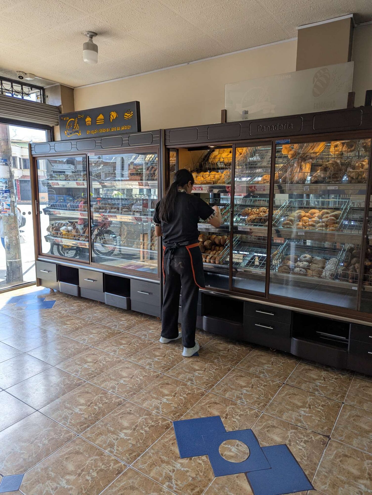
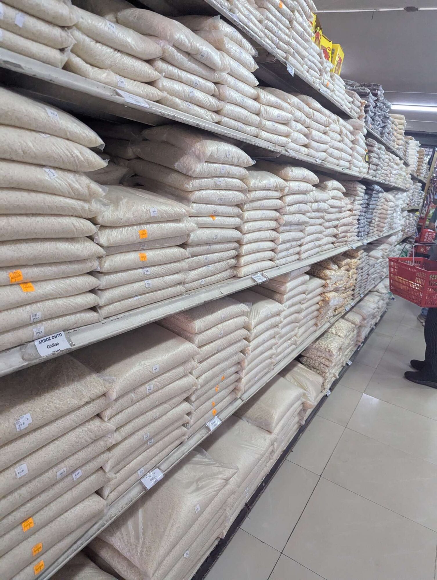
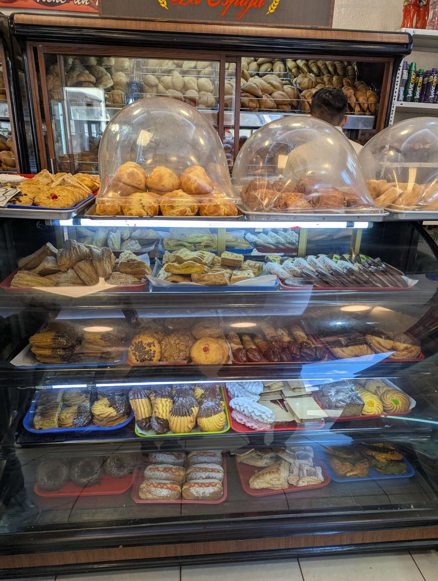
We fell asleep at around 8 in the evening. The following morning, on day 54, Sunday, we woke up between 5 and 6 AM. We slept around 10 hours. After breakfast we called family, then we went for a walk around the town center. We saw a lot of places that offered “Desayunos” (breakfasts), way more than we’ve seen anywhere else. Before we returned, we stopped in a shop to get some food for the next two days and at a market to buy some fruits. We were out of breath as soon as the road started to go uphill a little bit. We were happy that we had two days of acclimatization ahead of us before we started cycling again.

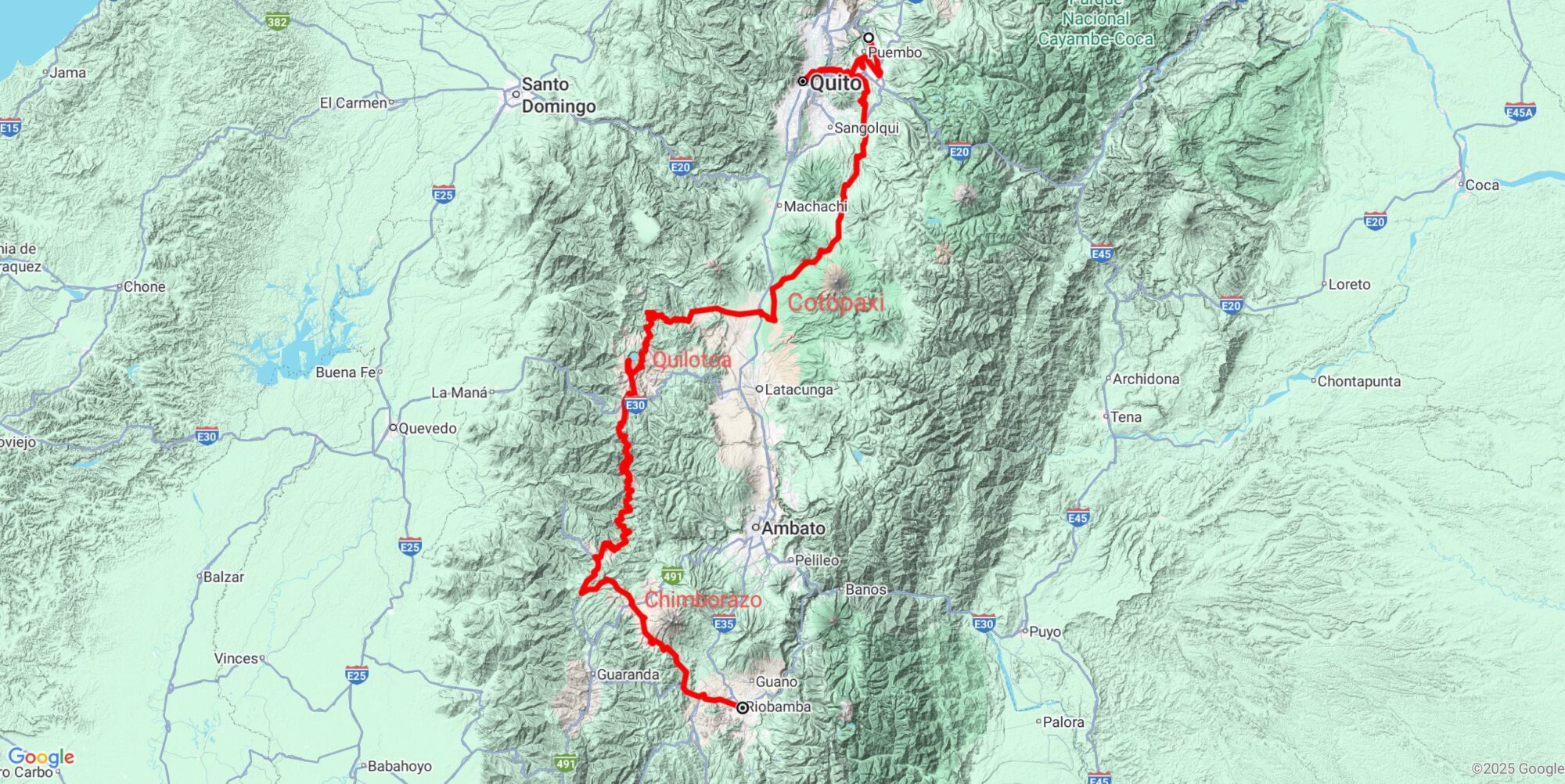
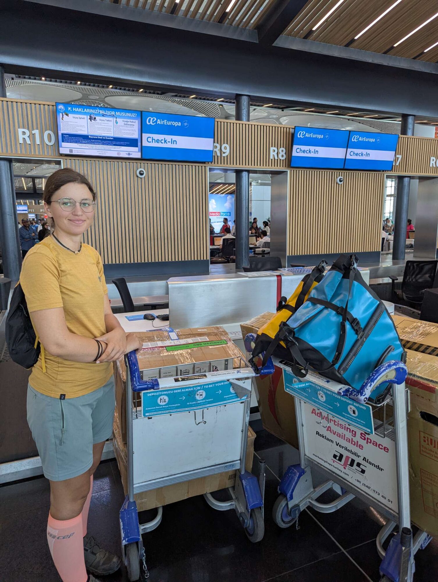
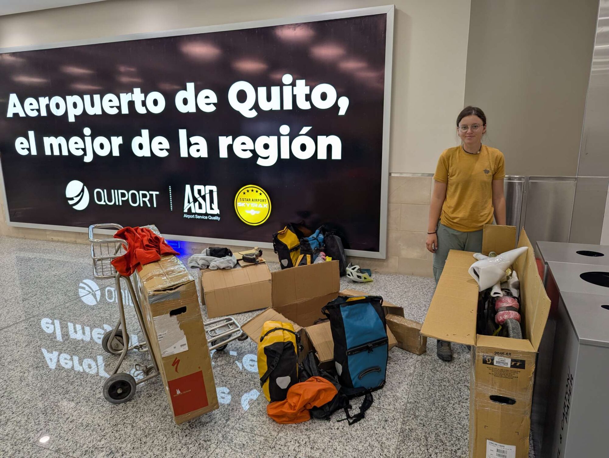
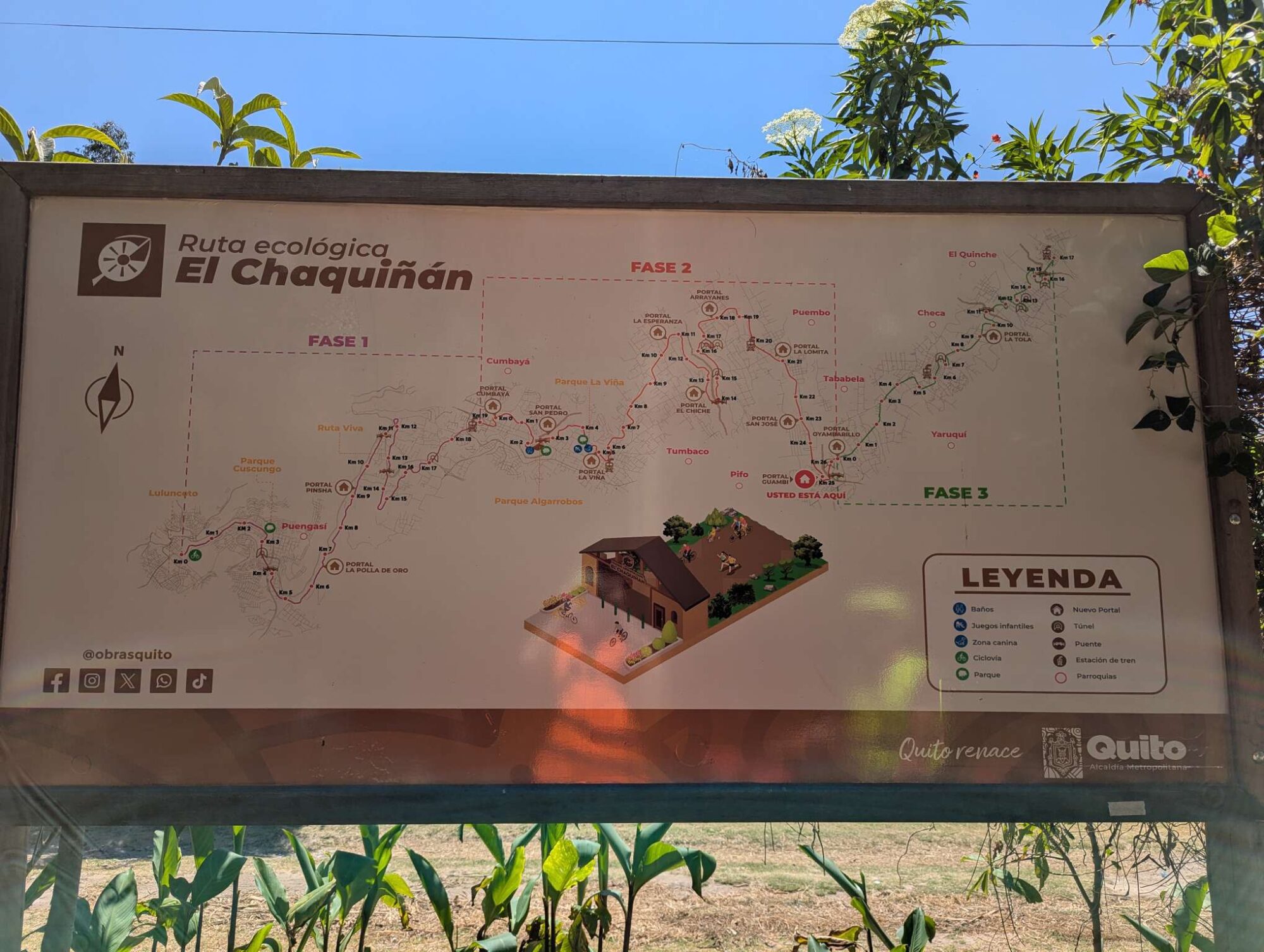
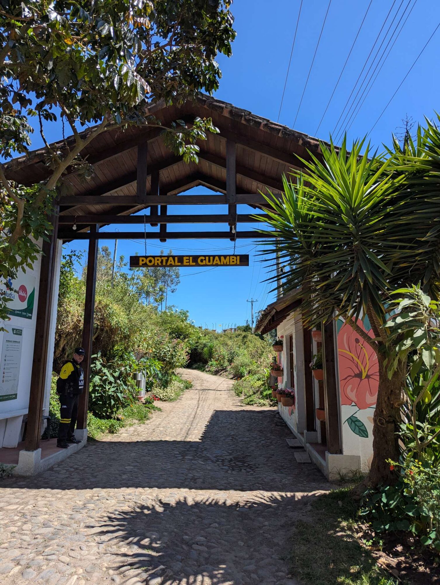
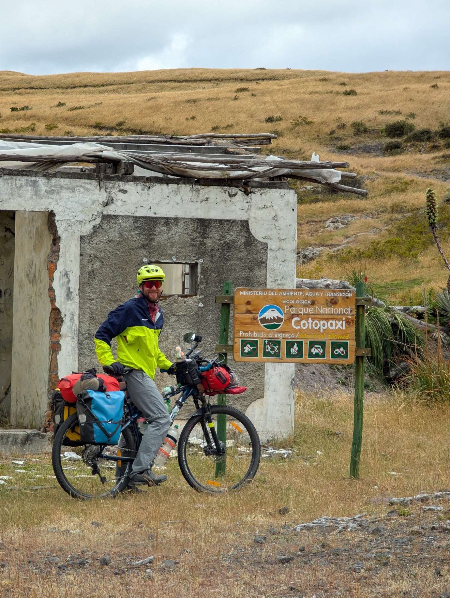
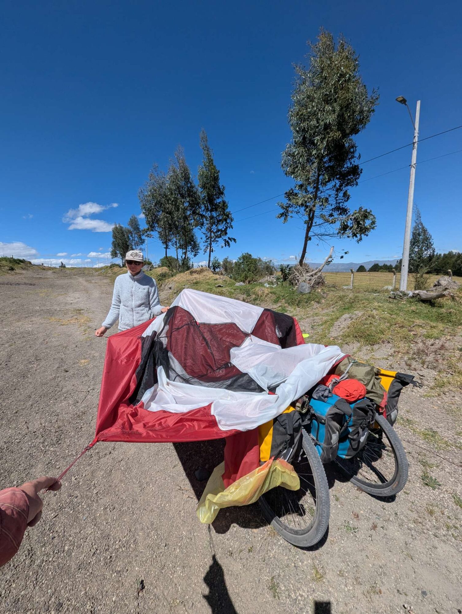
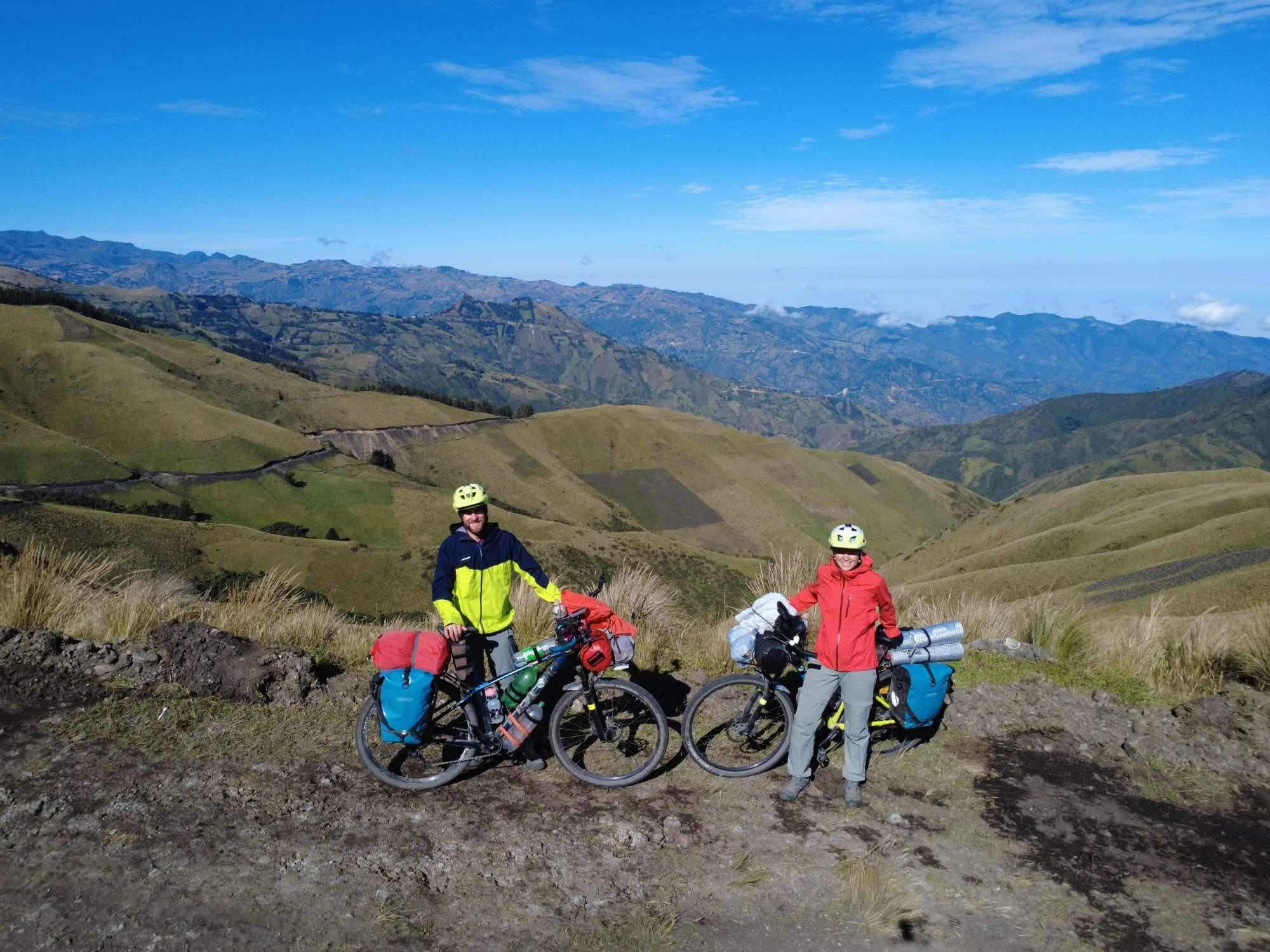
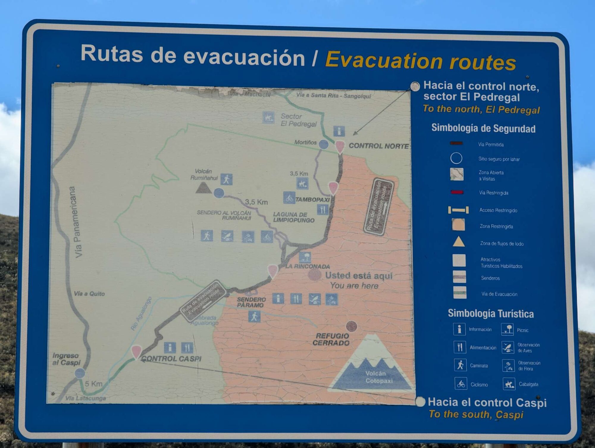
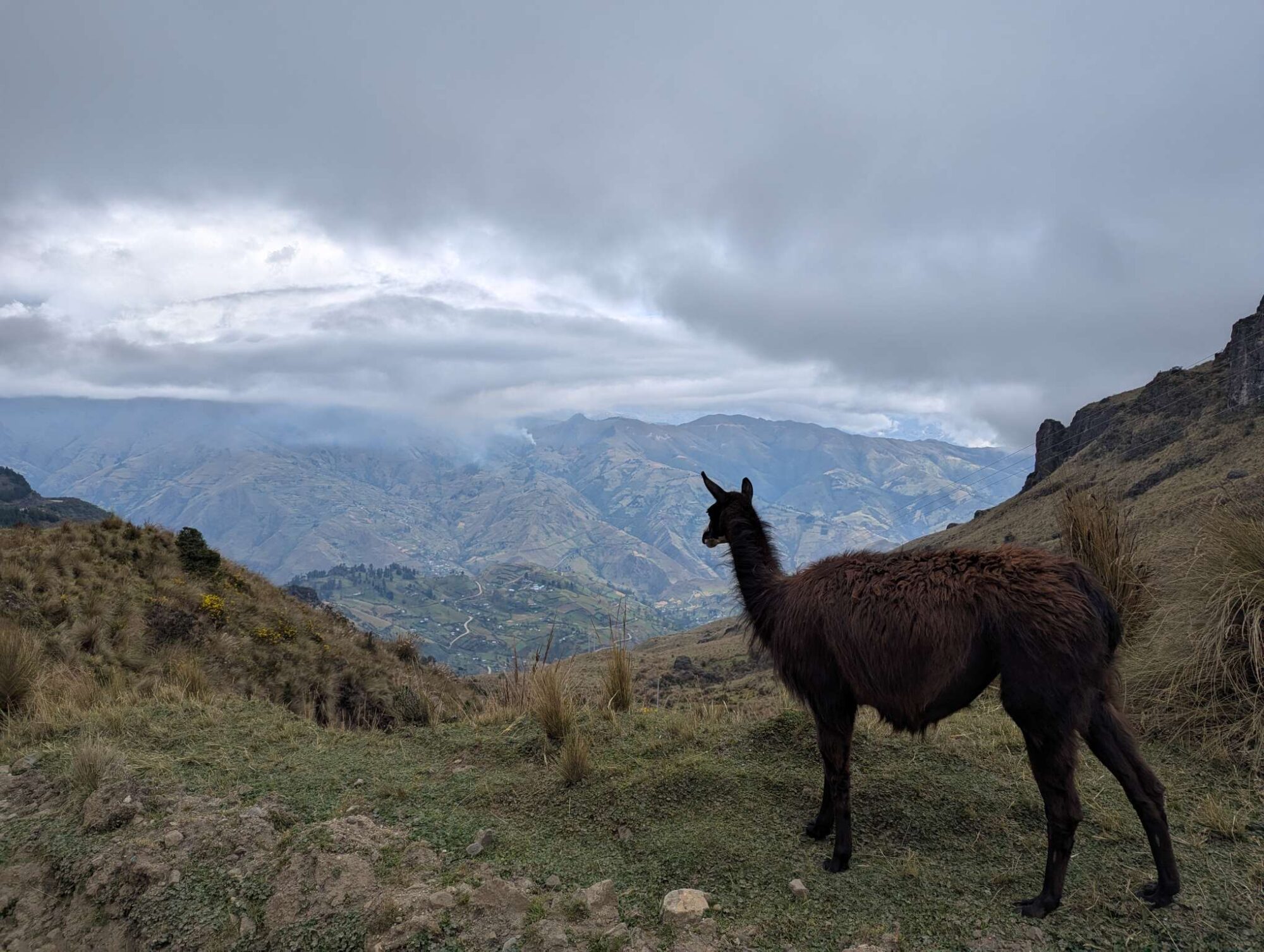
Two notable things happened on day 55. First, we found a camping store and bought gas canisters for cooking (they are not allowed on the plane, even in checked luggage). And second, we have decided on where to go from Ecuador’s capital—on bikepacking.com we’ve found a Trans Ecuador Mountain Bike Route (TEMBR), which looked very interesting and like something that would be fun to try. In total, it spans over 1300 kilometers and 35.000 vertical meters, but it starts in the north of Ecuador, so we would join it in Quito and follow it south. You can read more about the route here.

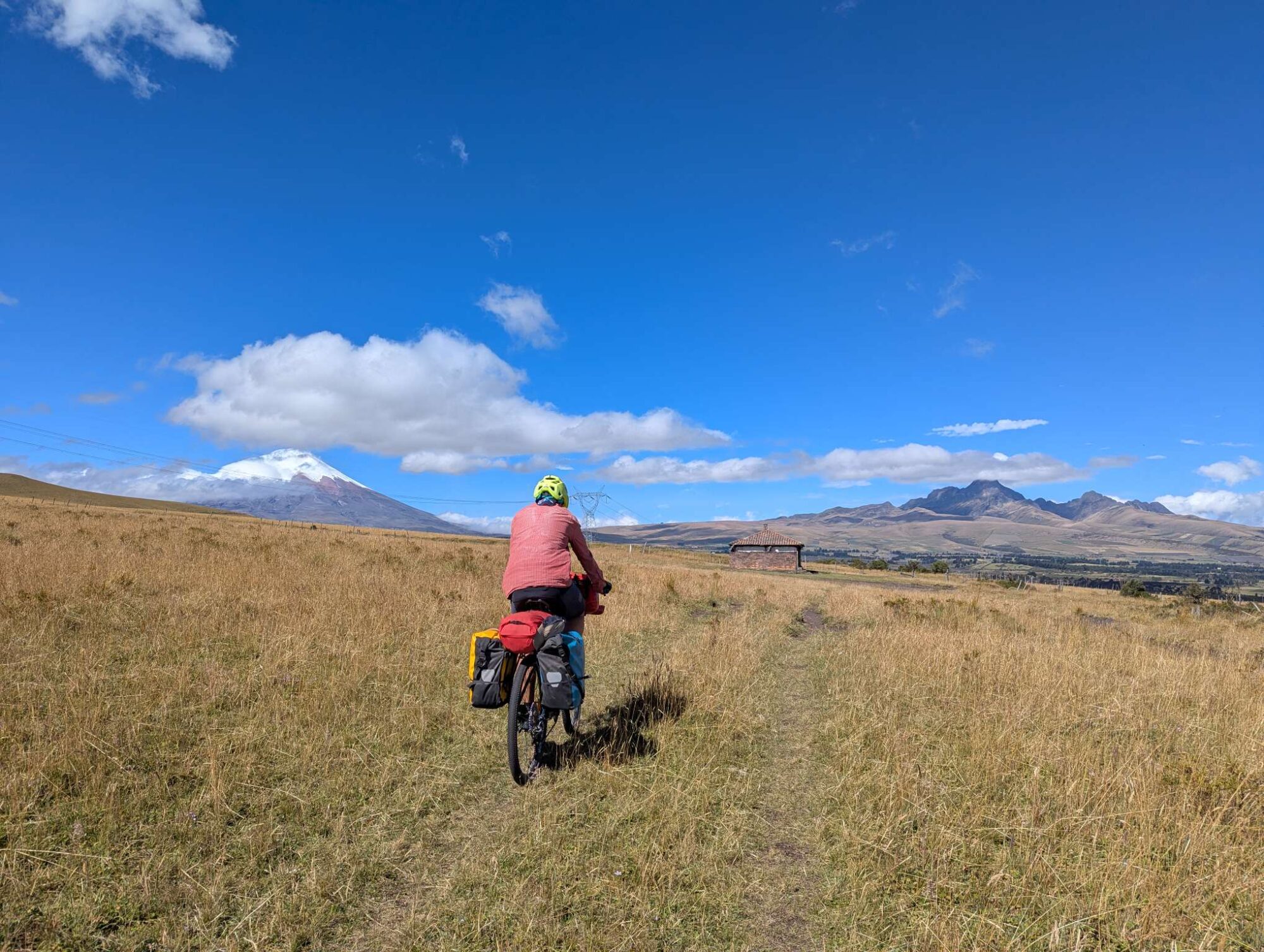
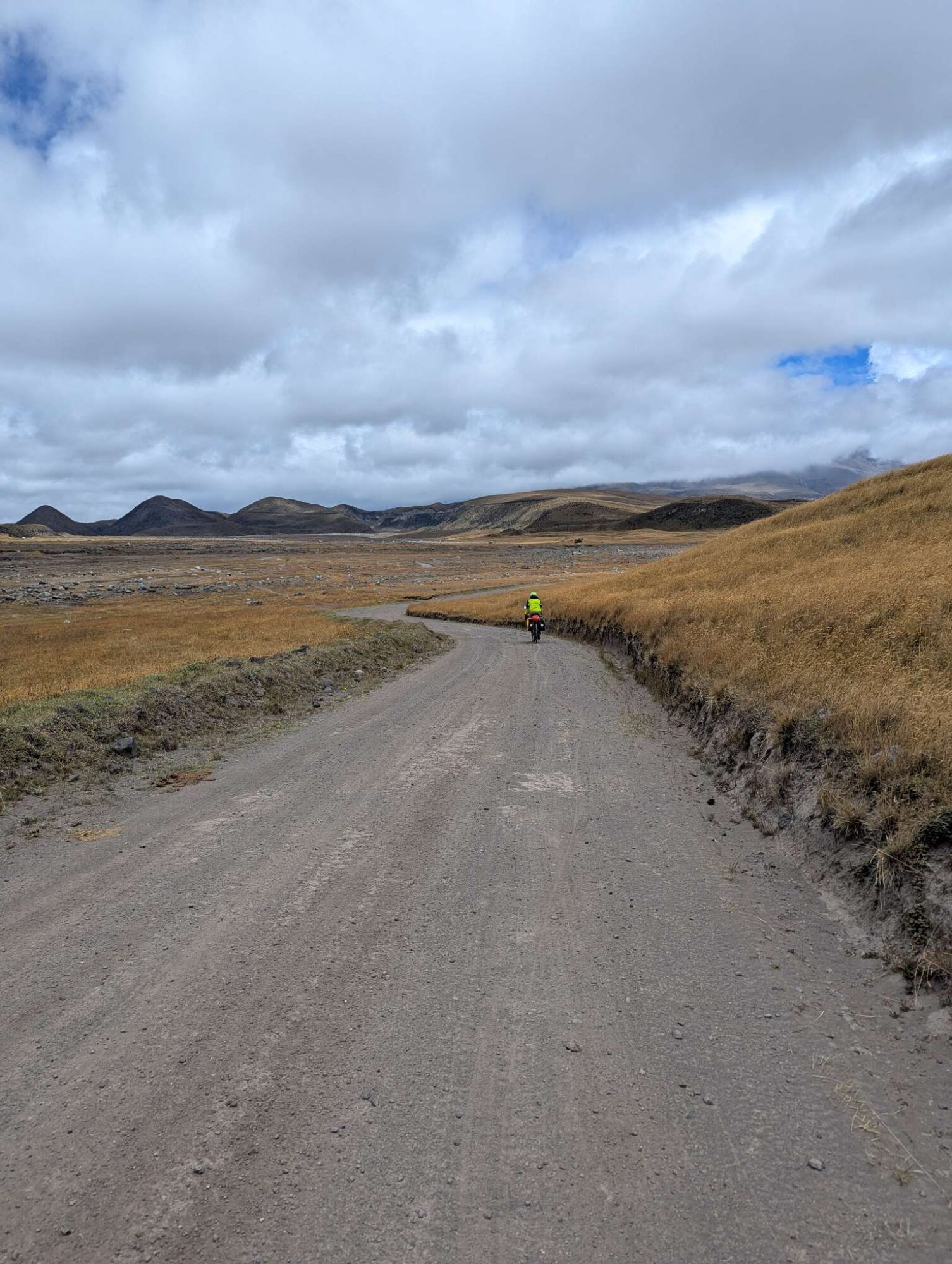
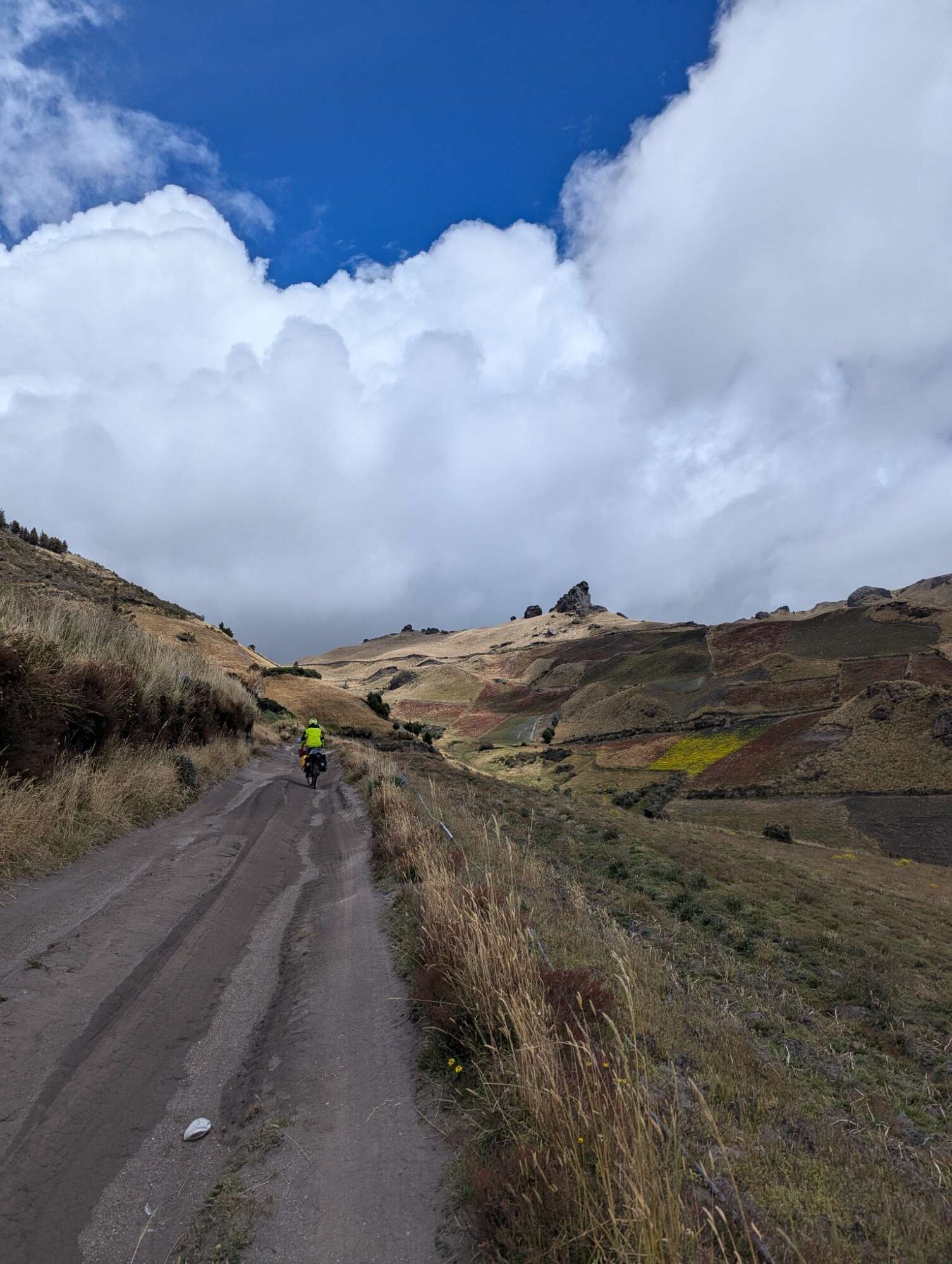
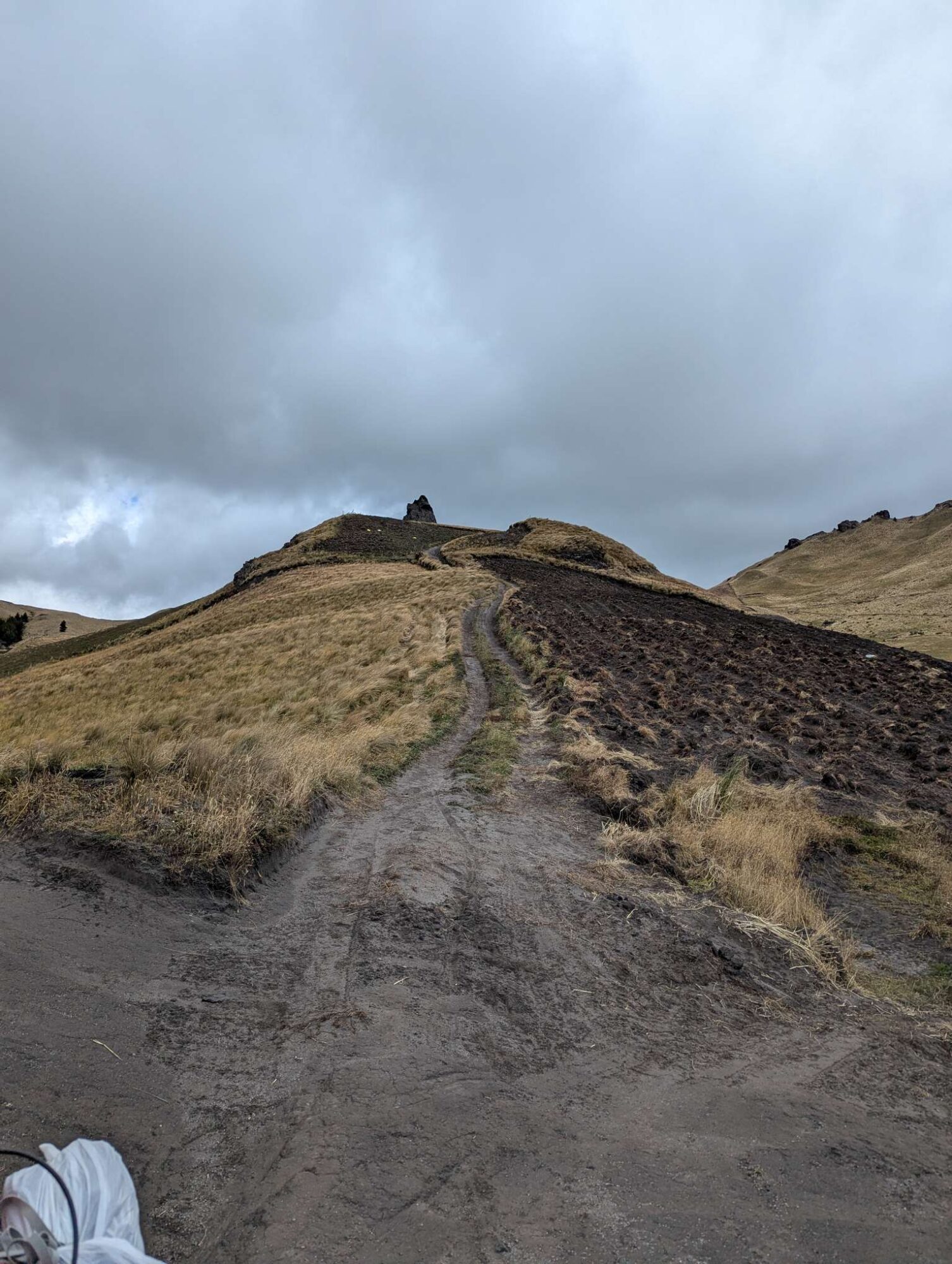
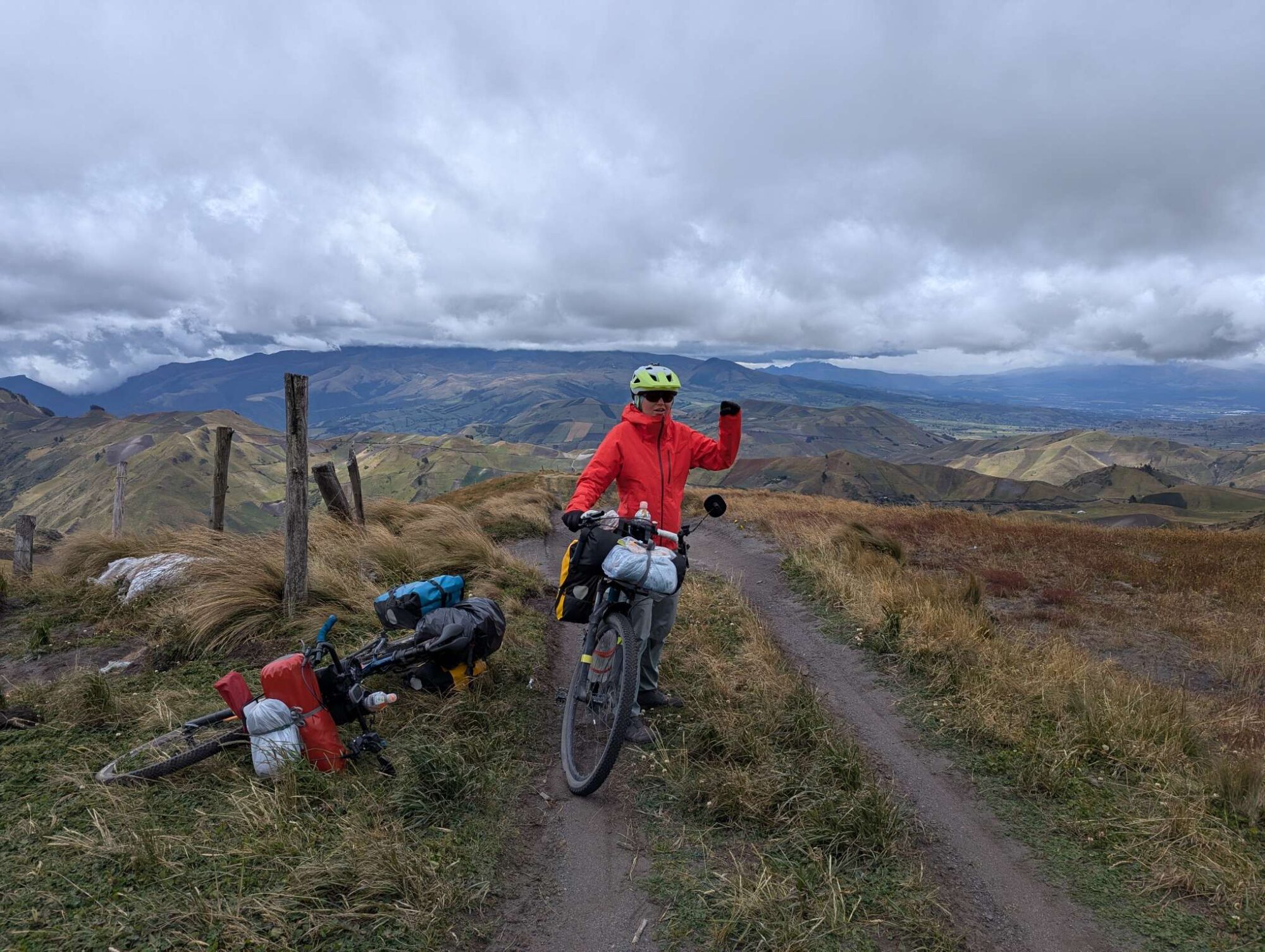
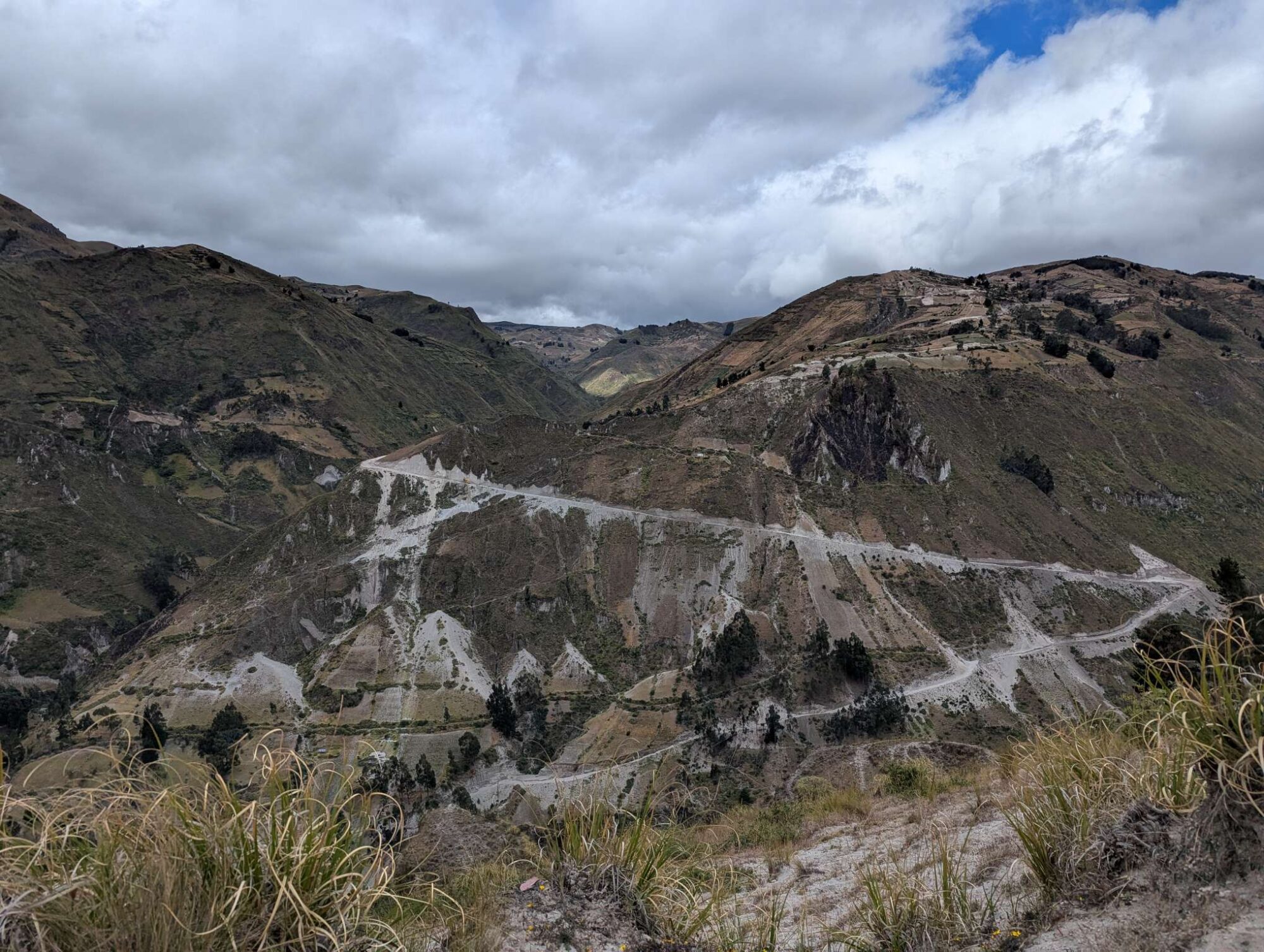
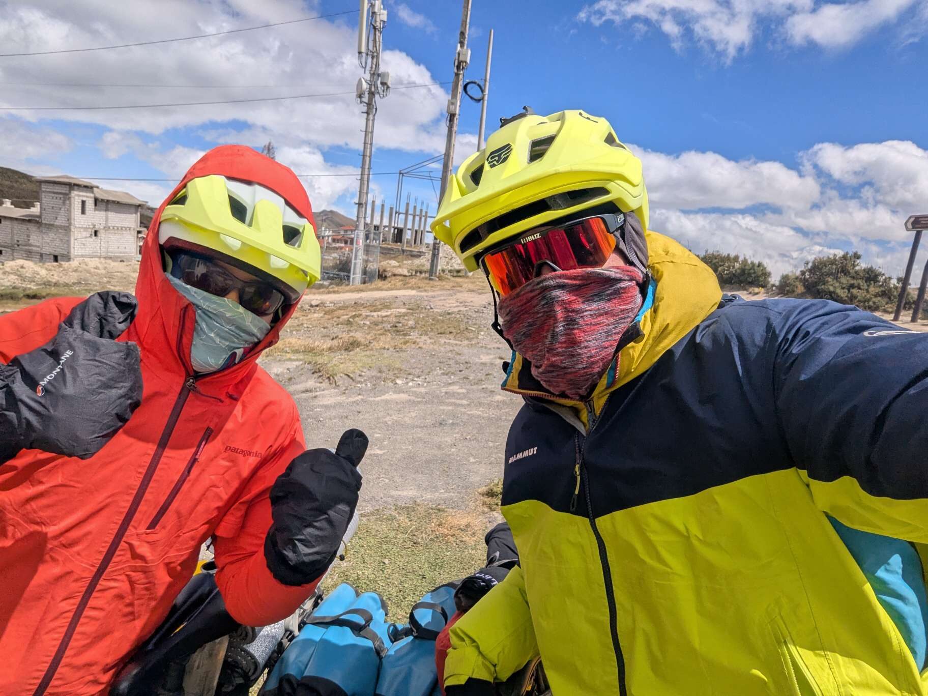
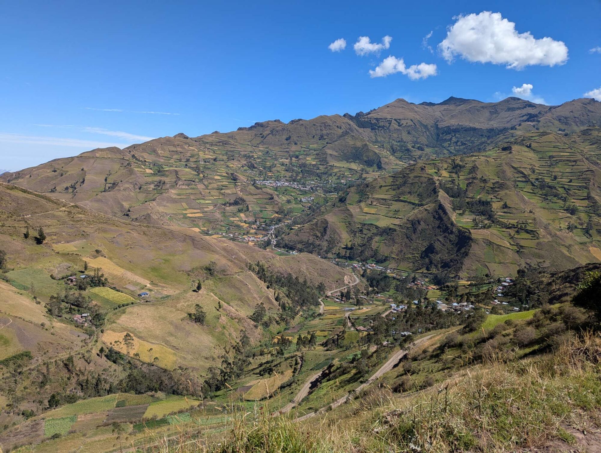
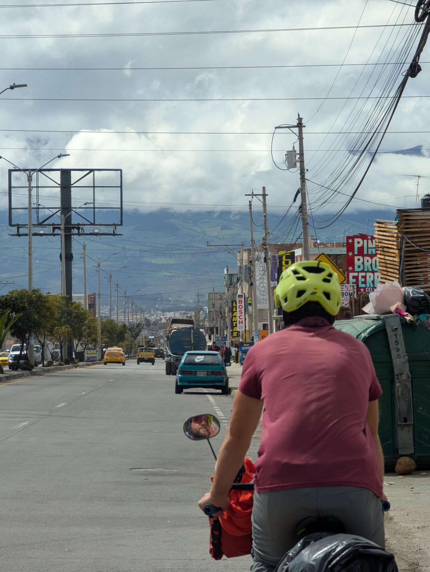
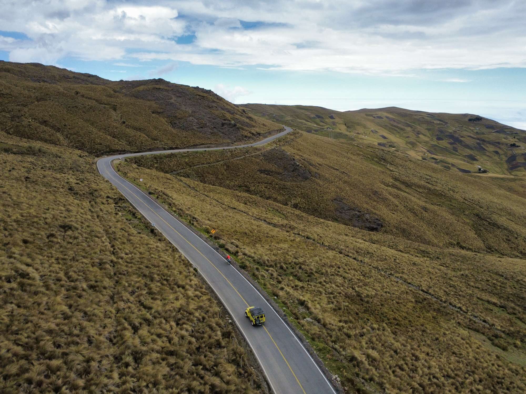
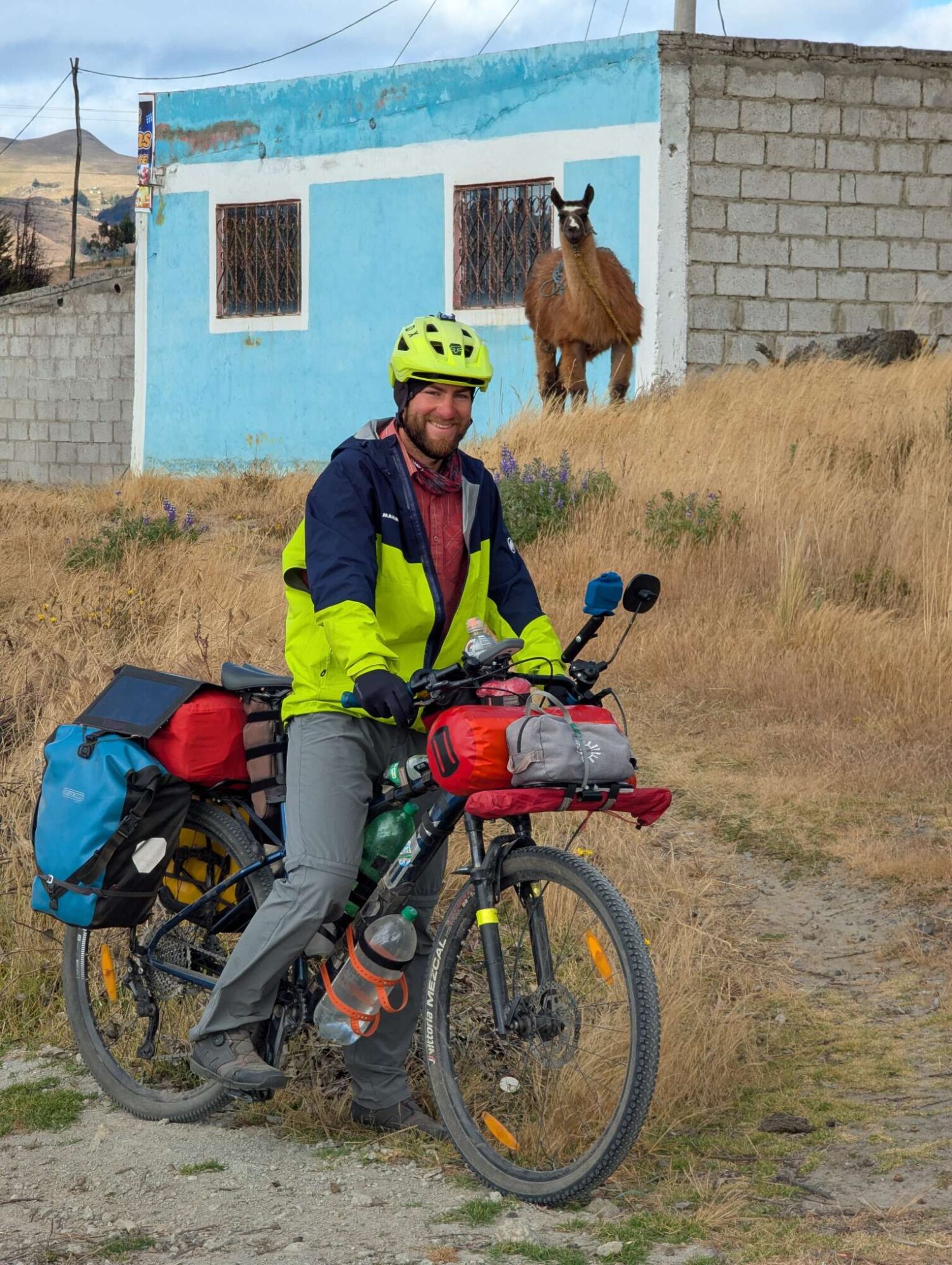
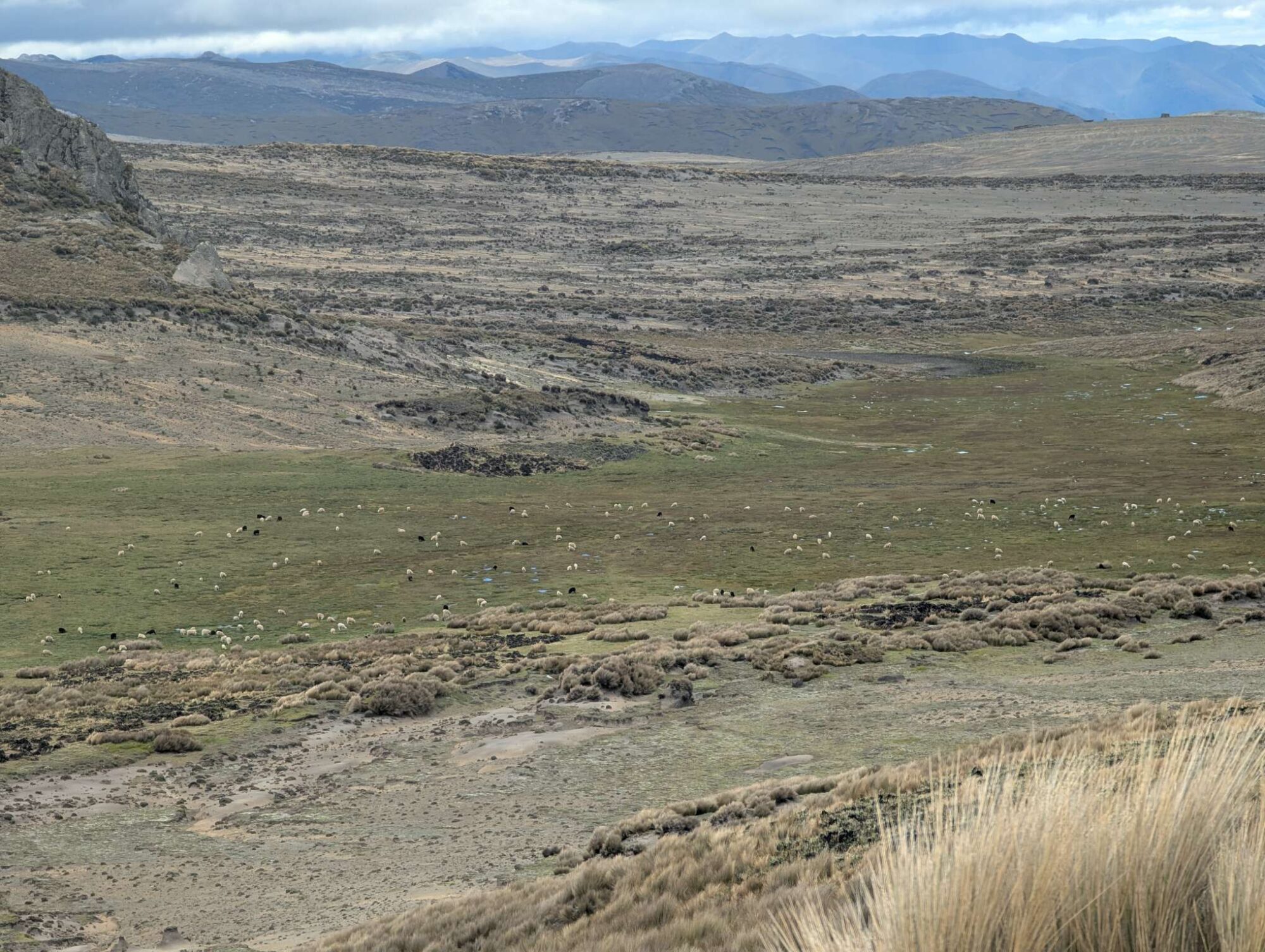
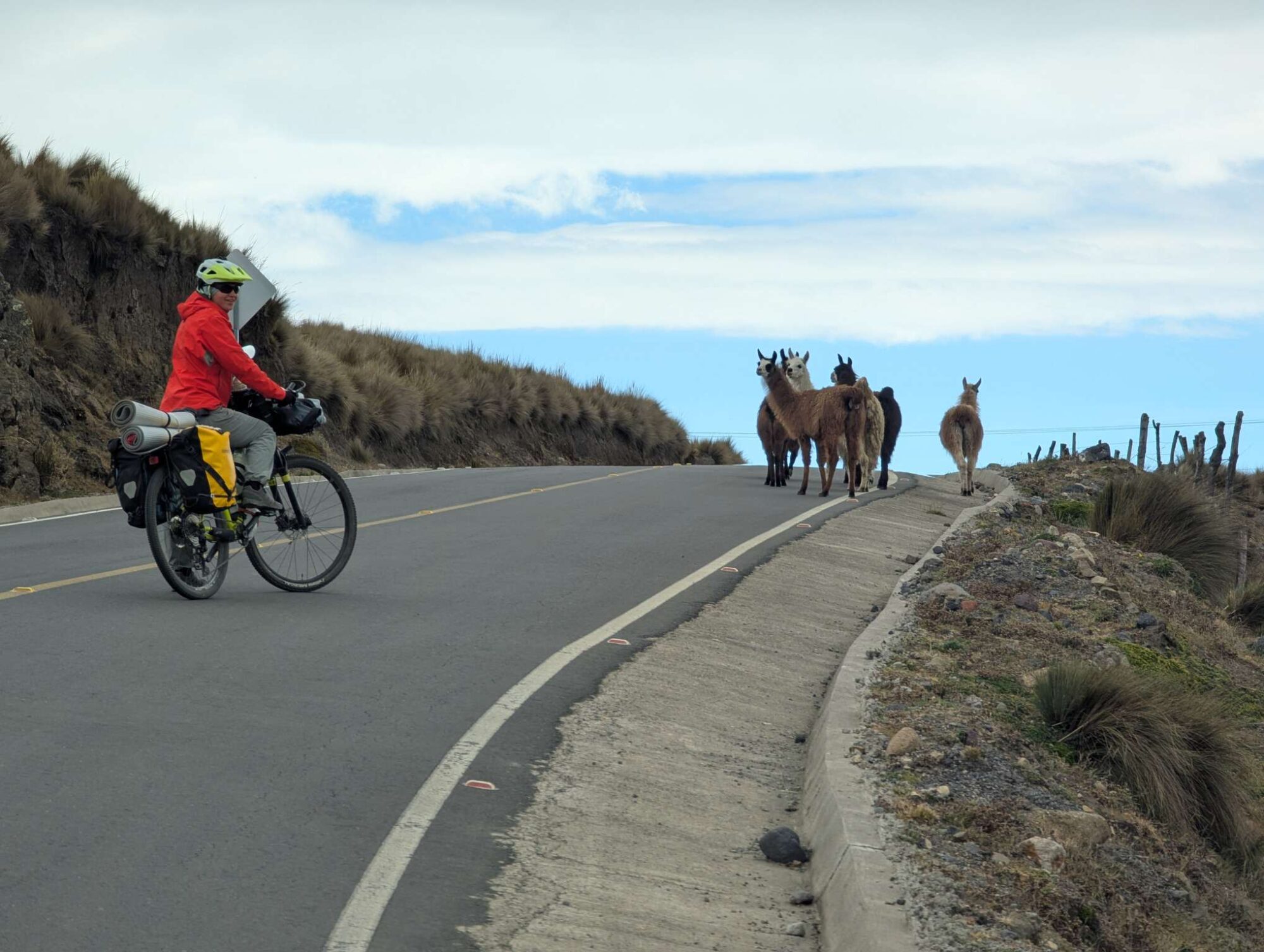
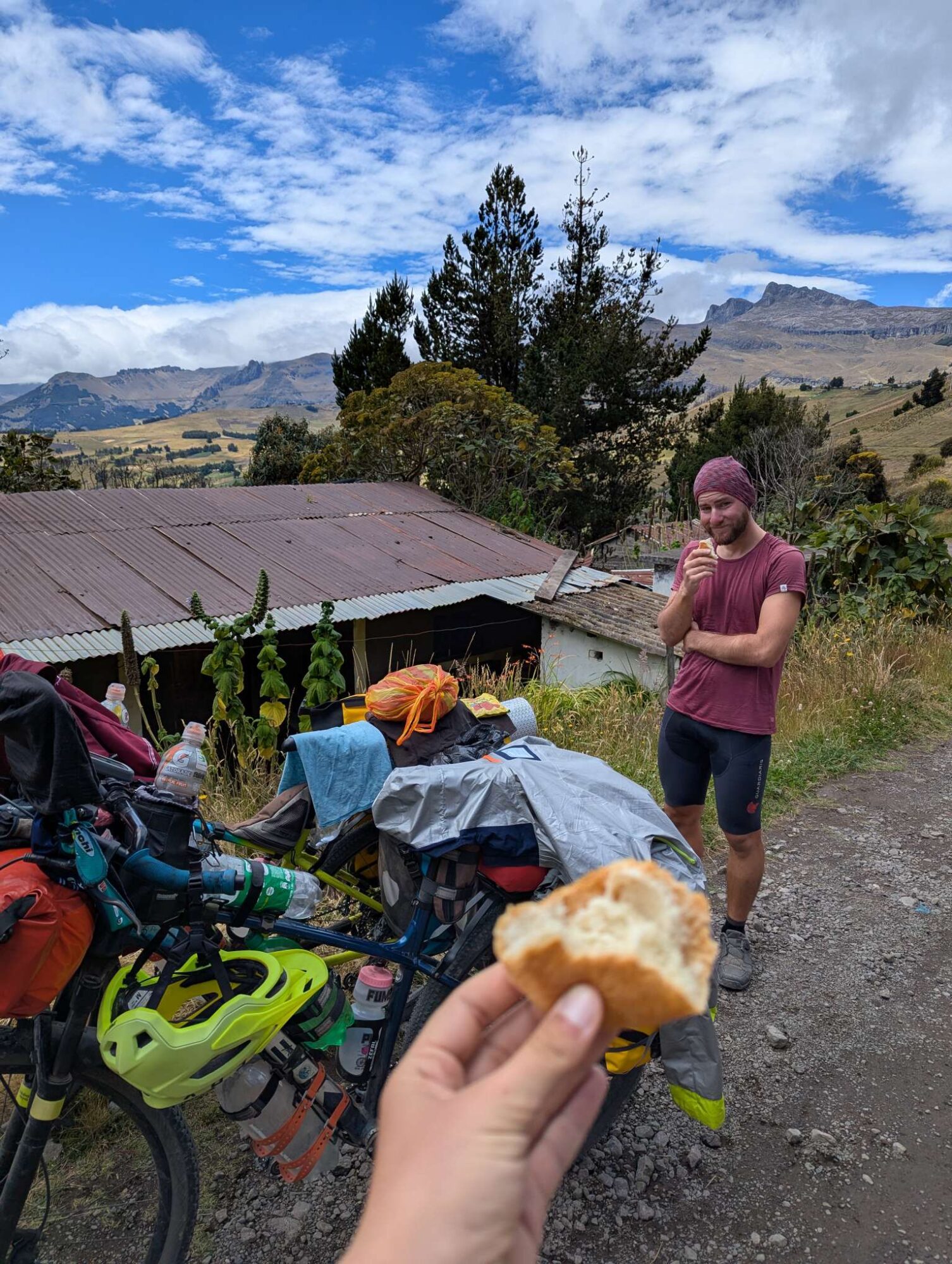
We were up at 5 AM on day 56. It was Tuesday, and we were excited to start cycling. Our heads were full of pictures from TEMBR that we saw on the previous day, and we couldn’t wait to experience them in person. What we didn’t know was that there were still days of cycling ahead of us before we would reach those remote and gorgeous areas. Many kilometers of bad roads and plenty of hills to climb.

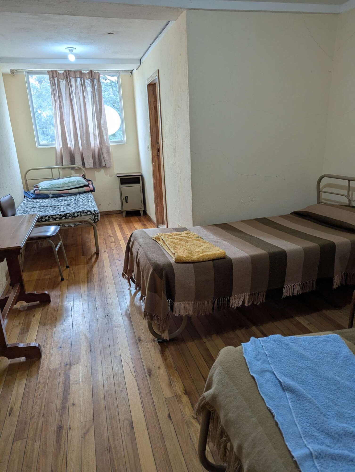
We’ve read online that when looking for a room to stay, always ask if water is available all through the night, because some places close it. One of such places was apparently also our hostel, at least regarding water in our bathroom (the one in the kitchen was working all the time), so we had to wait until 7 AM before we could use the toilet.

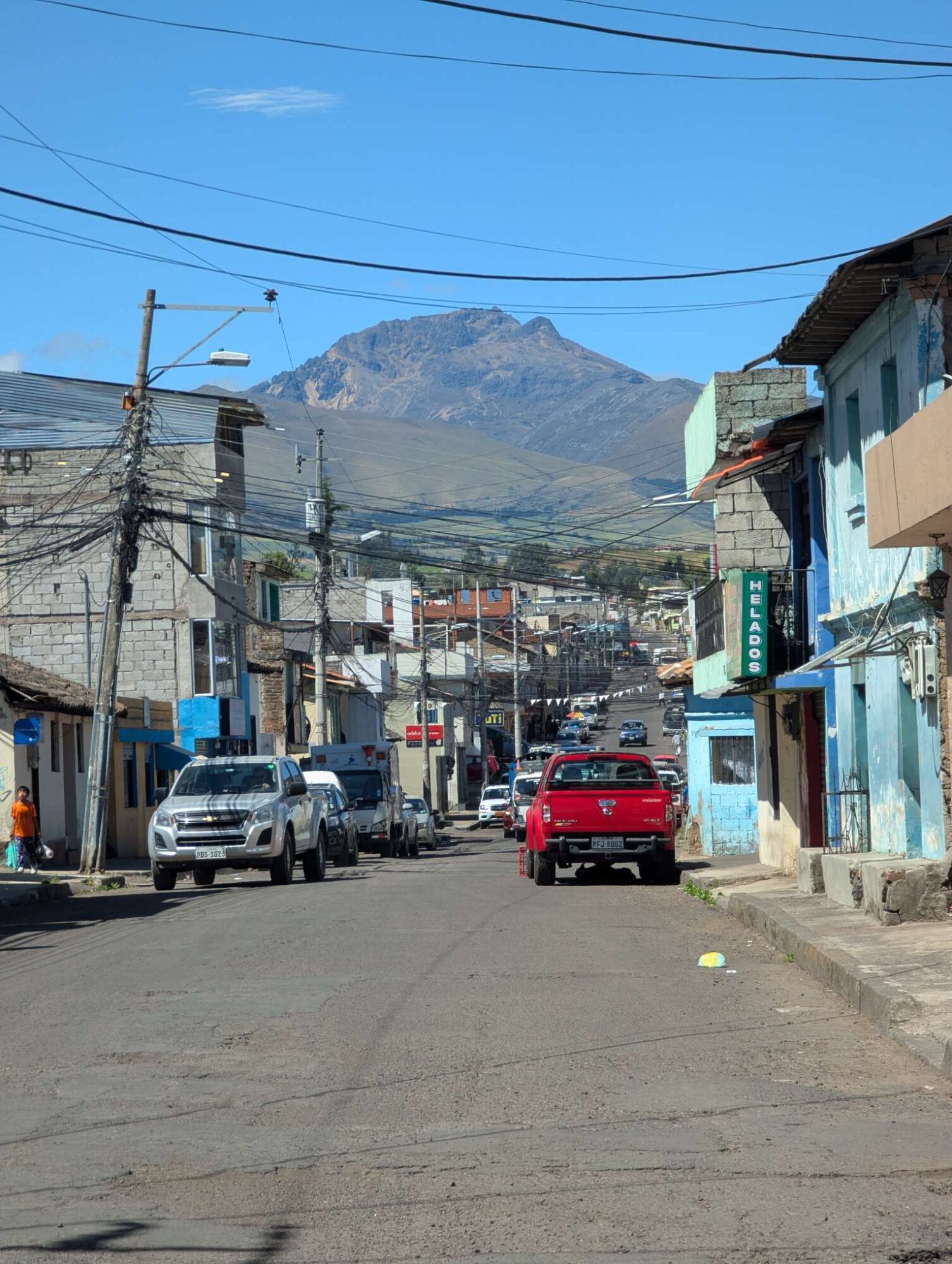
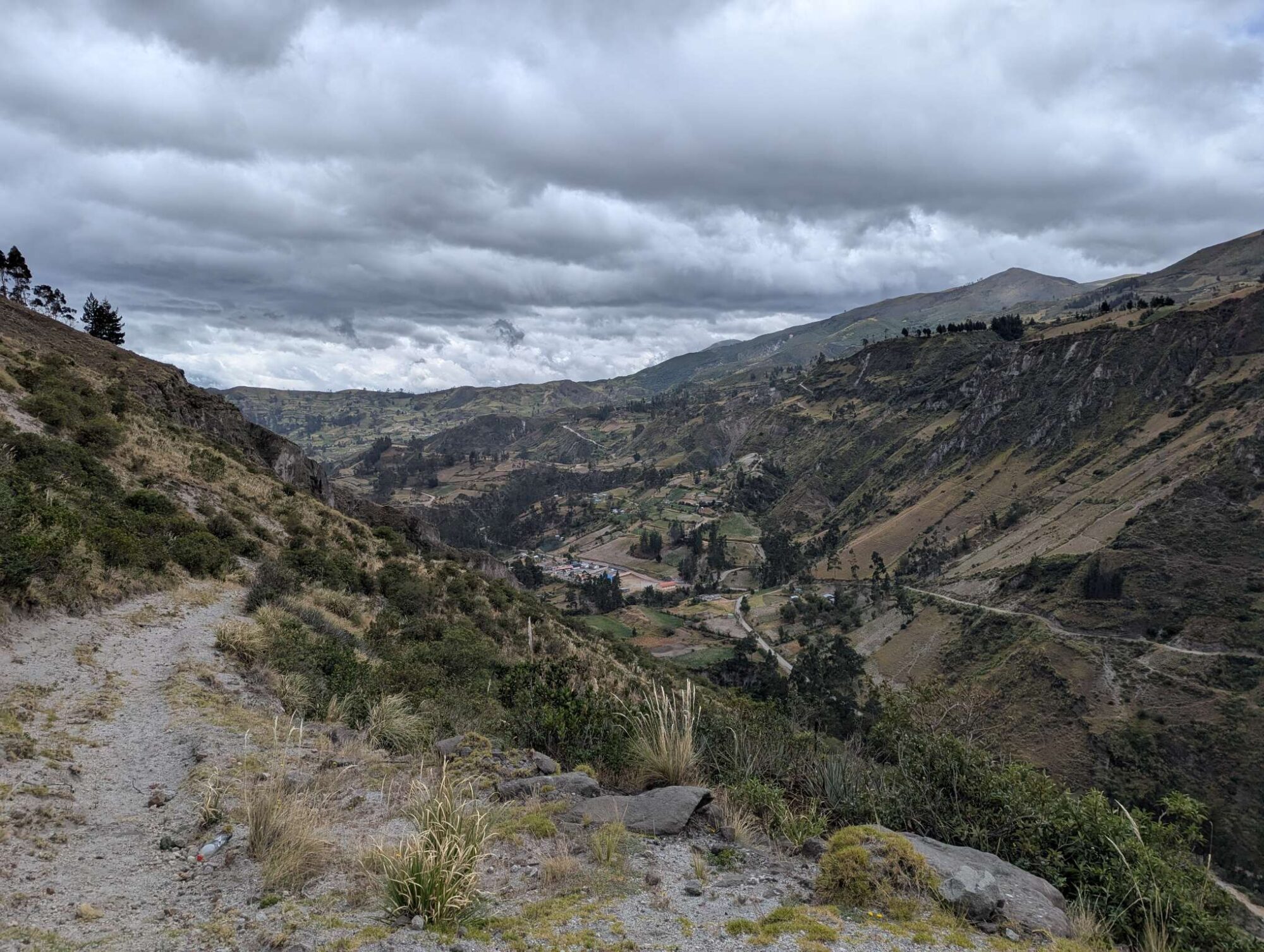
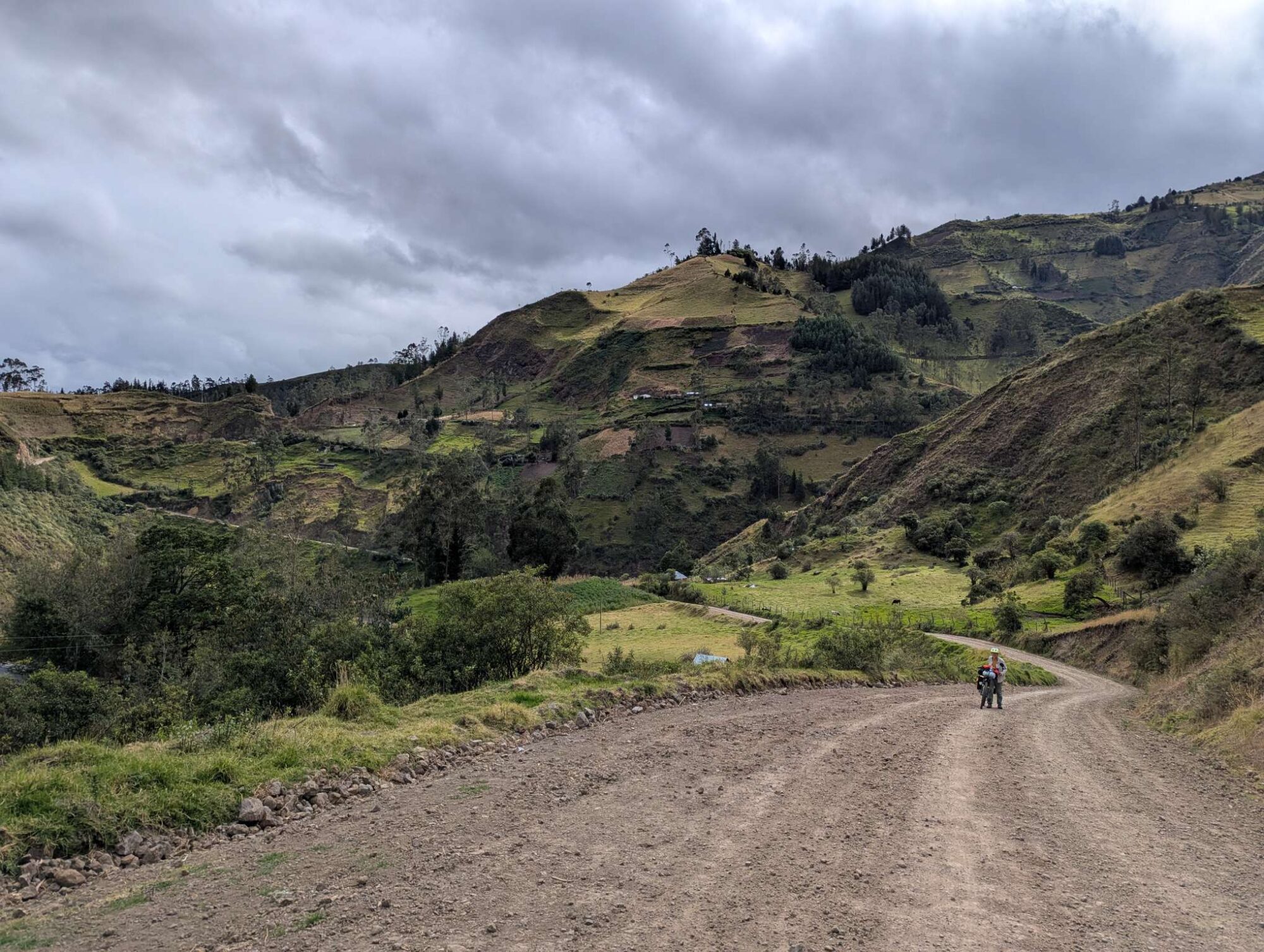
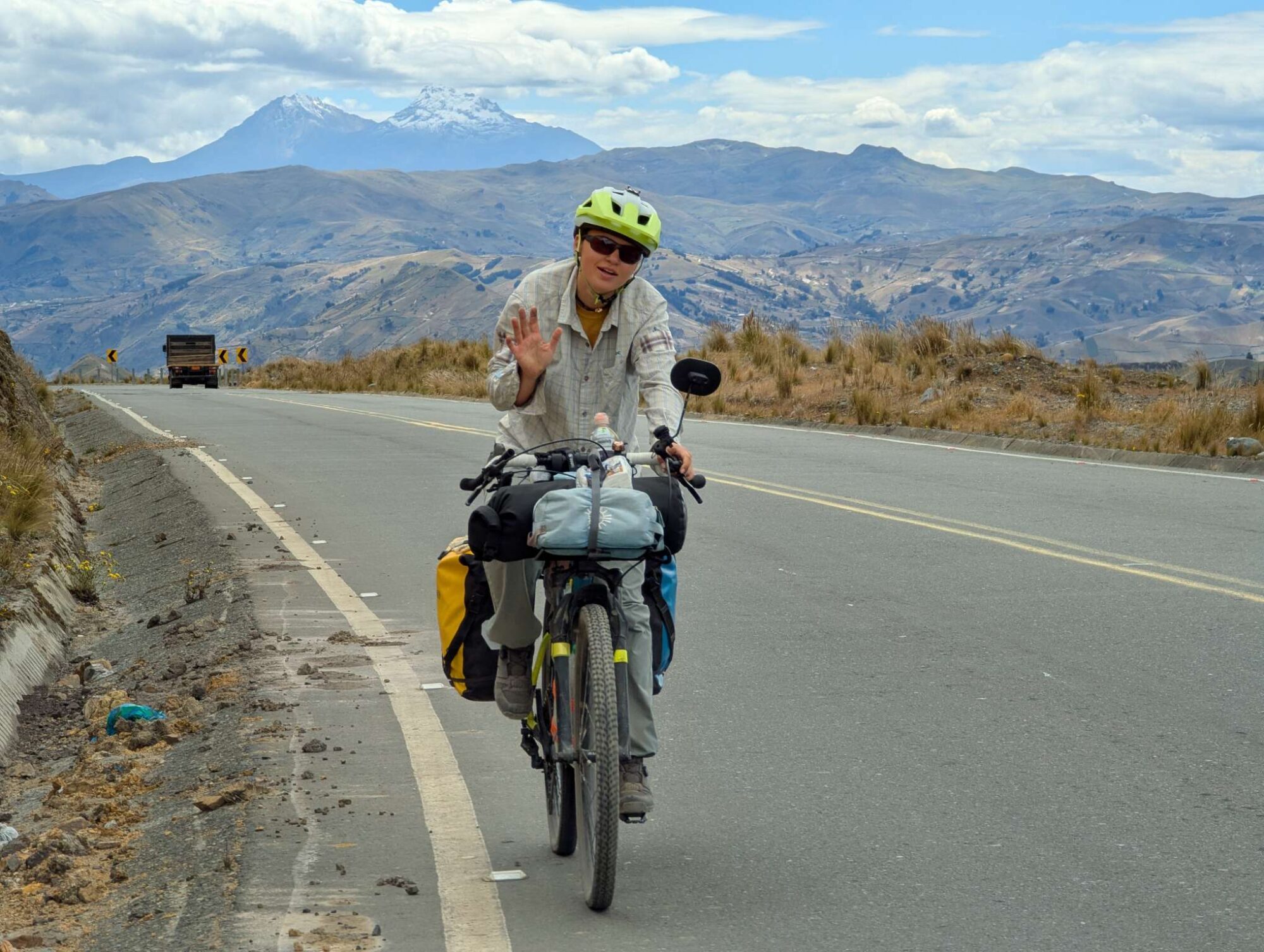
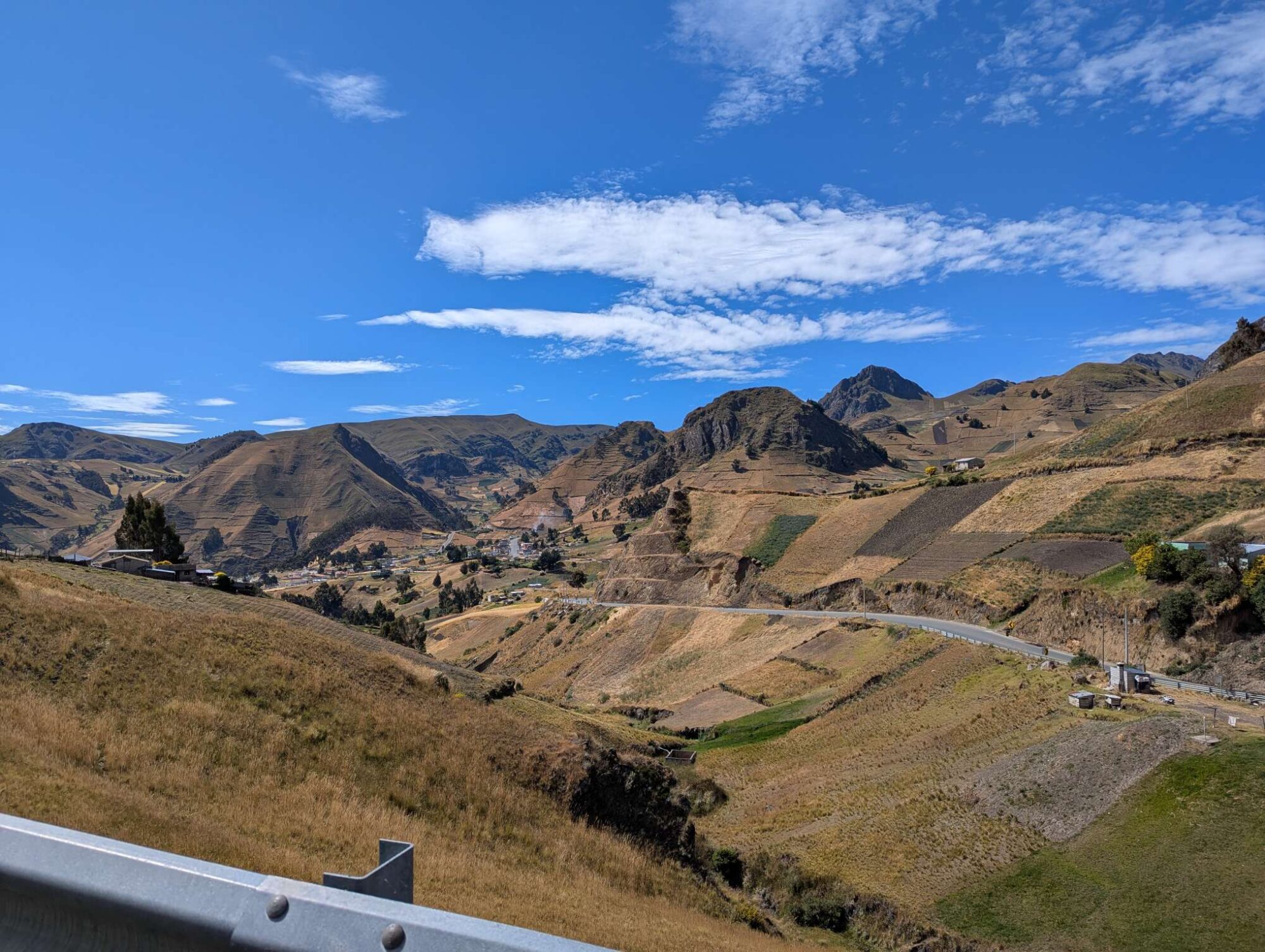
The route that would take us out of the capital and onto the Trans Ecuador Mountain Bike Route took us back down the same road that we were struggling to climb three days ago. It was way easier to go down than up, but it made us question our decision to go into Quito in the first place.

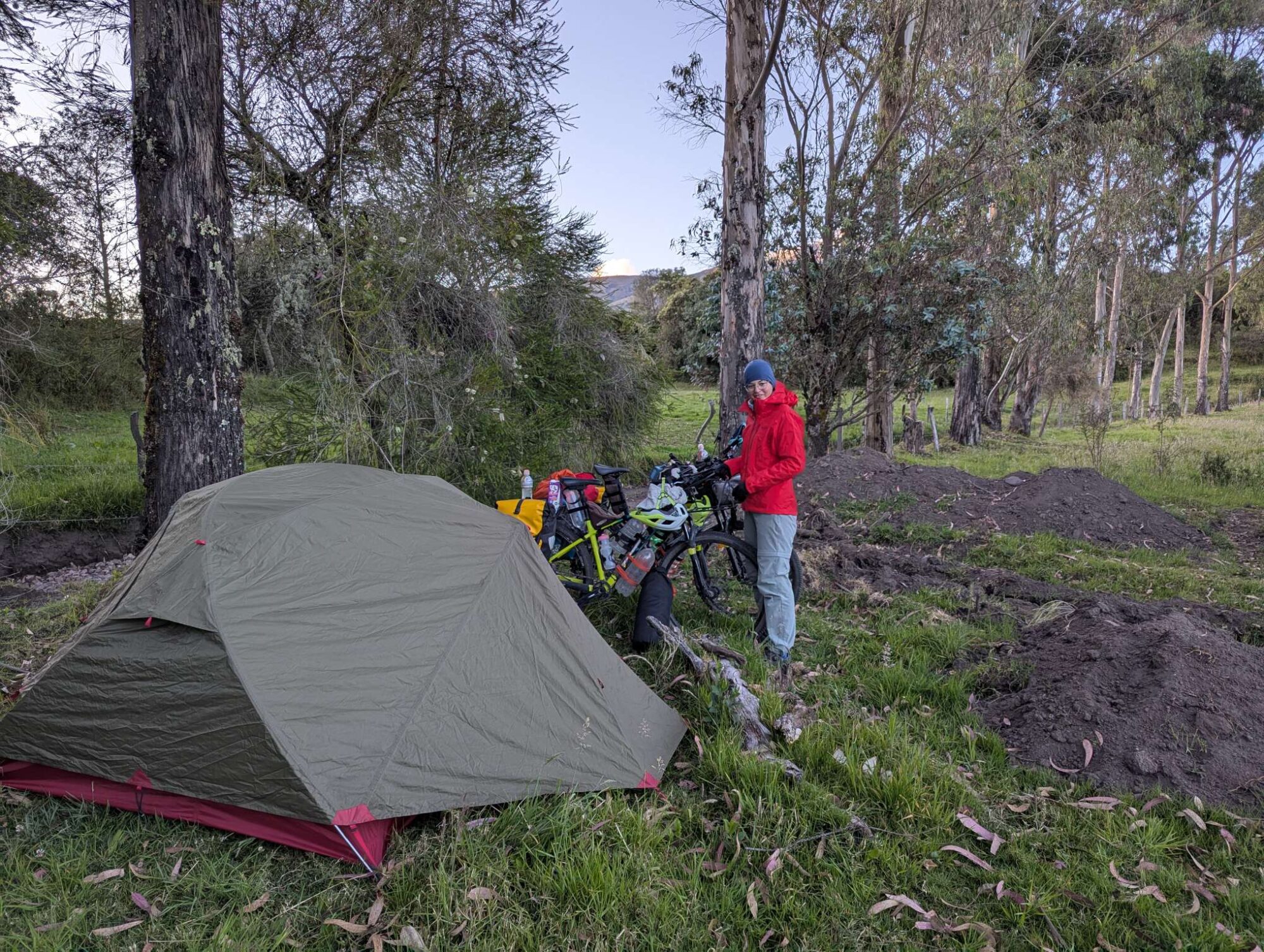
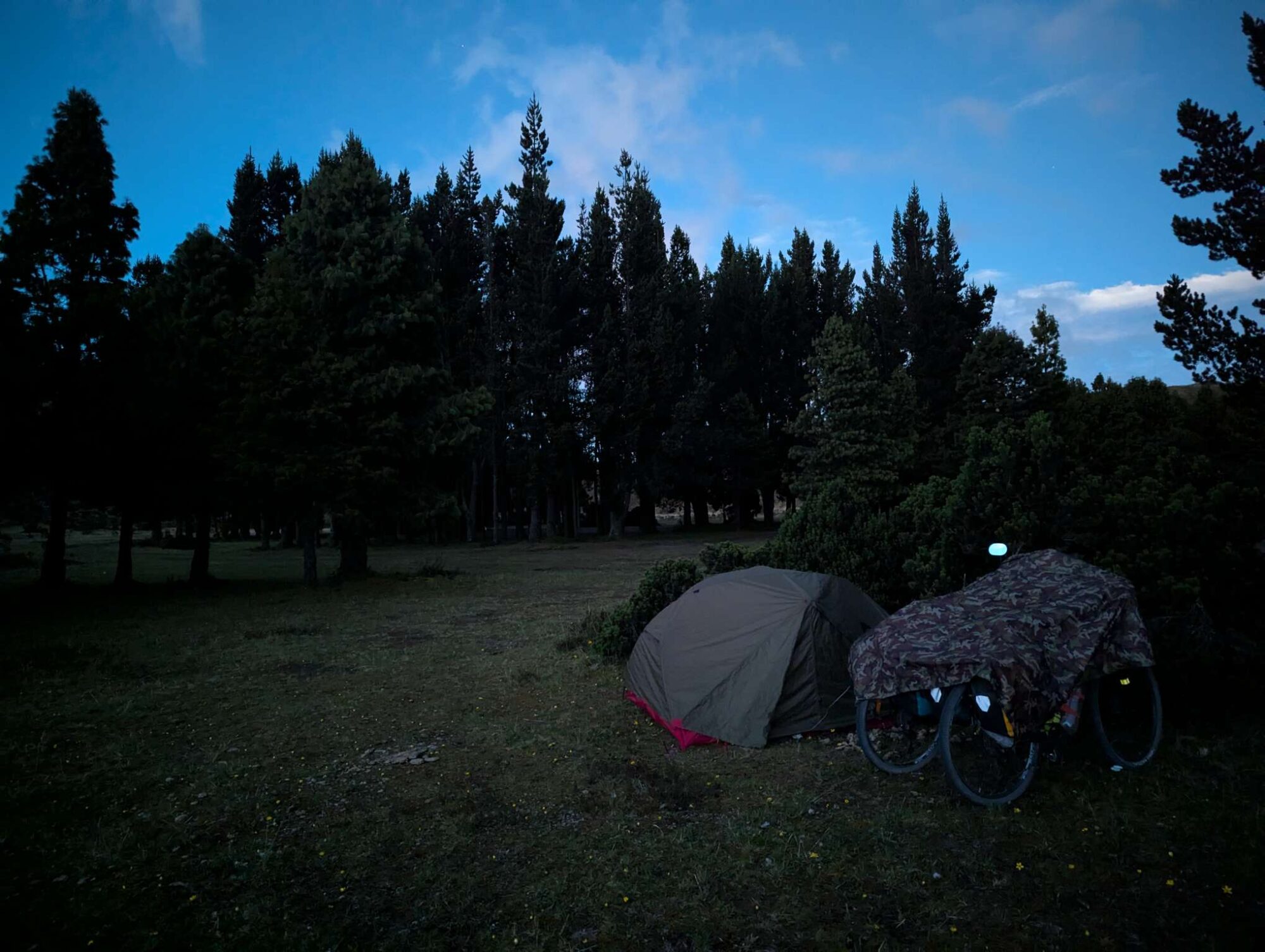
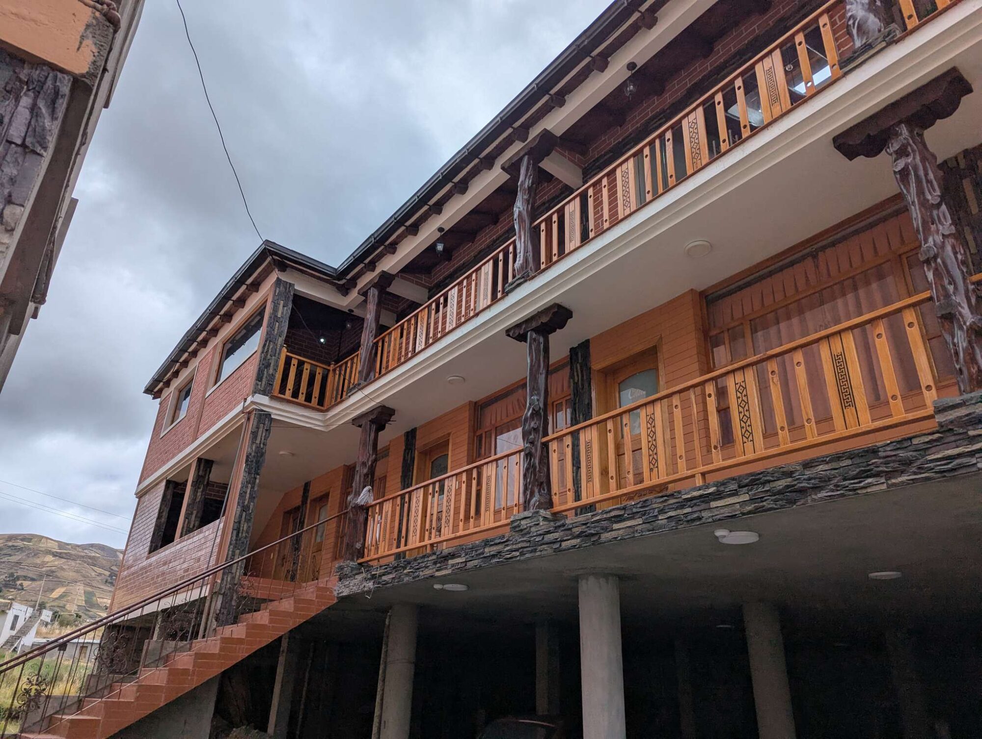
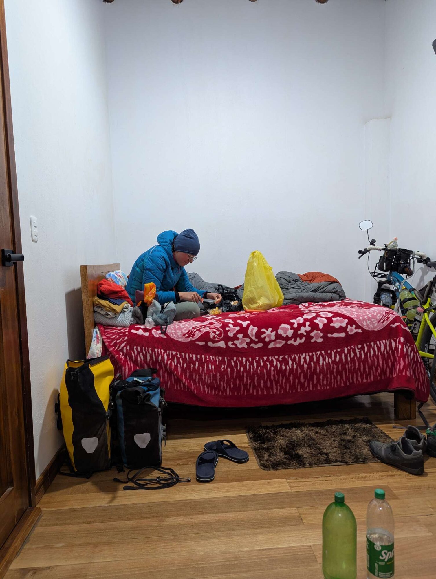
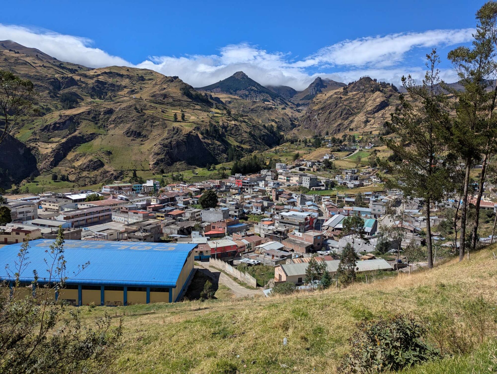
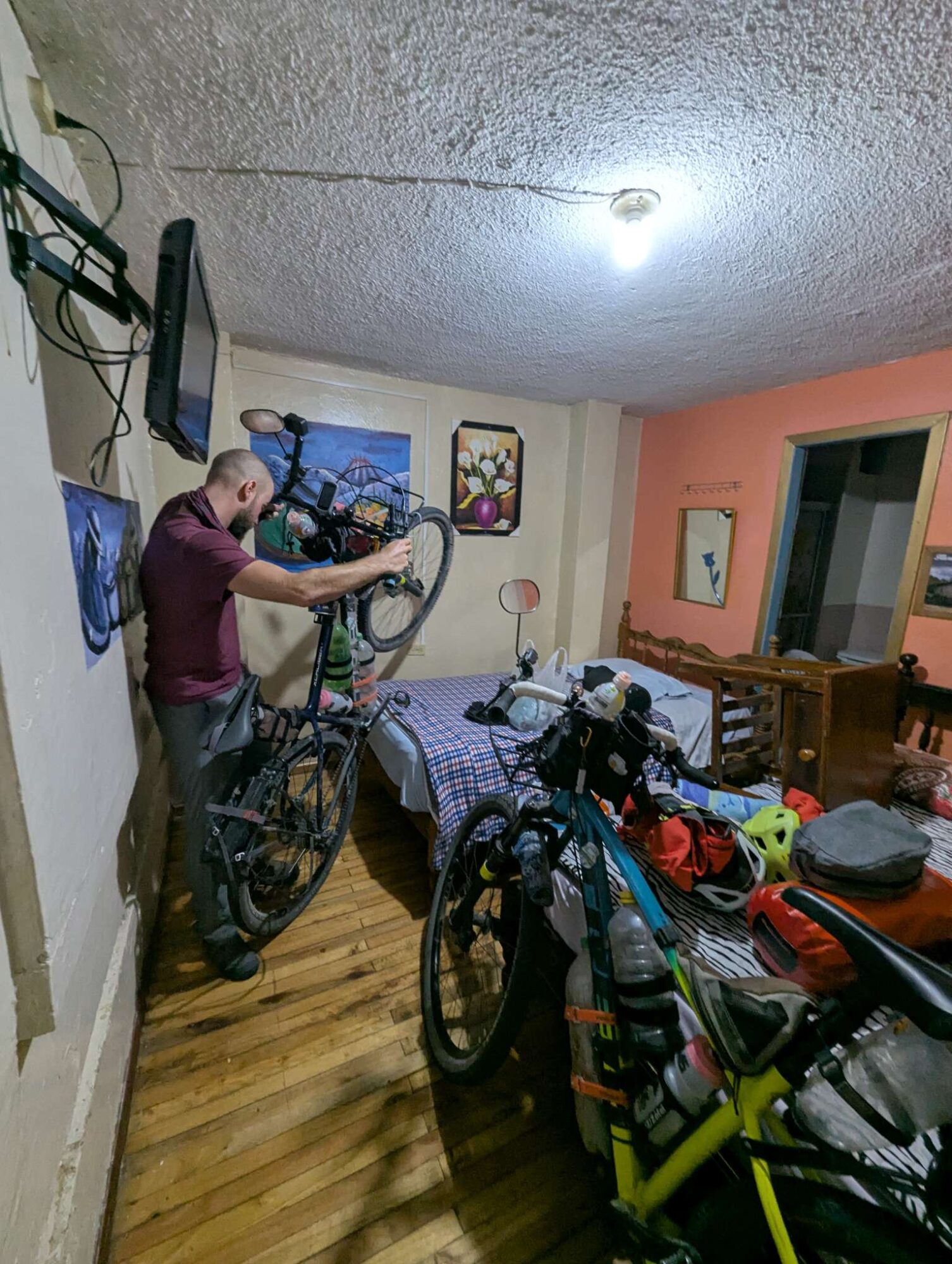
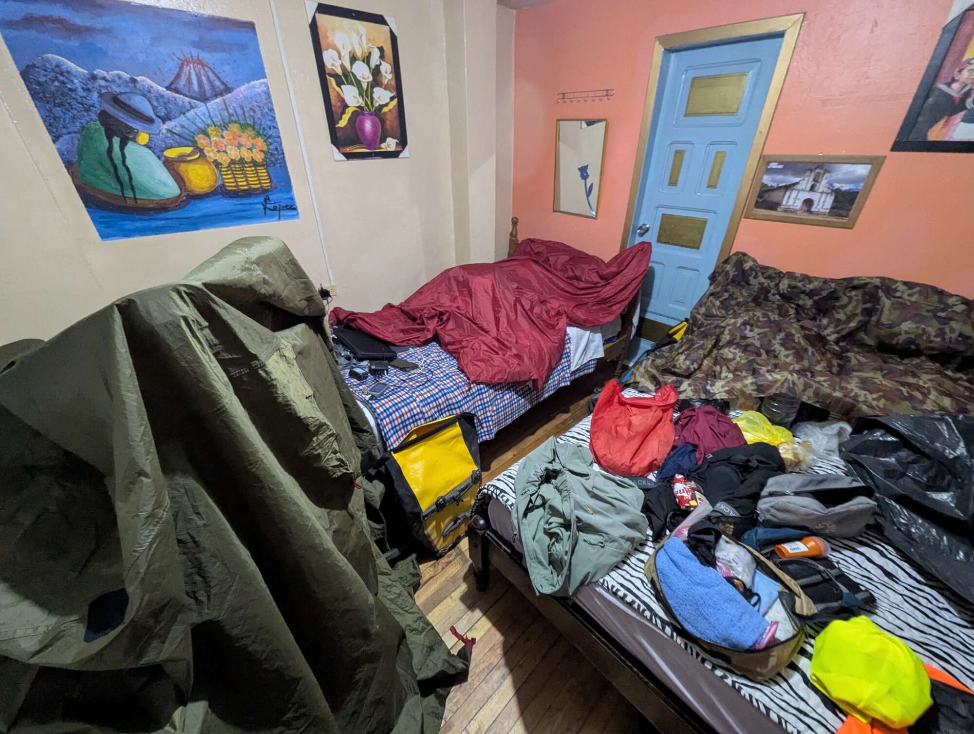
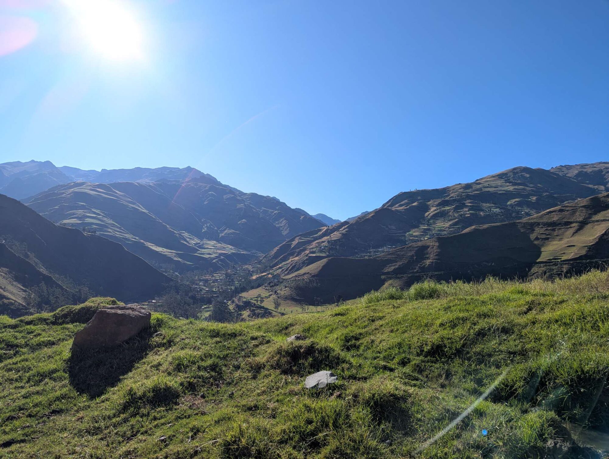
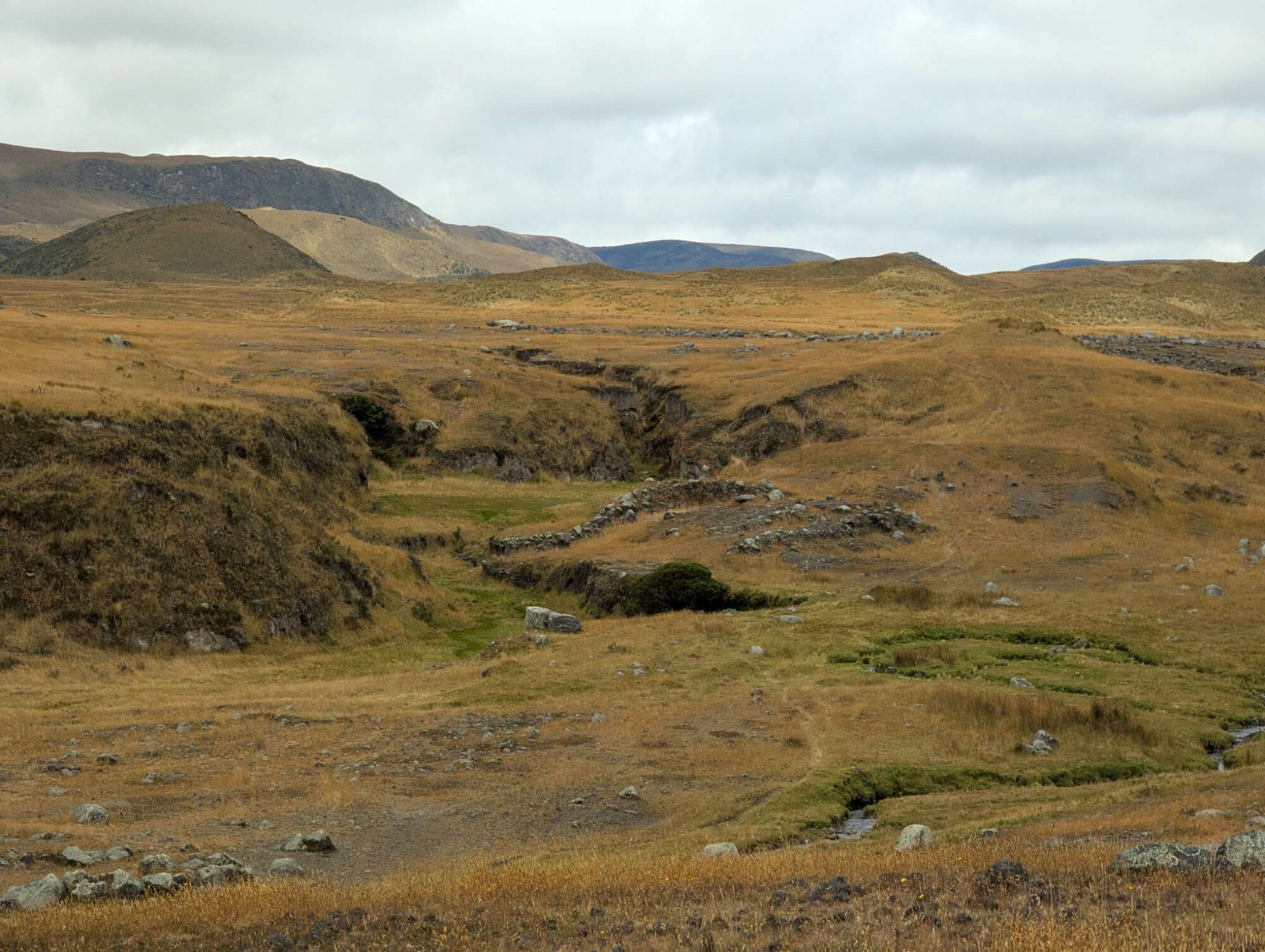
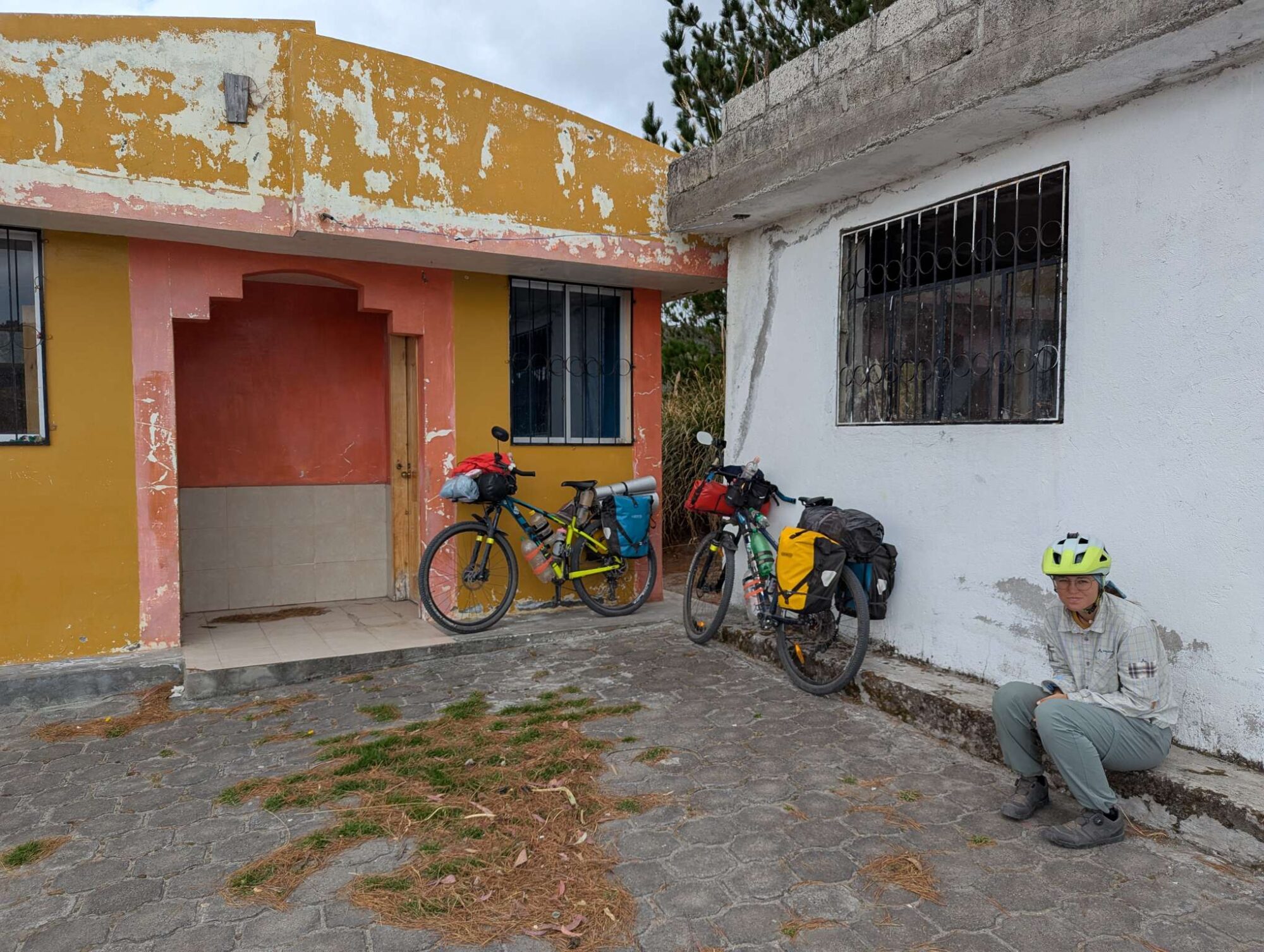
After that descent, we had 45 kilometers and 900 vertical meters to get back at 2850 meters, and we reached the town of Pintag. There, we found a room for 20$, and we were extremely proud when we were able to sufficiently communicate everything in Spanish. We took the bikes into the room, took a very hot shower, and looked at the route that was ahead of us. After all that, it wasn’t long before both of us were ready to sleep. It seemed that the jet lag made us into morning persons.

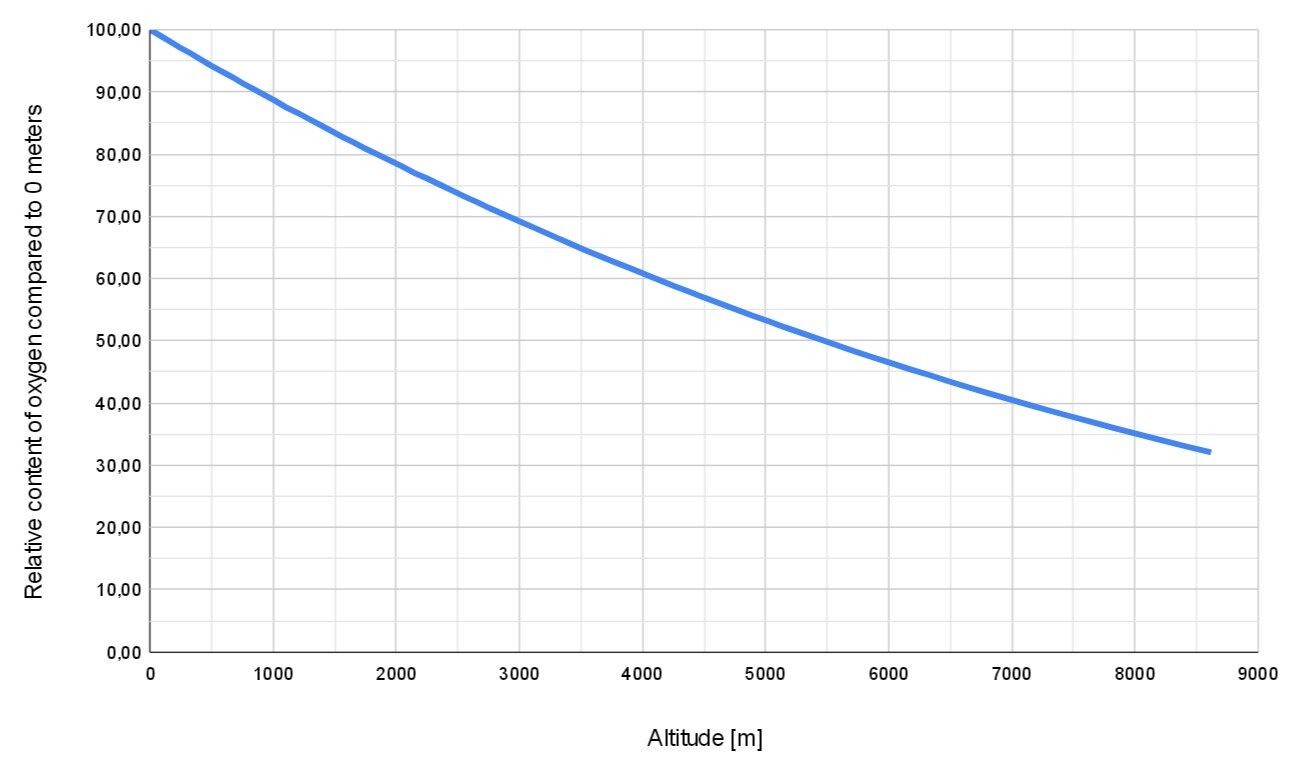
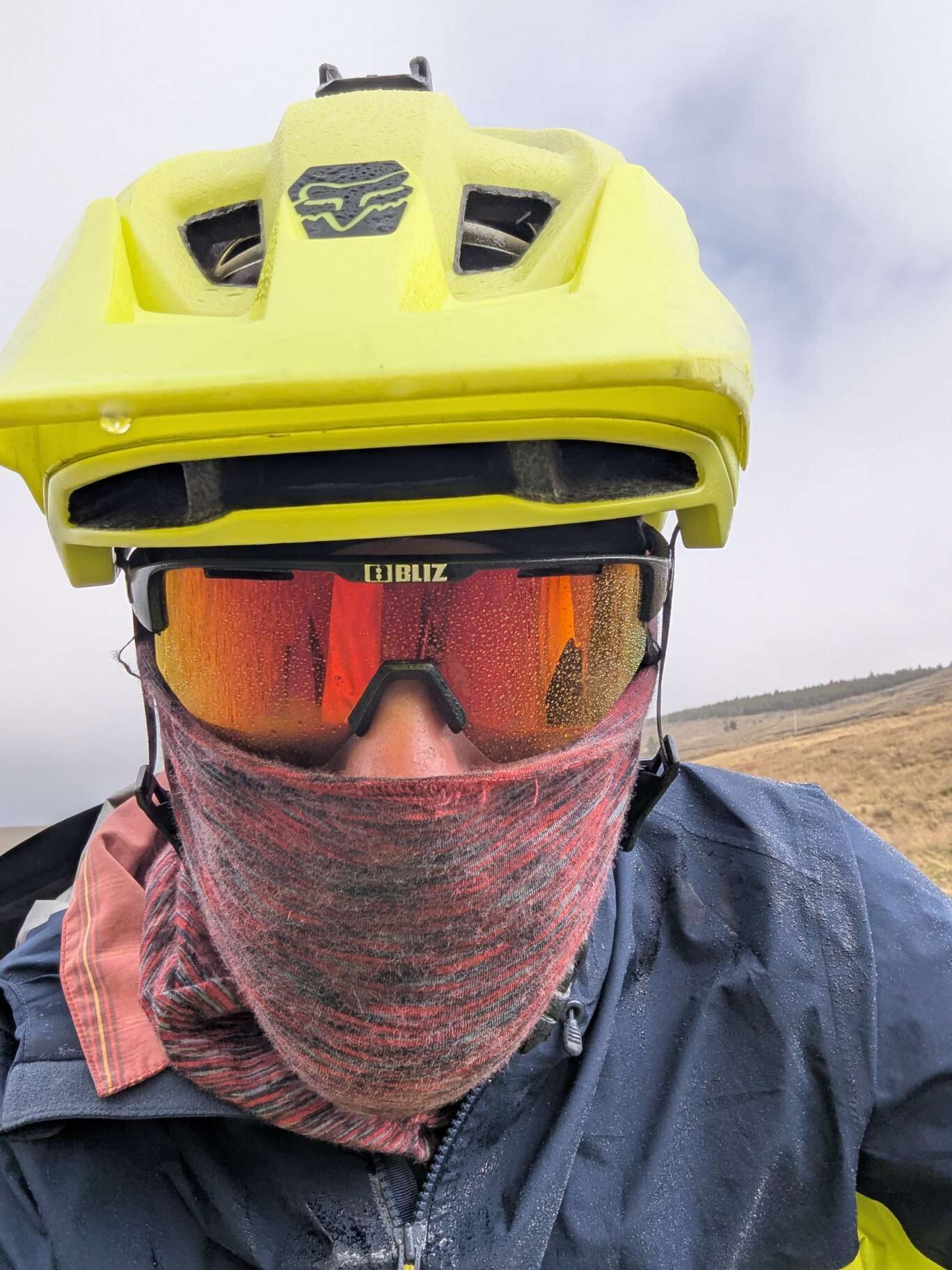
A bit of science of higher altitudes for the layman: to avoid high altitude sickness, it’s usually recommended not to sleep more than 500 meters higher than the previous night. It’s also said that most people have problems sleeping above 4000 meters because of the lack of oxygen. Early signs of mild altitude sickness are headaches and nausea, in which case it’s recommended to take a rest and drink plenty of water. In case of a more severe case (loss of coordination and balance, vomiting, blue lips and fingertips, confusion, …), one should immediately descend at least 300 meters and rest.

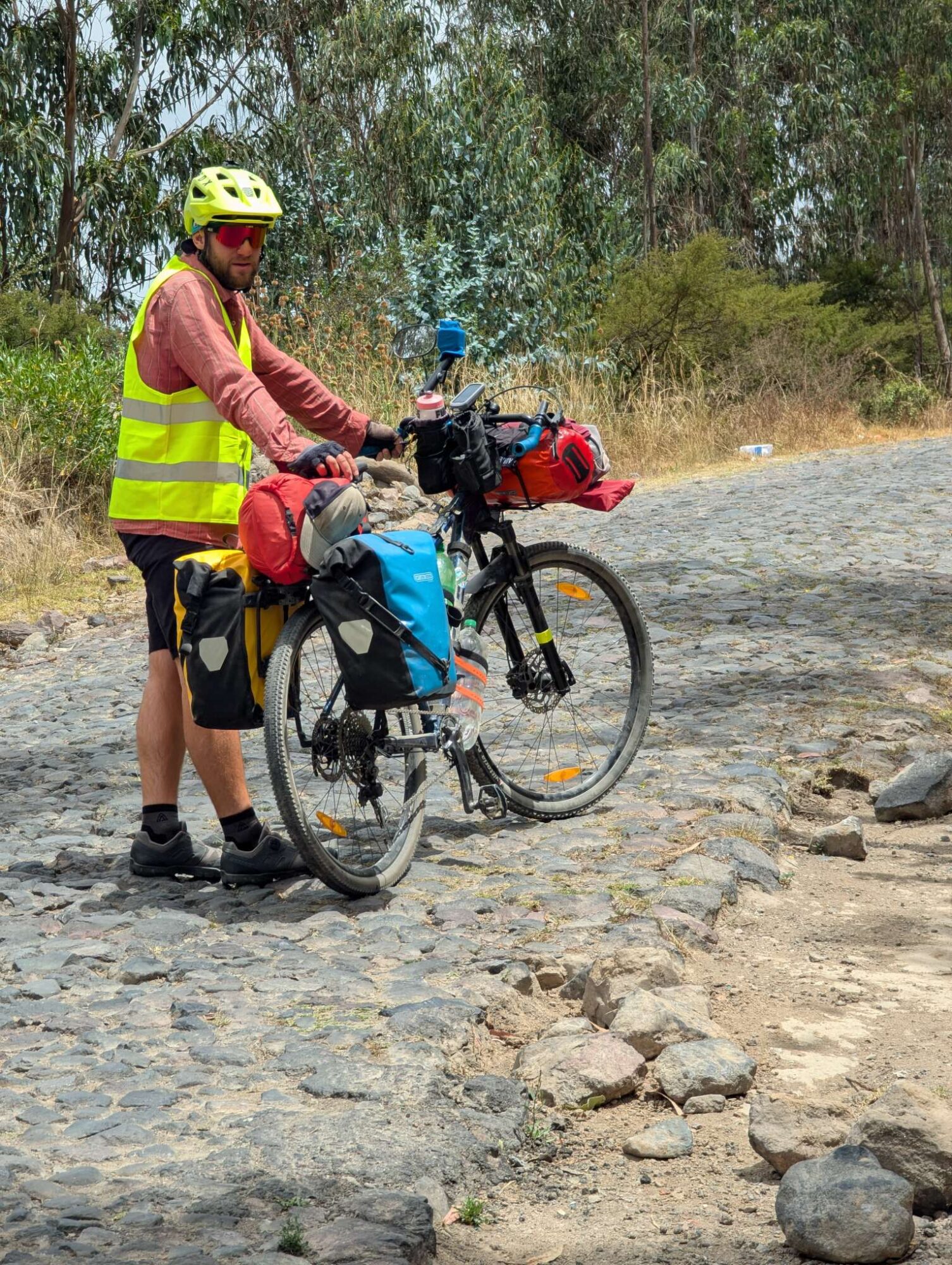
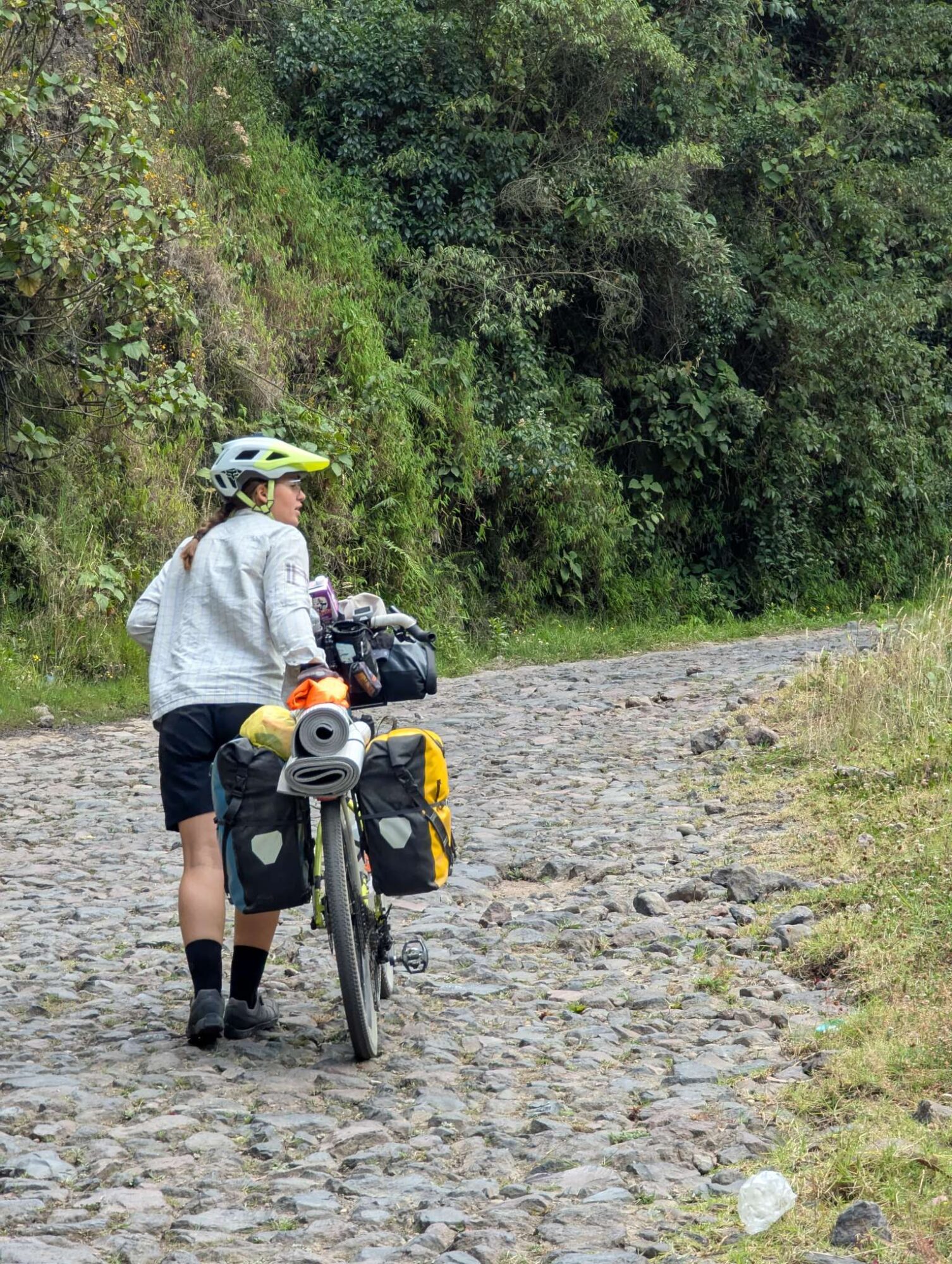
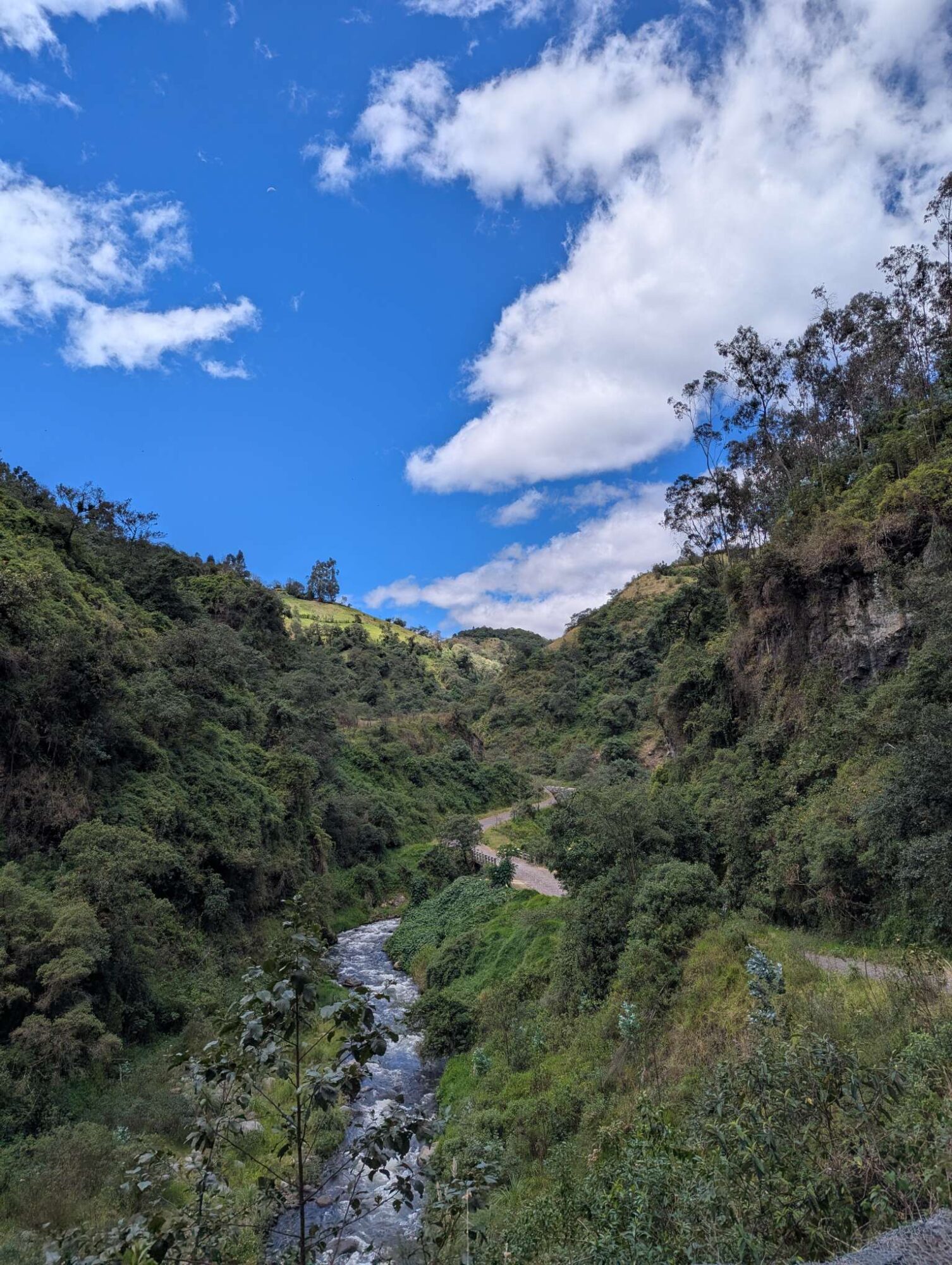
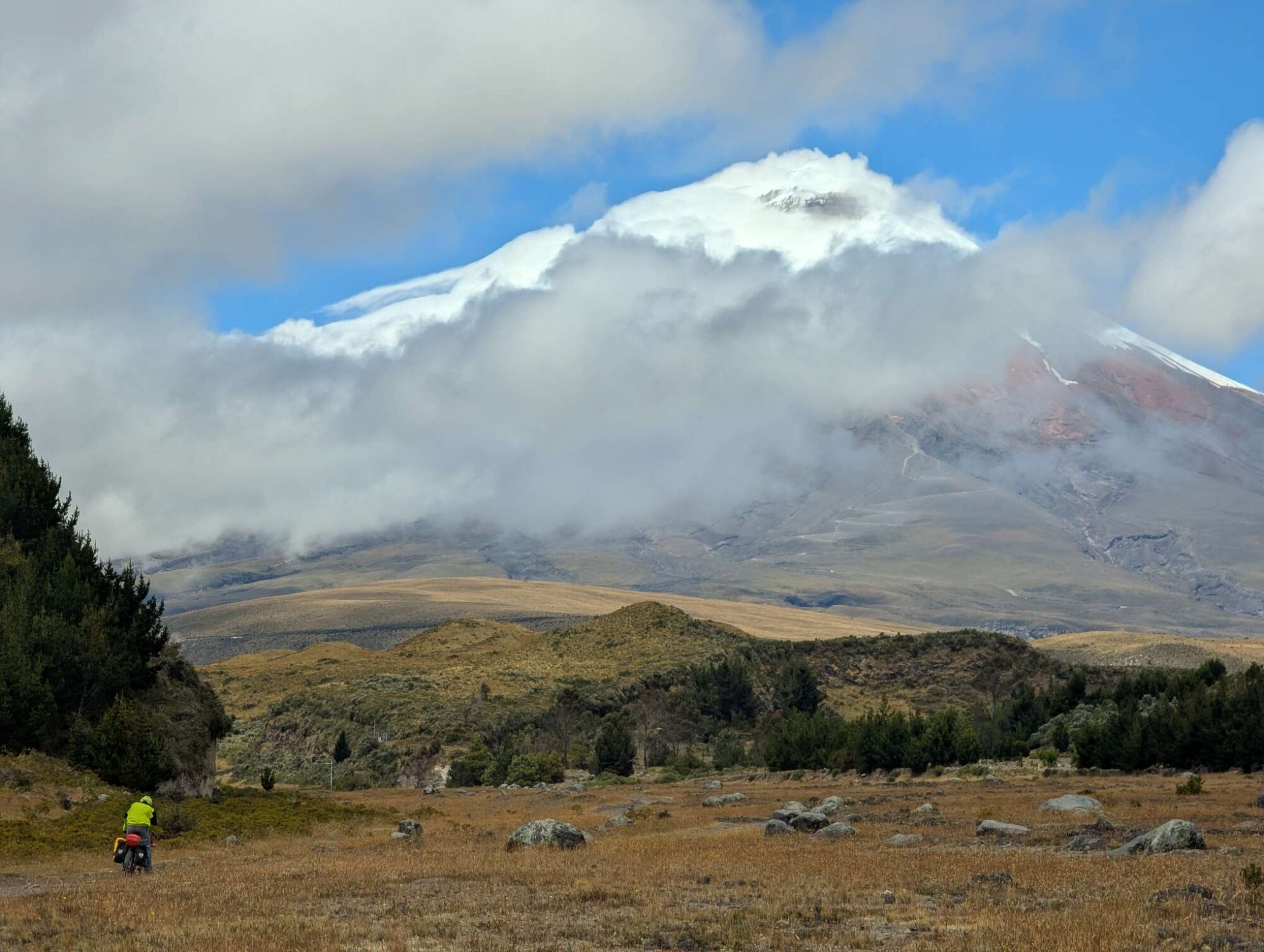
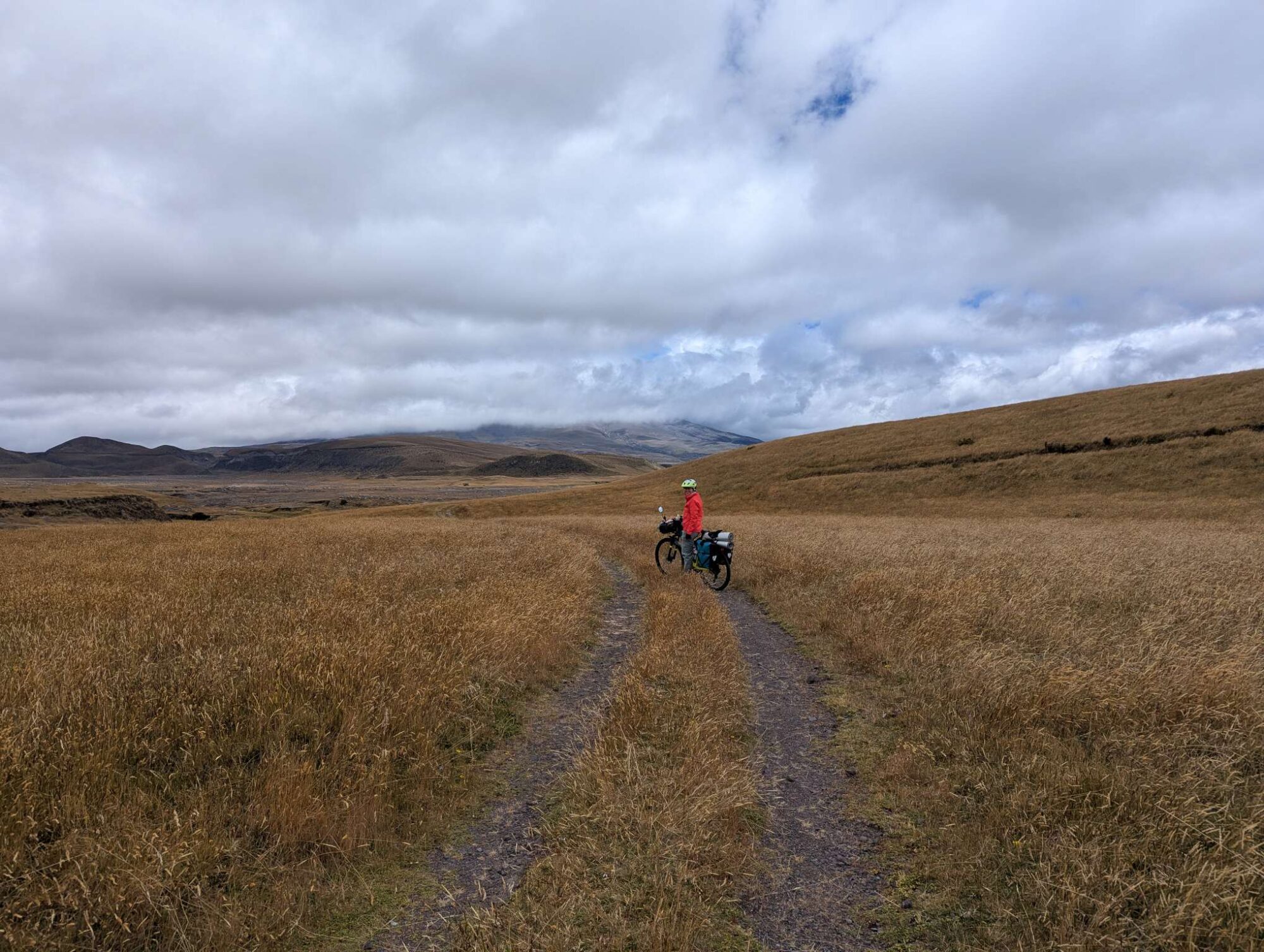
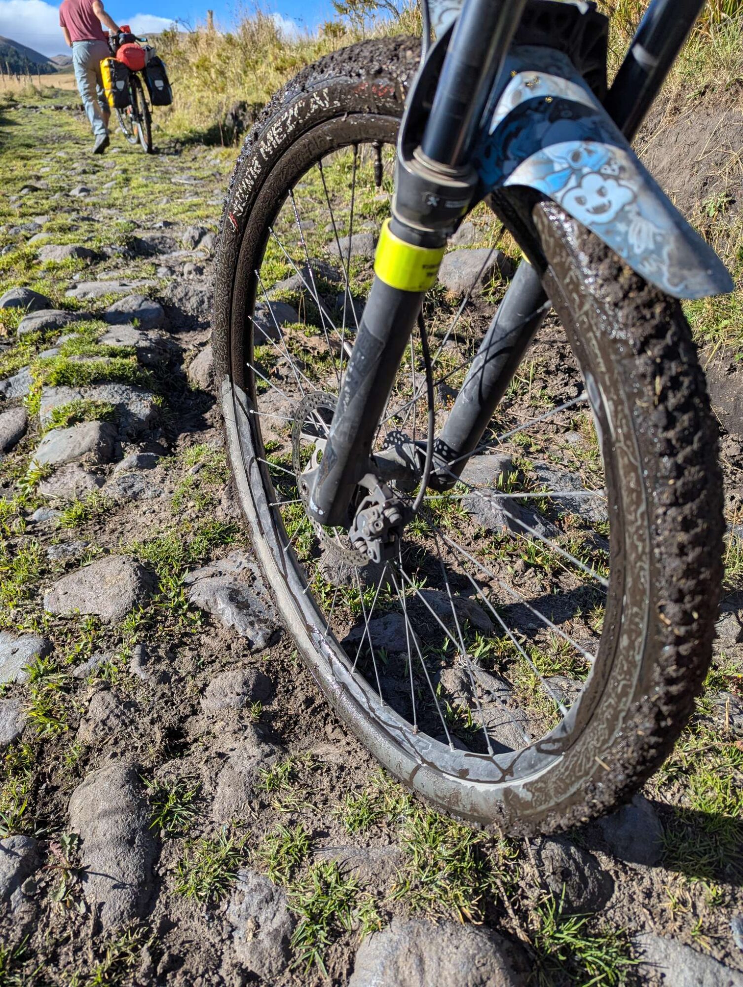
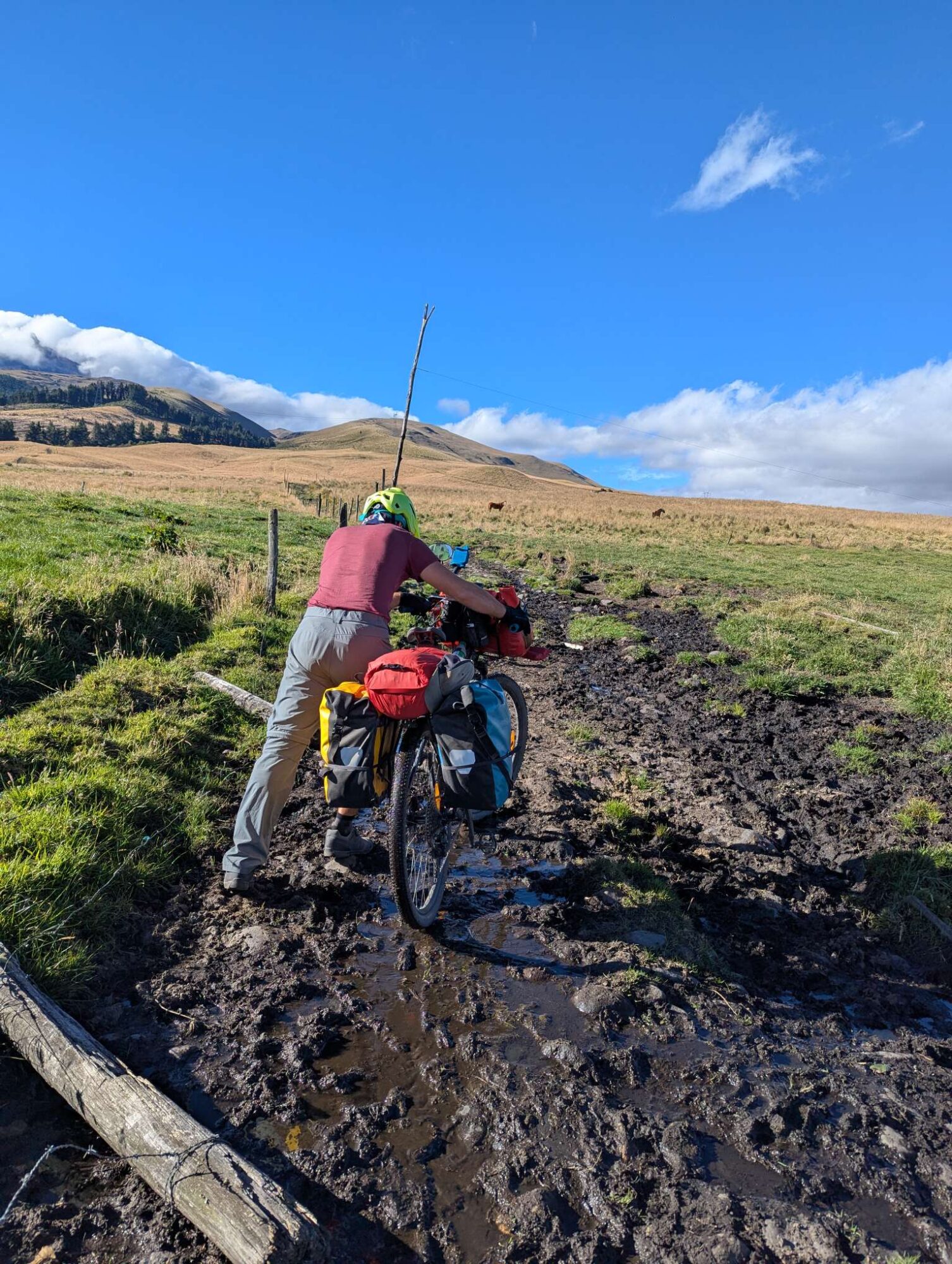
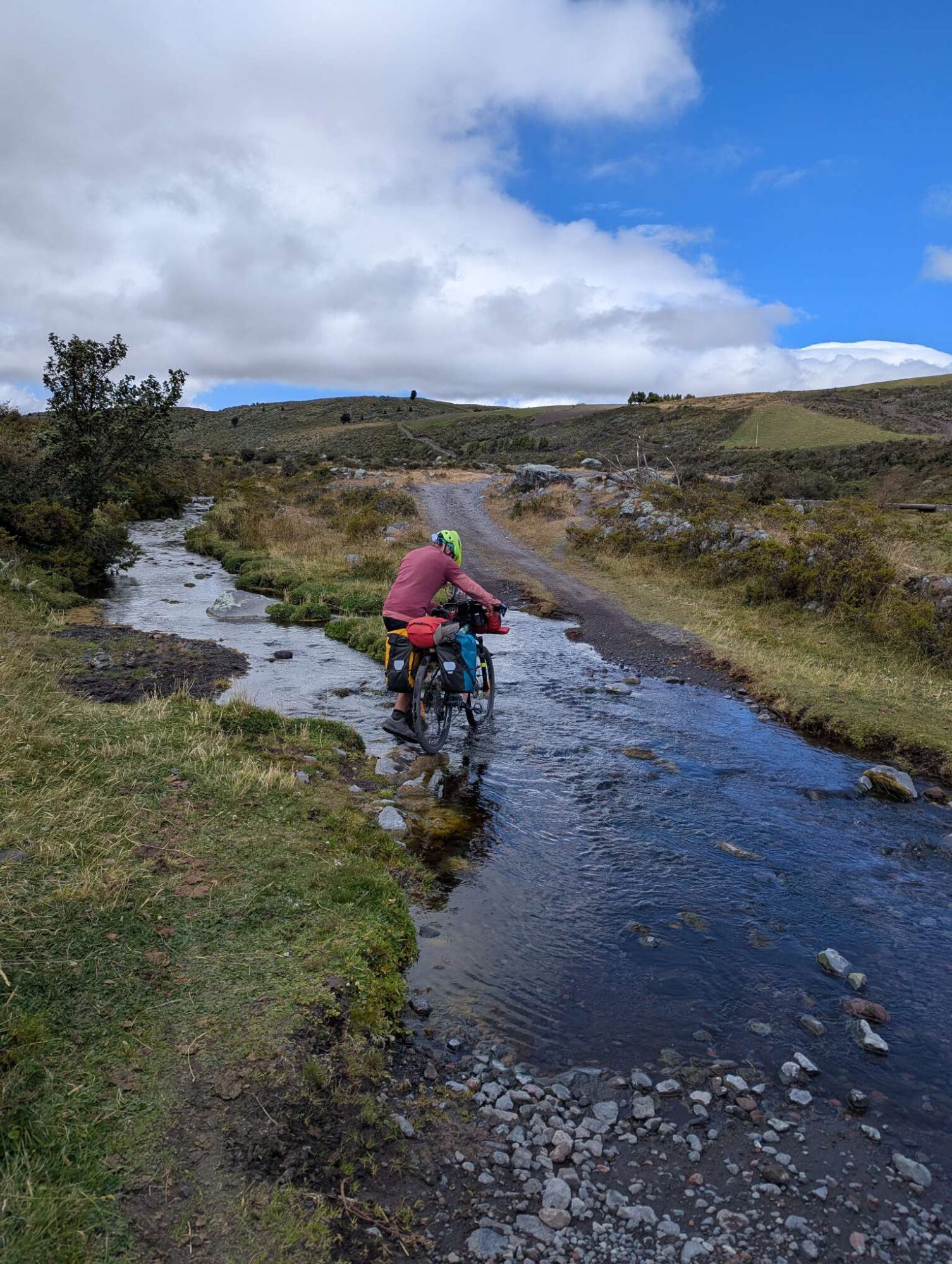
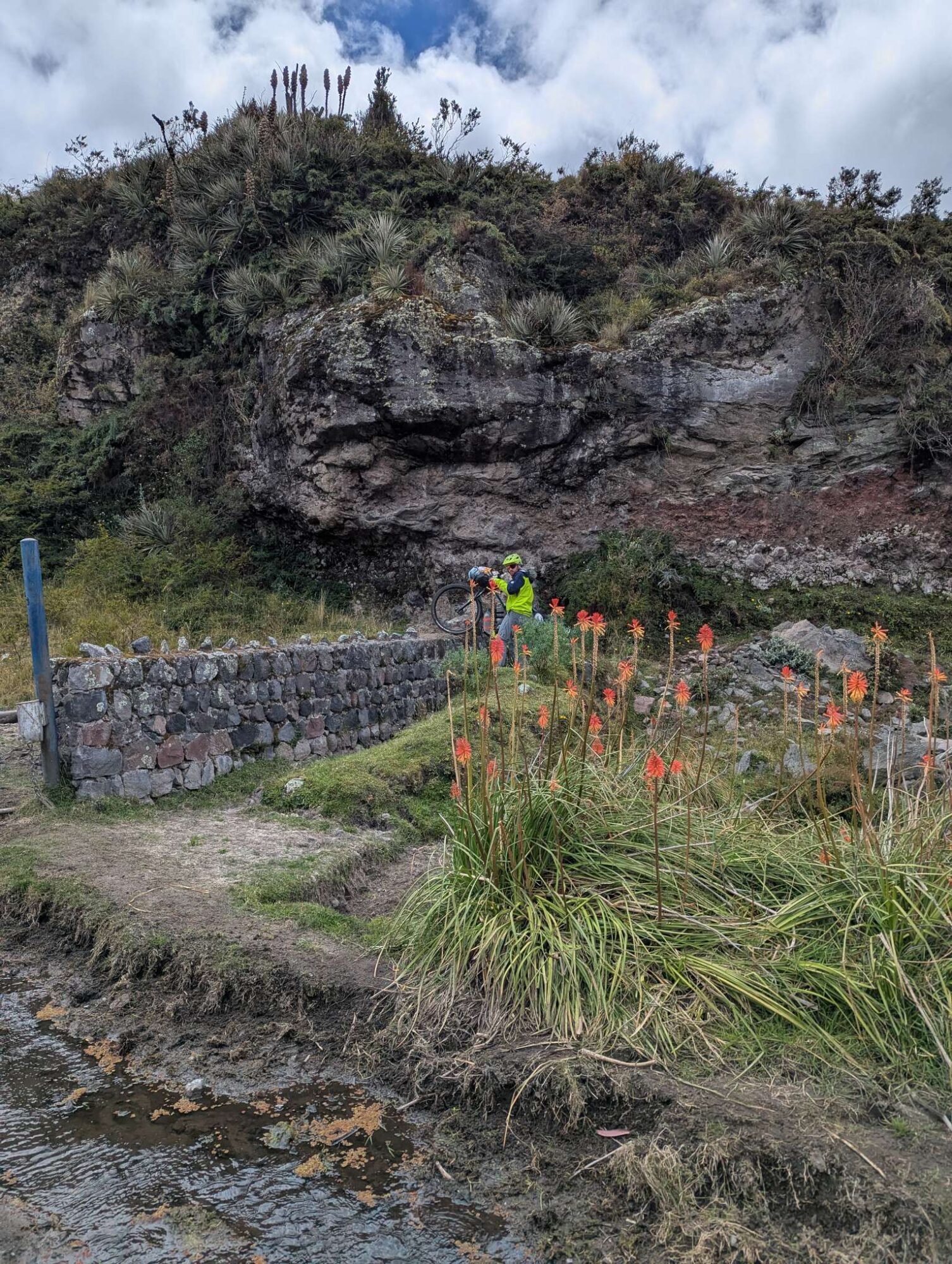
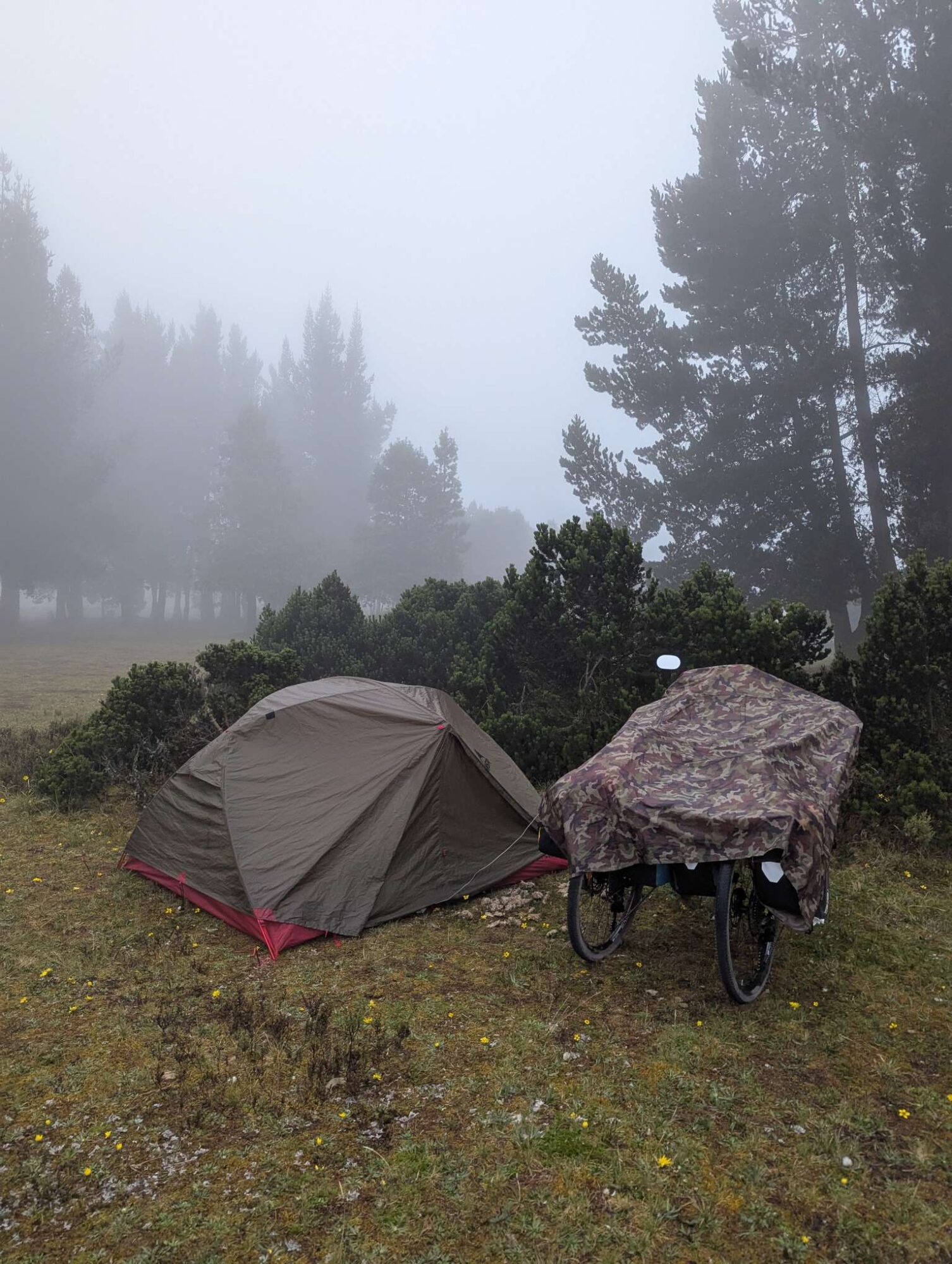
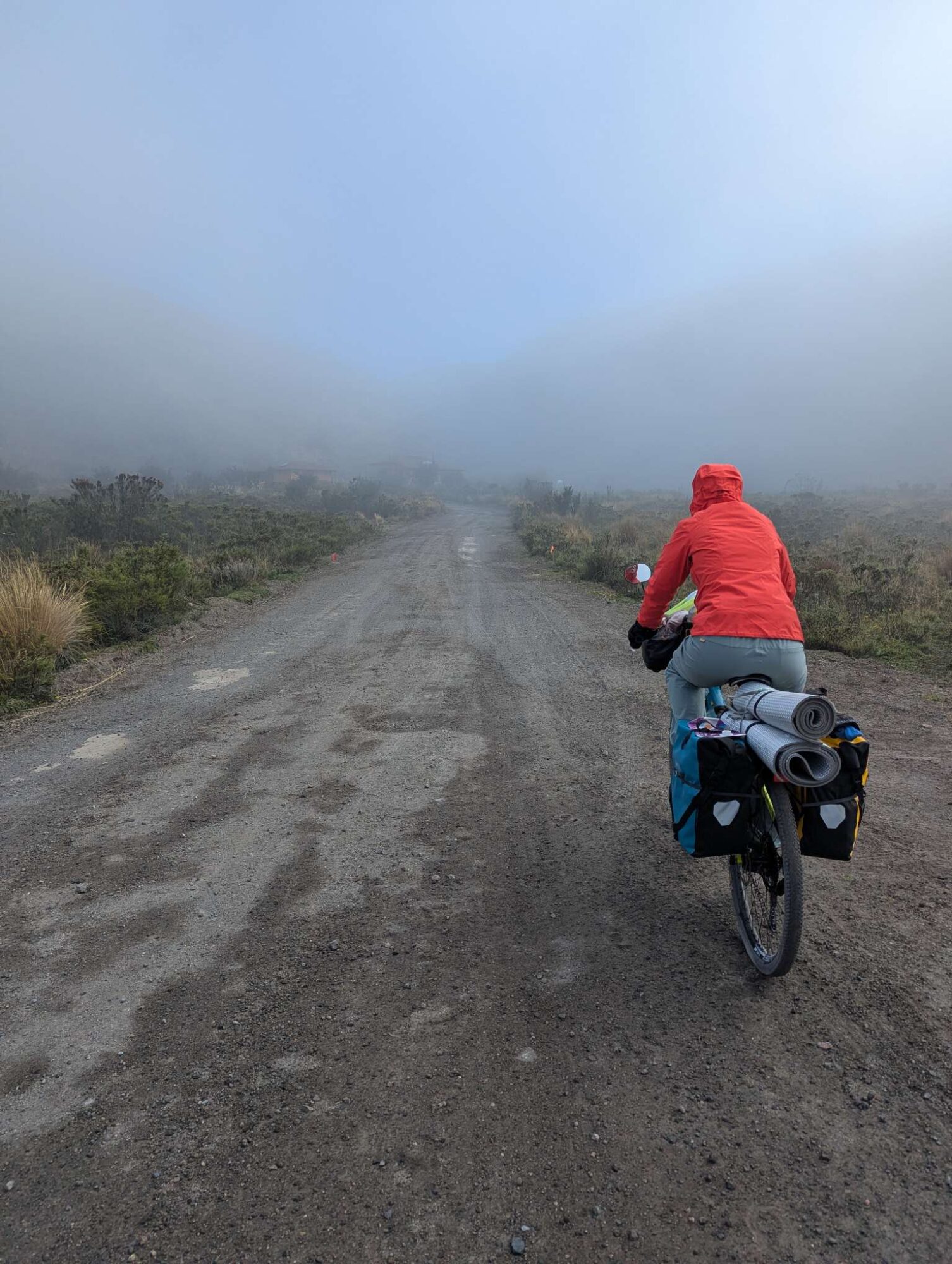
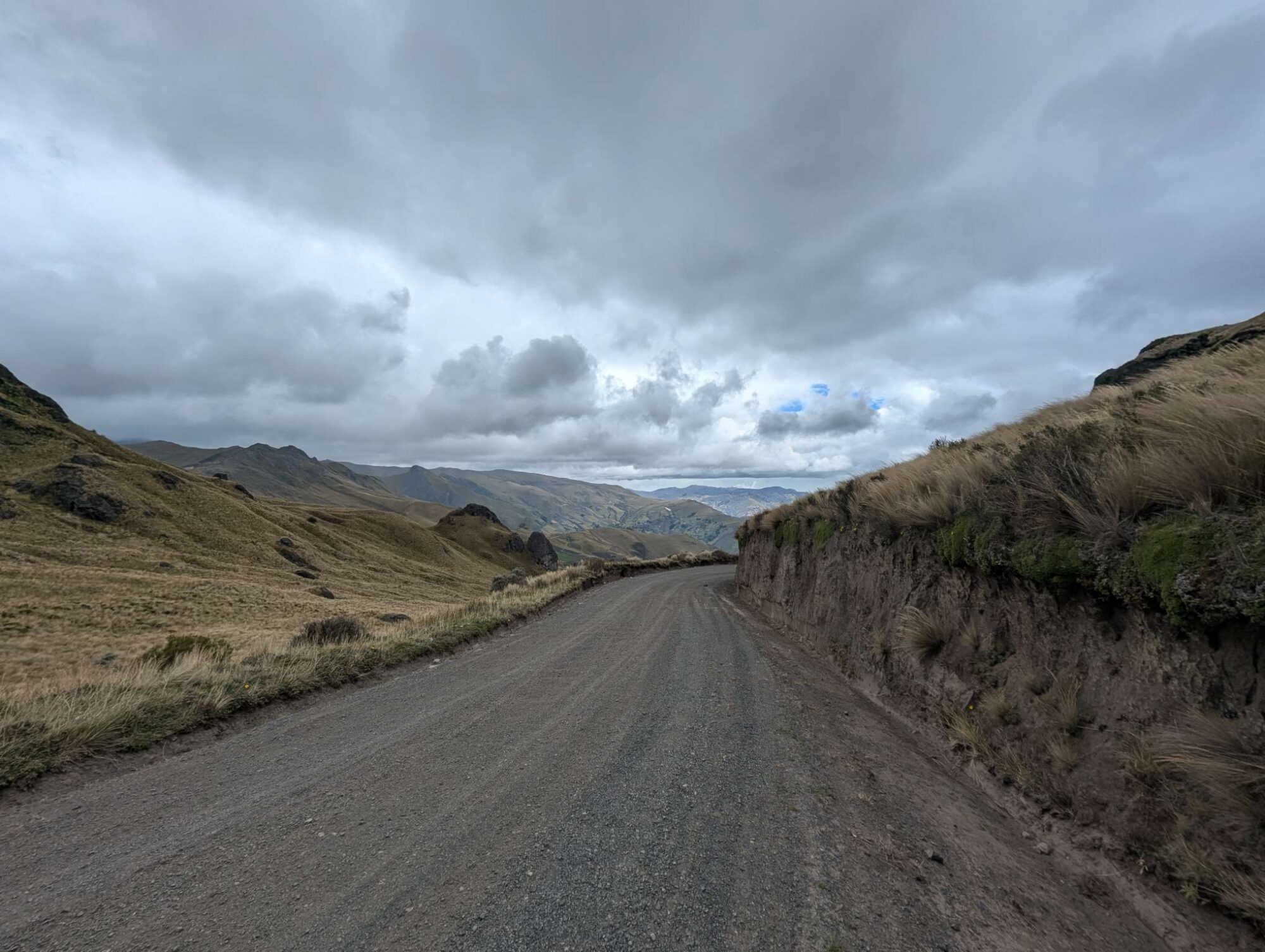
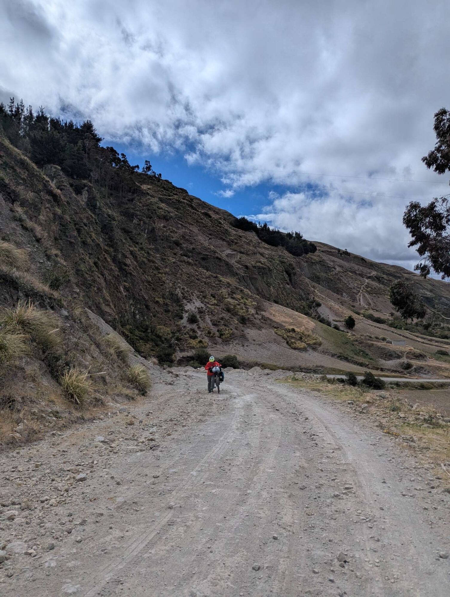
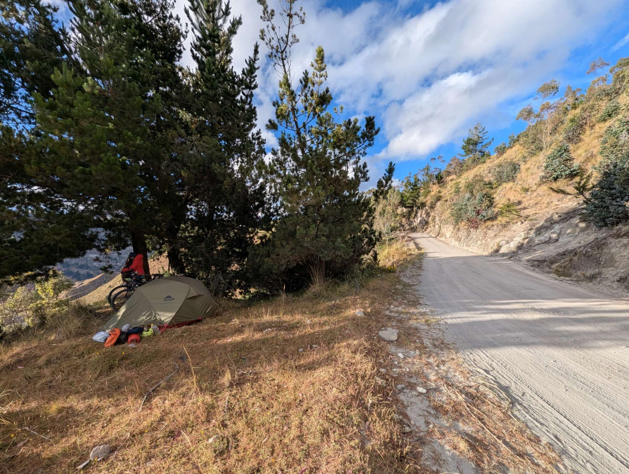
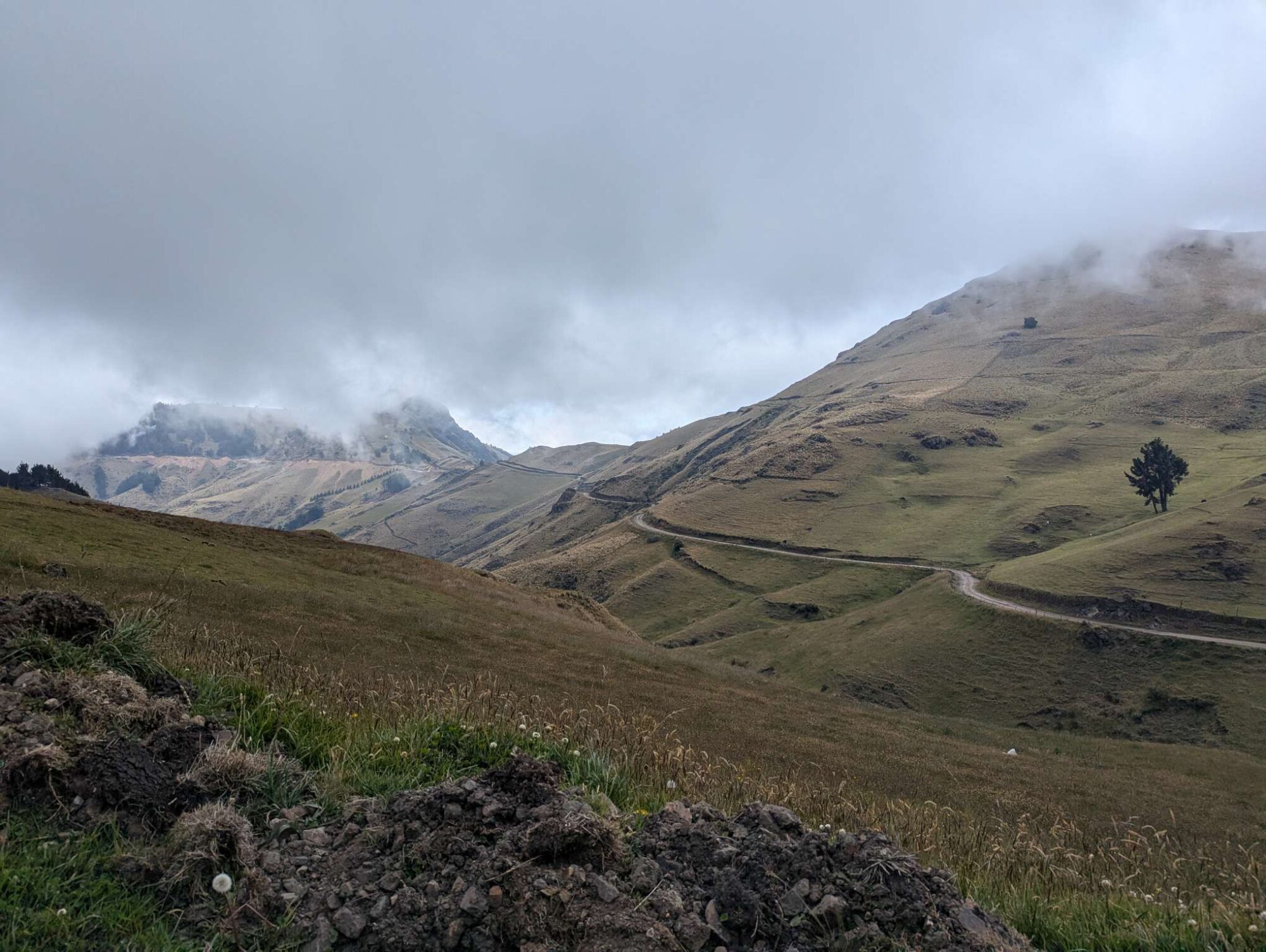
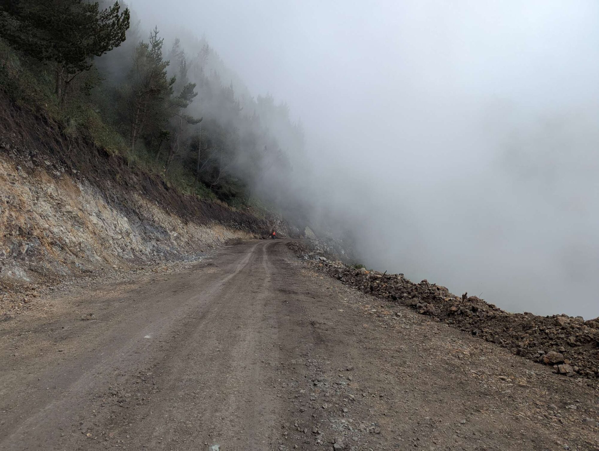
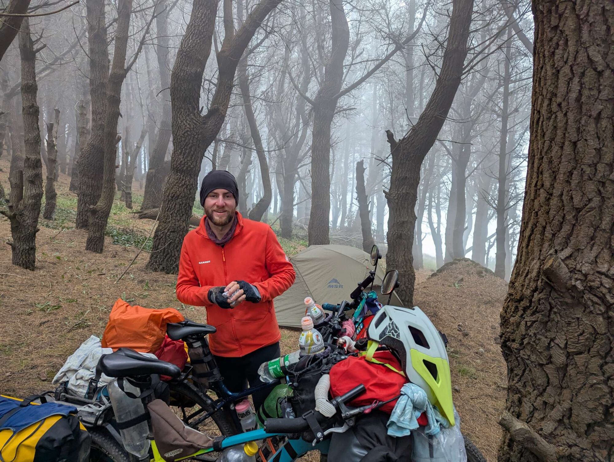
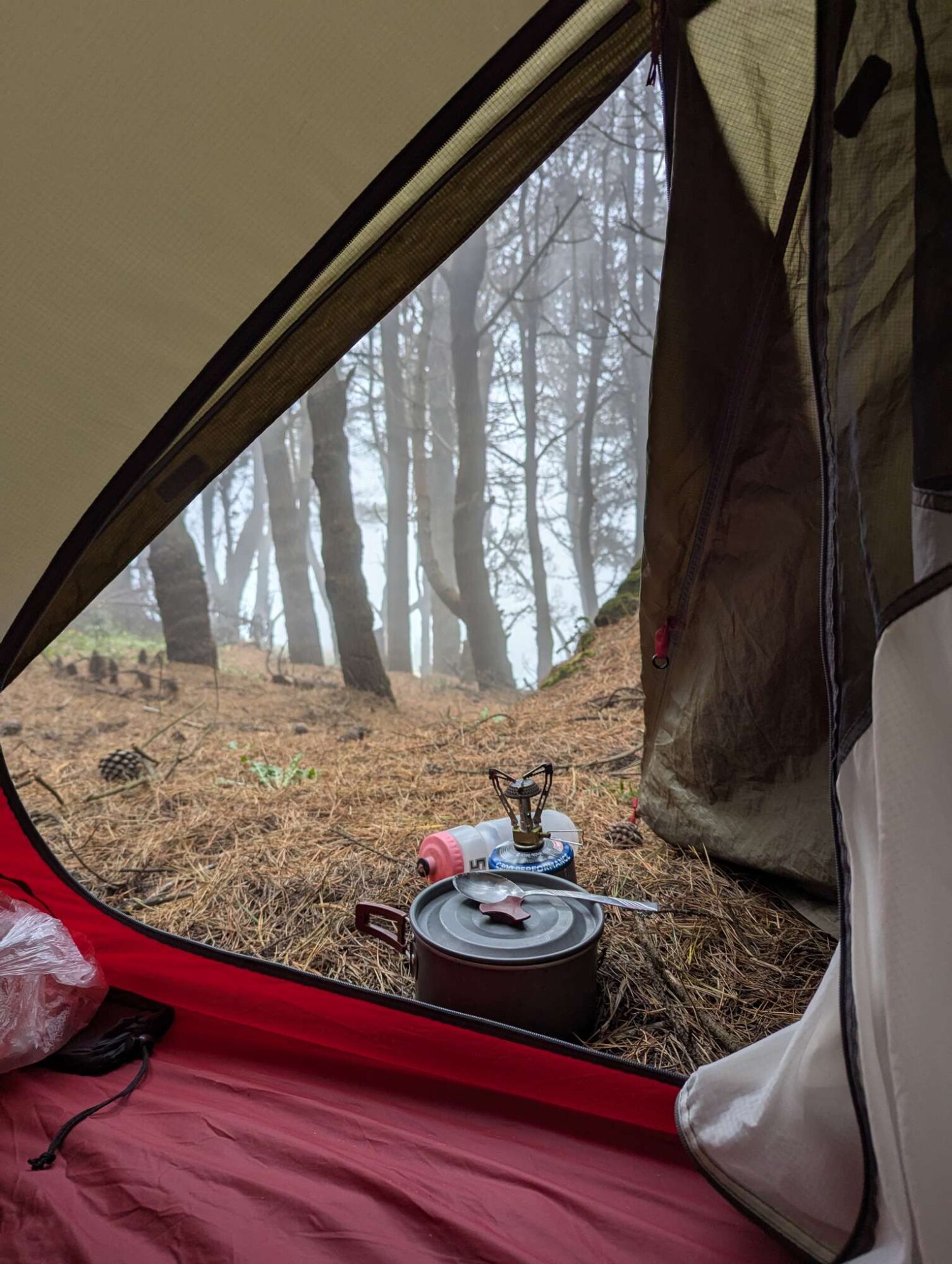
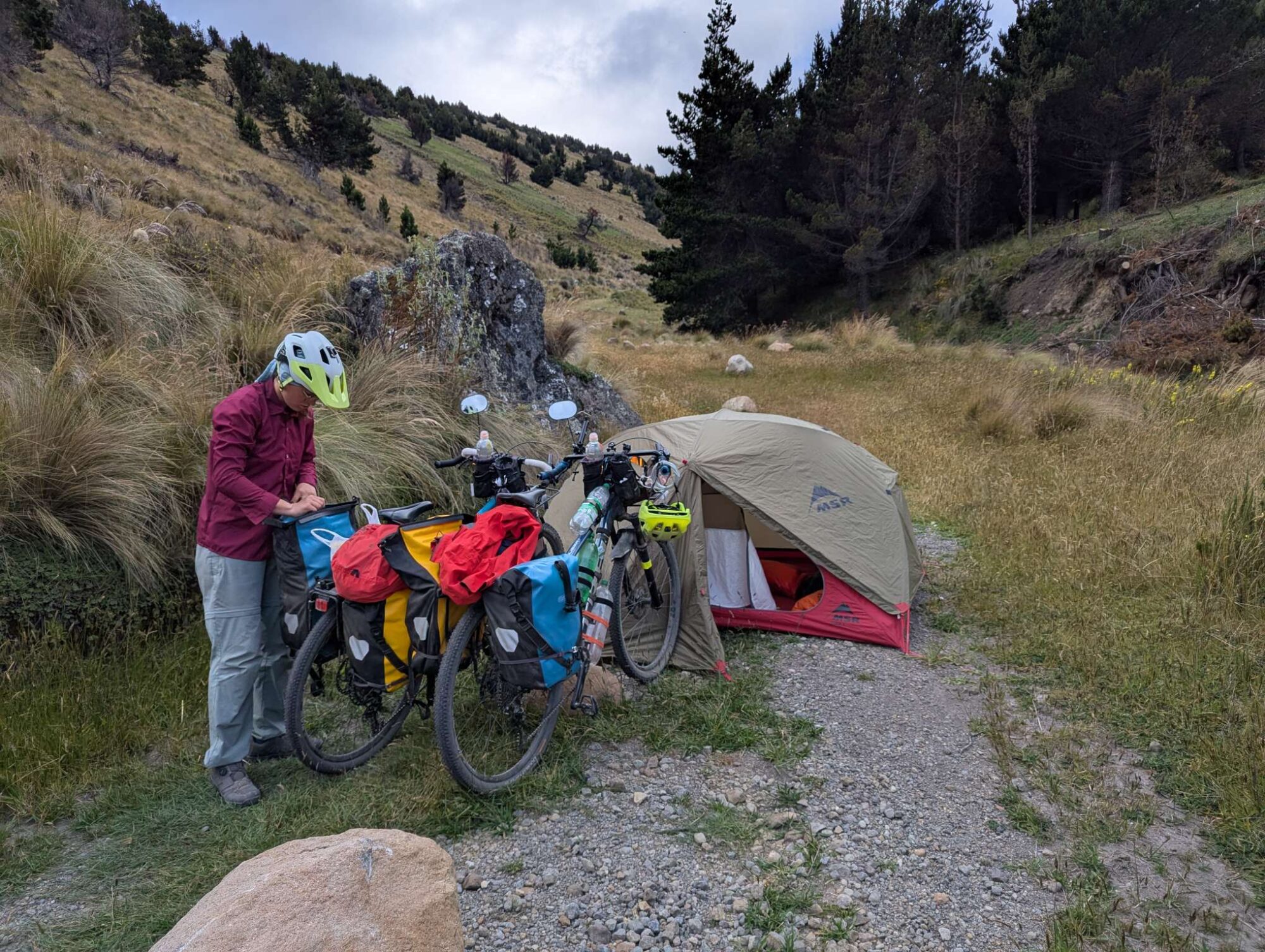
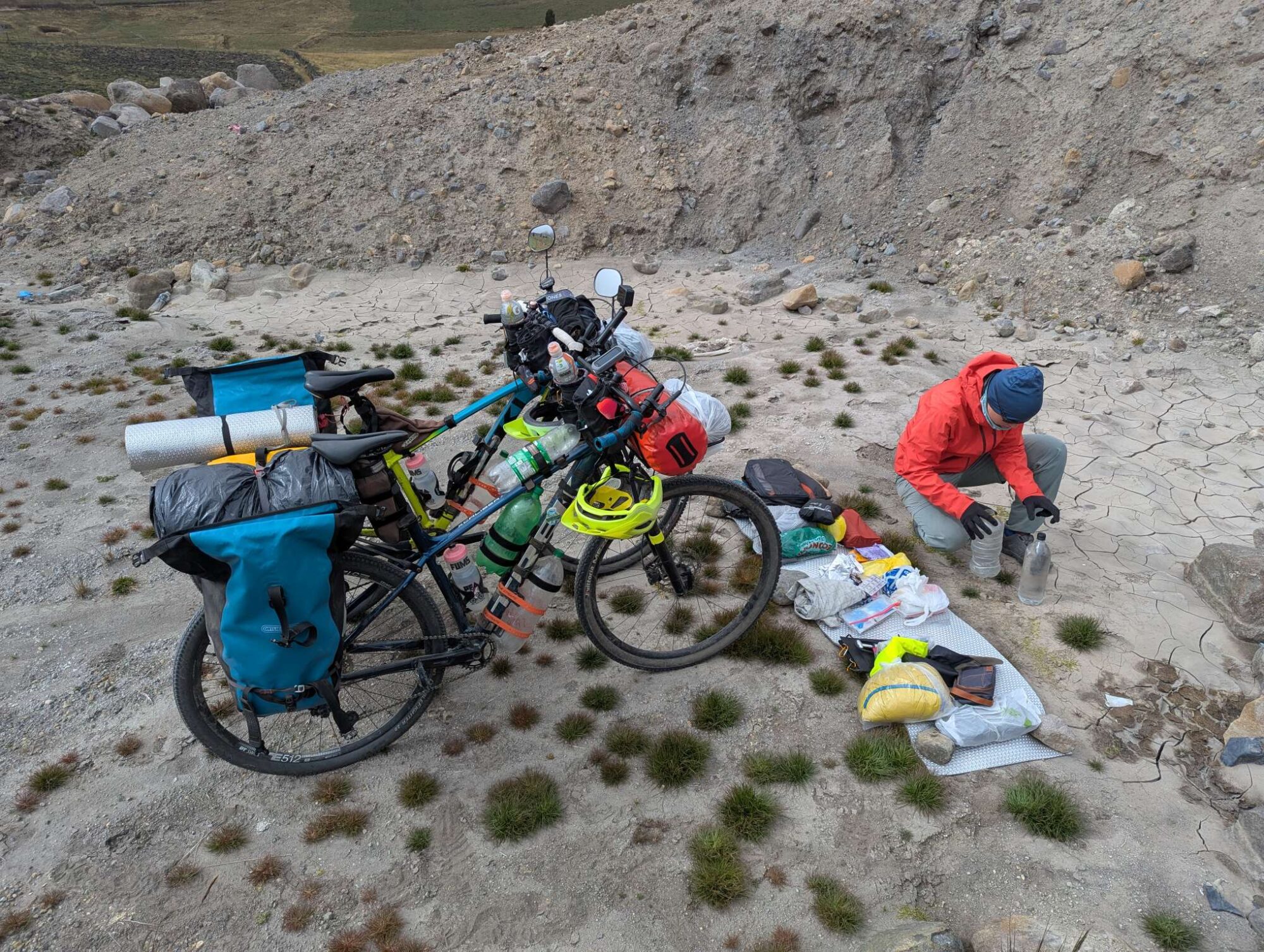
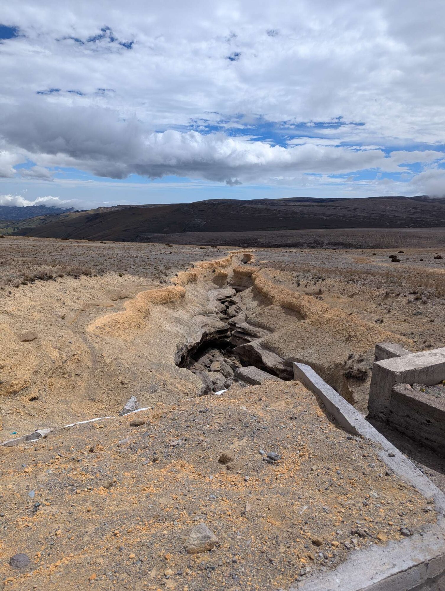
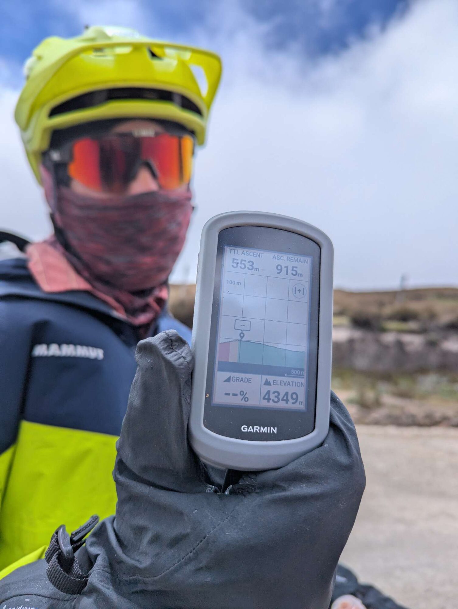
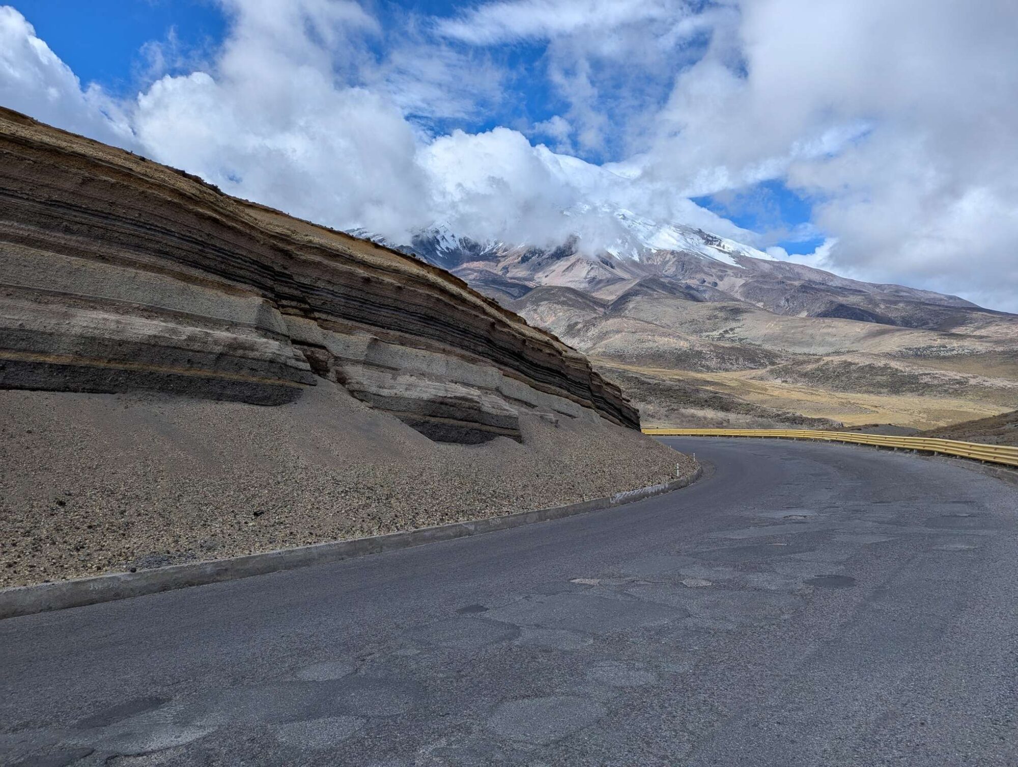
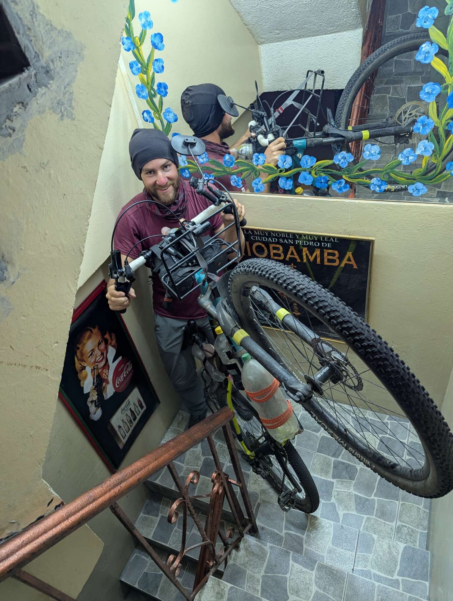
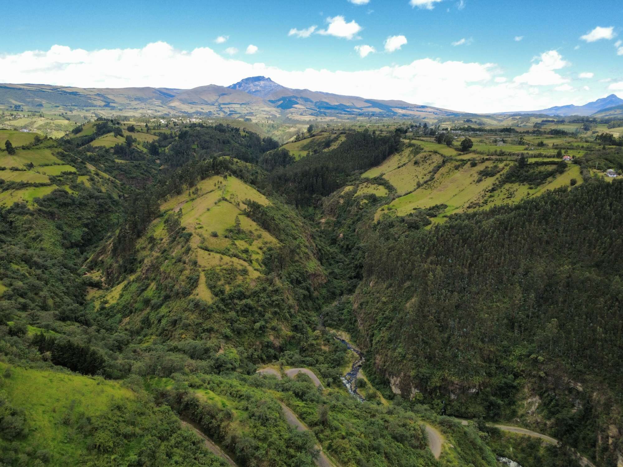
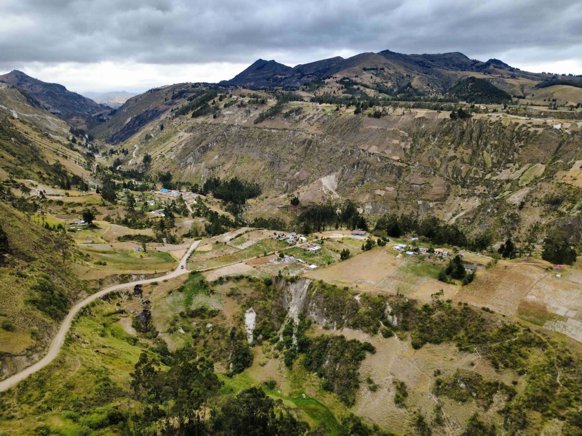
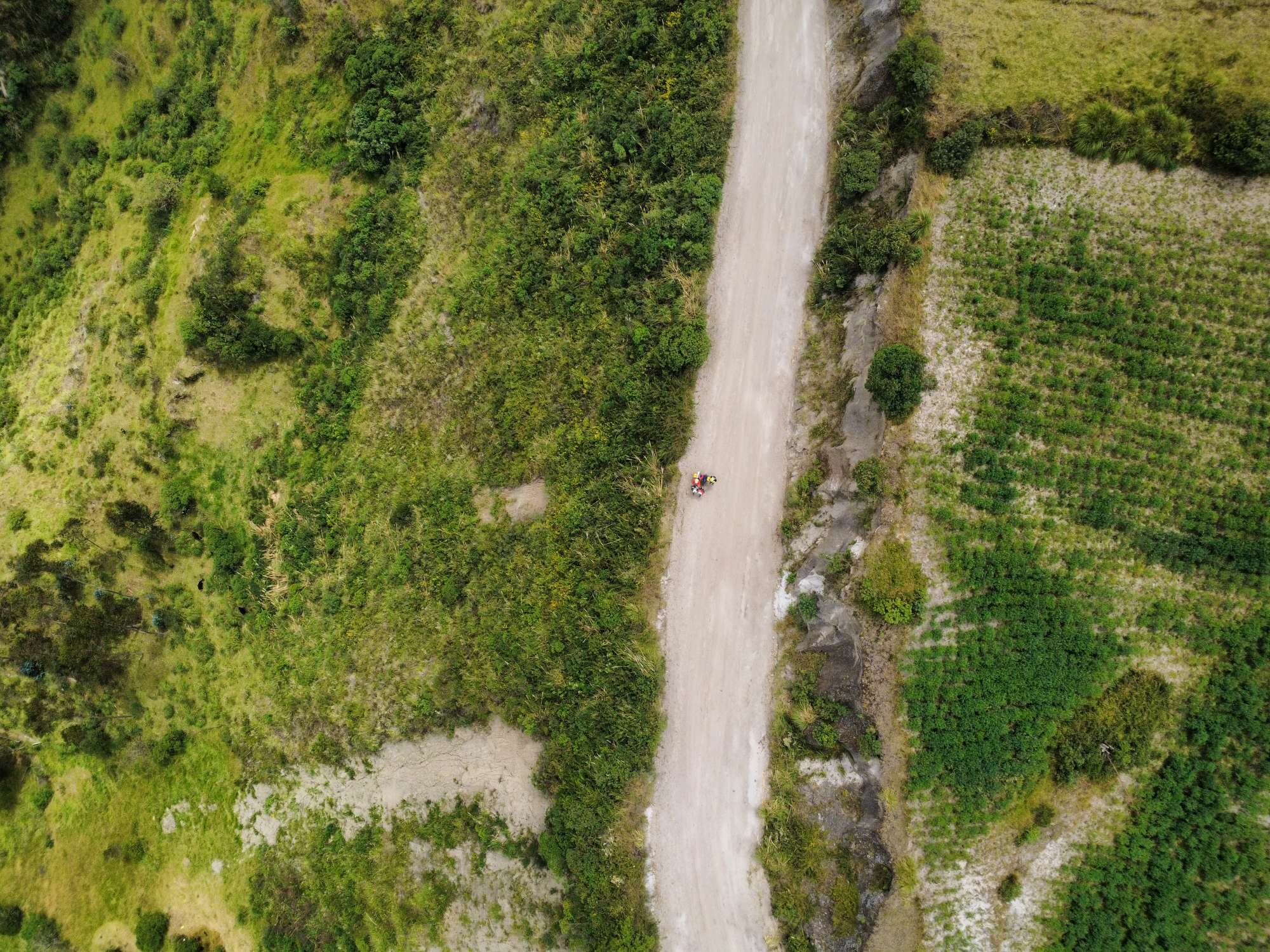
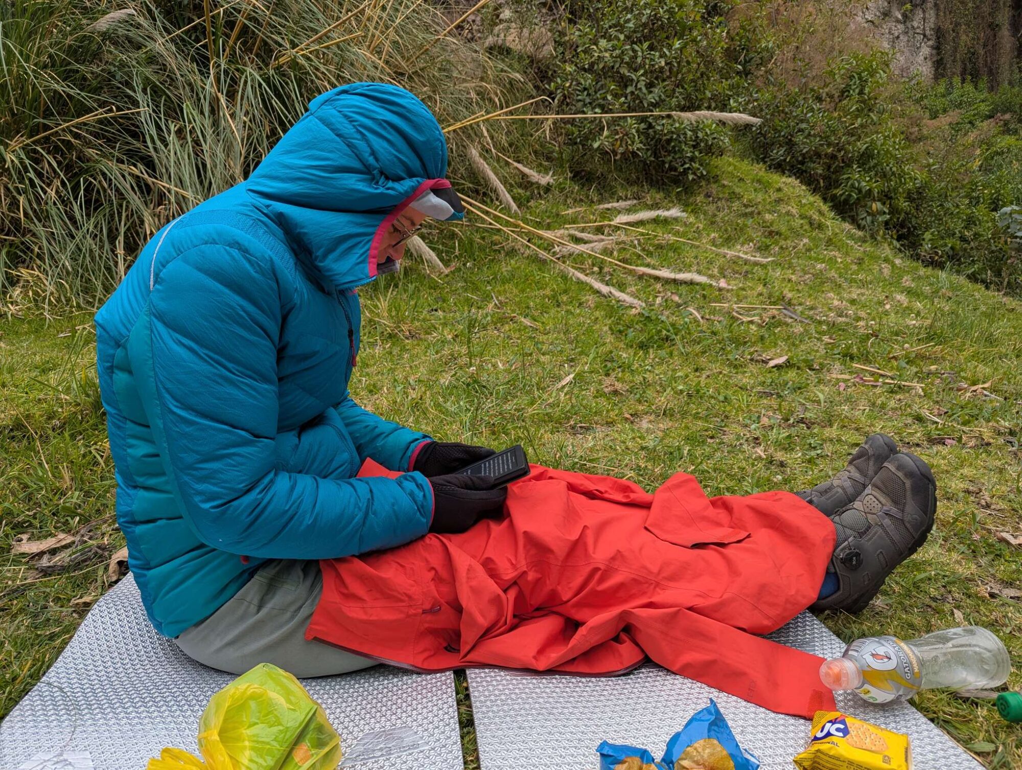
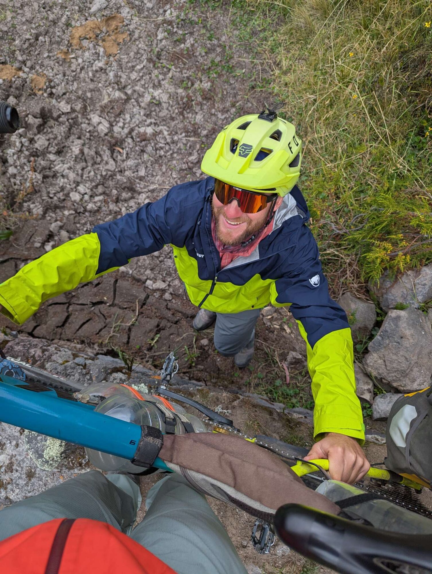
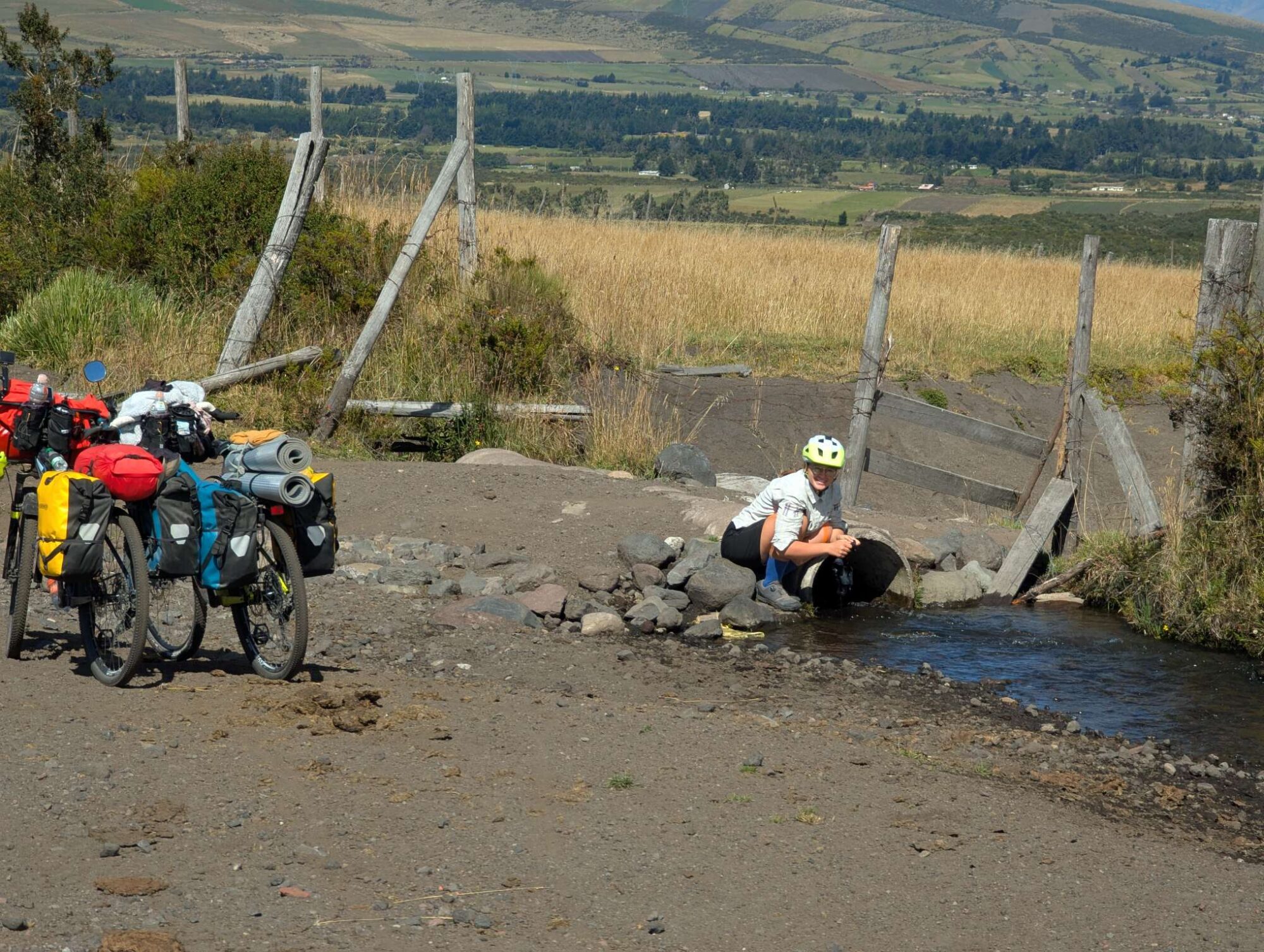
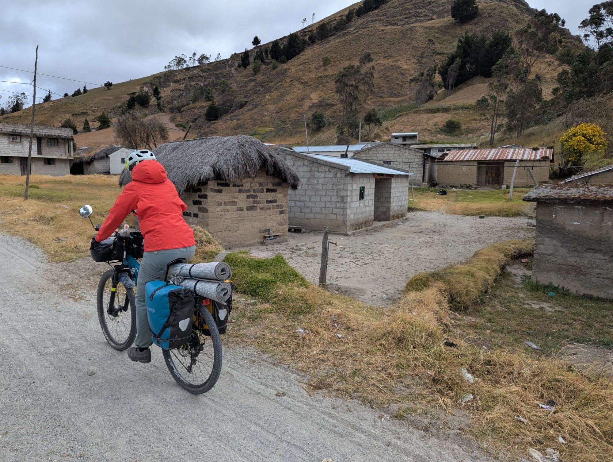
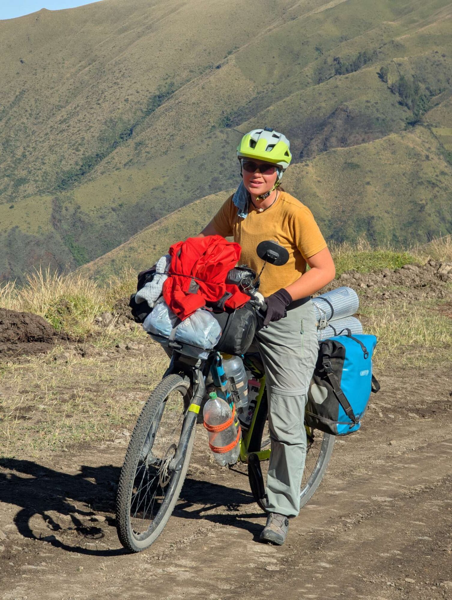
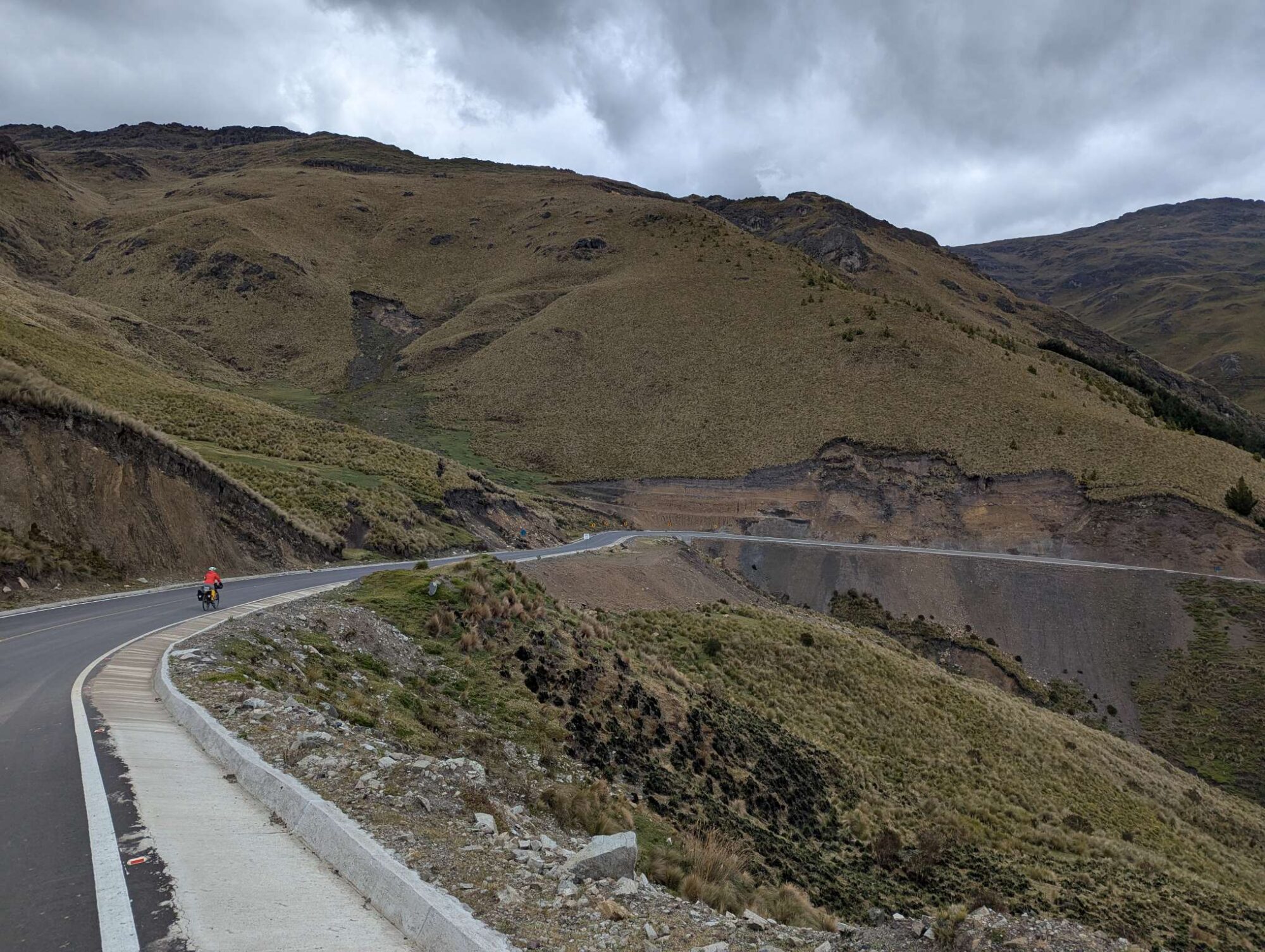
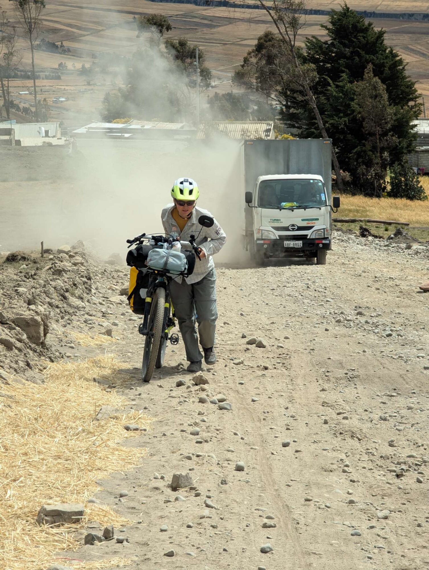
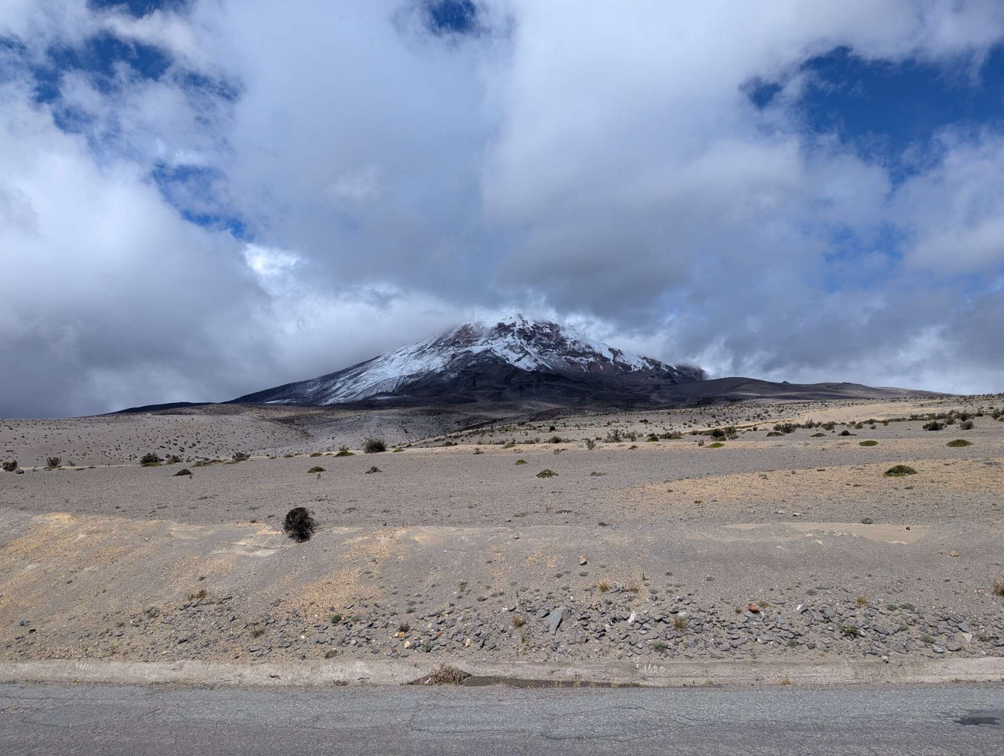
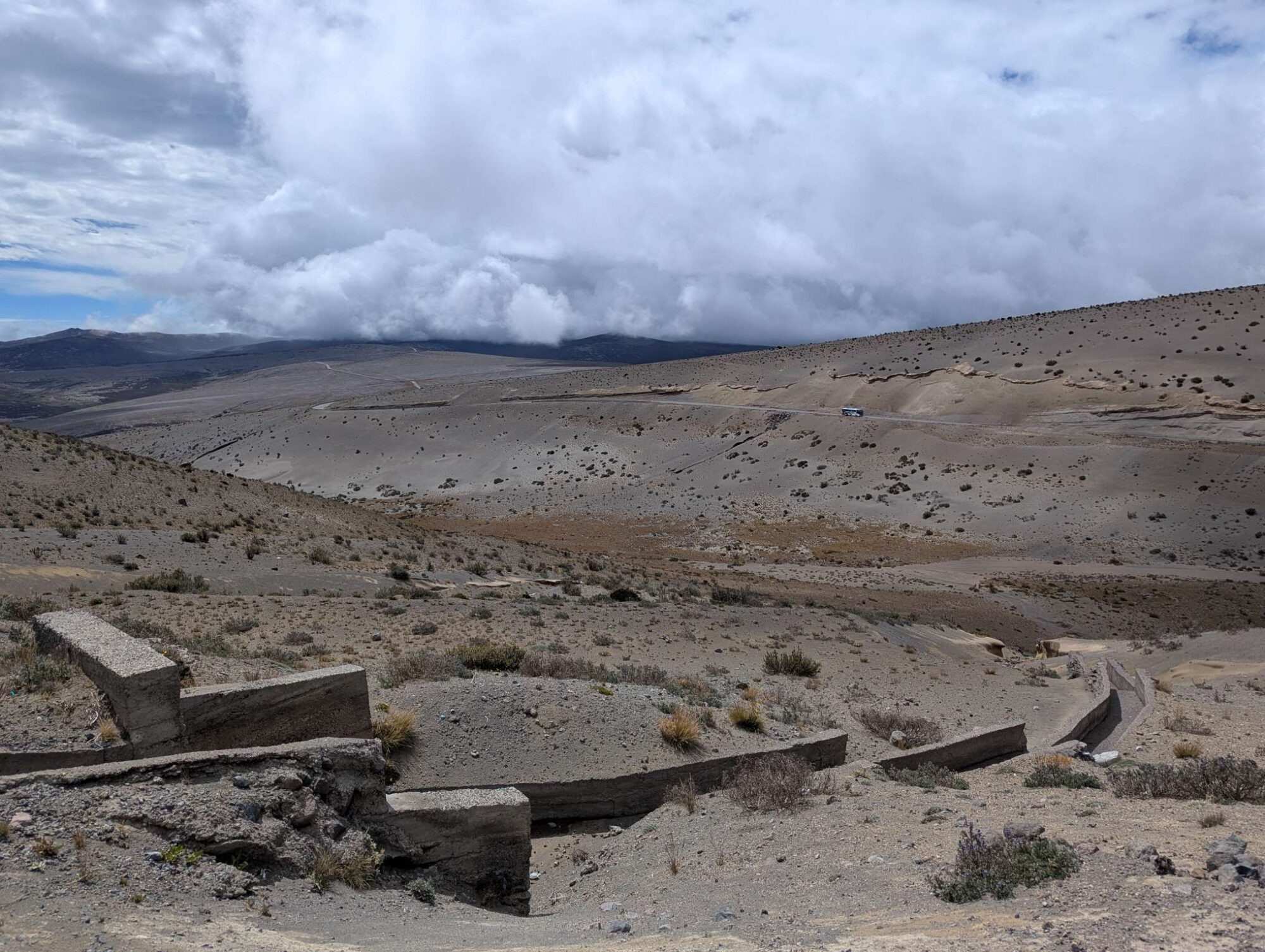
For the last 4 nights we slept at the altitude of 2850 meters, and we didn’t have any problems, sleeping or medical-wise. But we didn’t want to take any risks so early into our trip, especially because we’ve never slept (or spent more time) at such altitudes. So, to stay on the safe side, we followed the recommendations. On Wednesday, day 57, we began to climb higher, then we stopped at 3350 meters, even though that meant only 20 kilometers of cycling. But it wasn’t as if those kilometers were easy. The roads were in terrible condition to cycle (or to travel in any other way); many kilometers were paved, but the rocks that were used were sticking out in every possible direction. There were also plenty of sections of the road that were so steep and in bad condition that it was easier to push our bikes instead of cycling.

It was horrible cycling over paved roads like this - we were afraid of breaking a rack or panniers.
We had no idea that was only the start of pushing our bikes uphill.
At least the nature was beautiful.

We developed a habit of assigning a score to the environment around us as we are cycling, based on how good it is for stealth camping. Ever since we left our room in the morning, we haven’t spotted a single place that would be a “good spot” in our books. We hoped that things would change as we were to approach our 20-kilometer mark, but sadly it wasn’t so. Everything was fenced away with barbed wire, either as a field or a meadow with cows or horses. Around two kilometers before the end, we stopped by the road and asked a local family if we could put up our tent somewhere on the corner of their land overnight, but with their Spanish at the 1.5x speed, we only understood “… no here, no there …”, so we thanked them and continued. At the altitude of 3330 meters, we found a bit of grass by the road where the fence with spiky wire was taken off, and we stopped there. It was good enough, and the road wasn’t heavy with traffic (there was only one motorbike in the next 3 hours). At 6 PM the sun went behind the hill, and it suddenly got a lot colder, so we quickly set up a tent. We were to put our new sleeping bags and inflatable mattresses to a test for the first night. The forecast said to expect temperatures as low as 7°C.

Evening of day 57.
We camped right by the road on day 57, luckily it wasn't very busy.
We were very pleased with new sleeping bags.

We woke up at 6 AM on day 58, but both of us also woke up several times during the night. It wasn’t as much for the cold (sleeping bags did their job); neither of us could pinpoint the reason, but we suspected the altitude and the lack of oxygen. Hopefully, it won’t take too long for us to get adjusted to the Andes.

The morning was cold, and it wasn’t particularly pleasant to get out of the sleeping bag and put on cold clothes. When we left the tent, we were in two layers of pants and 3 layers over the torso, together with a hat, buff, and gloves. Our weakest points were our feet because we had only regular socks (which weren’t very warm) and one pair of thick woolen socks for sleeping (which are too thick to go into shoes). If we’re too cold in the next few weeks, we will find some warmer socks. It was a regular business after we were out of the tent—pack everything, eat breakfast, brush teeth, and go to the toilet (this part wasn’t fun because one’s ass quickly starts to get cold out in the open). We continued cycling around 7:30, and we were slowly peeling off the layers as we were getting warmer.

We started the day at 3330 meters above sea level, the highest altitude we’ve ever slept at. Our plan was to climb up to the height of 3880 meters in the Cotopaxi National Park, from where we would descend back down to a lower altitude where we would sleep. The plan was solid on paper, but the roads were terrible, and the lack of oxygen didn’t help as we were climbing. It took us over 3 hours to reach 10 kilometers (a bit after 11:00), and it was almost 15:00 when we reached the highest point. We were both getting exhausted, and we didn’t have a strong wish to start to descend on the bad roads. Iris also started to get a mild headache, which we explained with a combination of high altitude, heavy wind through the day, and not drinking enough water. Anyway, we stopped after 2-3 kilometers at the altitude of 3830m at the designated campground, where we paid 3$ per person. We really wanted to get out of the wind, and the price was worth it since we could set up a tent at 17:00 and take a rest.

One of the entrances to Cotopaxi National Park, this one was closed for cars and motorbikes.
Cotopaxi mountain behind clouds.
Cycling through national park with Cotopaxi in the background.

Now, one obvious question is why did it take us the whole day to do 23 kilometers and 650 vertical meters? There are a few reasons. An easy one is that the roads were horrible—a combination of big rocks, soft sand, grass, mud, and holes. We had to constantly steer around the rocks, step off the bikes, or push them. It didn’t help that the worst sections were usually also the steepest ones, where we struggled to push our bikes up the hill.

Another one is the constant strong headwind that we had through the whole day—even flat sections with rideable roads became much harder, and we were usually cycling in first or second gear. And the third reason would probably be the altitude. At 3500 meters the level of oxygen in the air is only 65% of the one at sea level. This meant that we were breathing heavily at the smaller climbs, and our legs started to burn as soon as we had to push on our pedals a little bit harder. But we think (and hope) that we will slowly adjust to this and the cycling will become easier.

Cotopaxi National Park.
Muddy tires and a roughly paved road.
Even though it was hard, we had fun and couldn't stop smiling.

Also, as a bonus point, there were several spots where the water was flowing over a part of the road, and we had to get our bikes on the other side alongside keeping our feet as dry as possible. There was also one point where we had to lift our bikes over the wall because the road was blocked for cars and motorbikes.

Muddy roads.
Crossing small stream.
We had to lift our bikes over the wall to enter Cotopaxi National Park. The gates for cars were locked.

But we were smiling most of the day. It didn’t matter much to us that we were moving at a snail-like pace; the feeling of being away from everyone else, the amazing nature around us, and the fact that we were on a real adventure was what we came here for. Most of the way up we had the view over Cotopaxi—a volcano in the center of Cotopaxi National Park with a snowy peak at 5897 meters, which was mostly hidden in clouds, but we were lucky enough that it peeked out a few times during the day.

At 3830 meters we were very close to that 4000-meter limit that we’ve read about regarding the quality of sleep. If the previous night was semi-good sleep-wise, this one was better. We still woke up a few times during the night, once because of a very strong wind that was bending our tent a little bit, but in general we both woke up more rested. Maybe it helped that we were very exhausted. Anyway, we woke up on Friday, day 59, at 6 AM after almost 10 hours of sleep. Luckily, Iris’s headache passed. When we got out of the tent, it looked as if we were inside a cloud—there was no way to see the Cotopaxi (which was one of the reasons why we wanted to sleep so high); we could hardly see 10 meters away.

Camping area at 3800m in Cotopaxi National Park.
Evening at the campground - we set the tent behind the bushes to get some shelter from the possible wind.
We woke up into the fog at the campground on day 59. We couldn't see Cotopaxi at all.

We had a long descent ahead of us, so we put on several layers of clothes, then went on the bikes. The first few kilometers were on a nice gravel road, which was already better than any road during the last three days, but after a while it turned into an asphalt road. It was crazy how fast we reached the 20-kilometer mark—around an hour thanks to the nice road and 700 vertical meters of descent. It seemed almost unfair how fast the descent was over since the way up took a whole day.

Road in the foggy morning.
It was cold and wet.
Hard-packed gravel road that we used to descend from Cotopaxi Park.

When the sun started to show, we stopped by the road to dry our tent—in the morning it was completely soaked, and we just put it into a garbage bag to be a problem for later. At the bottom of our descent we got into the town of Santa Ana, where we had lunch at a fast food place. We got a burger and a beef steak (each 4.50$), and we used their wifi to check in with the family back at home. There mostly isn’t any phone signal above 3000 meters. We also looked up where we could restock in the next few days and how much food and water we need to take with us. We resupplied in the first small market by the road. In the afternoon Iris’s headache started to come back even though we were 700 meters lower—this time we blamed it more on strong wind and not enough water. She drank one rehydration powder in hope of fixing the problem, but it didn’t pass until the evening when she went to sleep.

Drying our tent in the sun.
We spoiled ourselves in the first fast food restaurant that we found after the descent from Cotopaxi.
The view from our tent on the morning of day 60.
Day 60 - one of the nicest spots we've found.
The same spot from above.

Saturday morning, day 60. Iris woke up several times during the night because of the headache, and it was still there, although in a mild version, in the morning. We weren’t in a hurry, and we didn’t want to risk the problem getting worse, so we decided on a day off. We were at a nice spot and still had enough food with us; it was great timing for a rest day.

Out of habit we took down our tent in the morning, and also in case we would need to move to a different spot if anyone came during the day and told us to go away. But we had the tent back up in a couple of hours when light rain started to fall. So we spent most of the day in and around the tent; temperatures jumped because of the cold wind and hot sun, and we periodically put on more or fewer layers because of it. In the evening came a short shower, and we were disappointed when our tent started to leak a little bit—we blamed the weathered waterproof cover because of the 6 months of sun, but the holes that grasshoppers left didn’t help in that situation.

Day 61. We woke up at 6:30 to a dry morning, but that didn’t last long. Before we got out of the tent, it started to rain again, and our tent got wet. We waited for half an hour until the rain calmed down, then we packed as fast as we could. Sometime past 8 we were on the road, wearing fleece and a hardshell over it. It wasn’t long before we were both sweating, and we had to take off some layers. Luckily, the rain stopped by then, but the wind remained. Since we don’t have many extra clothes with us, we had to make sure to wear the bare minimum to not get sweaty; otherwise, we wouldn’t have any dry clothes for later. Because of that, we were constantly a bit chilly.

For the next 18 kilometers the road was uphill, and we ascended from 3250m to 3970m above sea level. Most of the time the road wasn’t too steep, and we were able to pedal uphill, but there were occasional sections of soft sandy road where we had to push our bikes because our tires were slipping. All went well until the last kilometer to the top—we got off track, and we didn’t want to turn around and find the right road, so we went almost straight over the hill directly toward the road on which we should have been. The problem was that the road over the hill was so steep that we both had to push one bike at a time, and I’m not exaggerating when I say that we had to take a break every 10-20 meters of distance. It was so steep that it was hard to just walk downhill when we went back to get the second bike.

Beautiful nature and colorful fields around us.
Part of the steepest hill we've encountered. We had to get to that rock on top, and it took us well over half an hour.
Celebrating reaching the top of that hill.

Anyway, we got to the top, completely exhausted. With 3970 meters, that was our new highest point we’ve ever been on. From there, we had over 10 kilometers of descent on a semi-nice gravel road until we ended up in the town called Isinliví, 1000 meters lower. There we went into a small market to buy pasta and cooked beans, then we had one last short but steep hill to the location where we would sleep. It was a concrete roof on top of the hill by the town, which we found on the iOverlander app. We got there just as a strong rain shower started, and we were glad for the roof. It was around 16:00, and we still had enough daylight to dry our tent from the morning rain.

Gravel road on which we descended to Insiliví.
A concrete roof at the top of a small hill by the Insiliví town. We dried our tent and hid from the rain.

We were hesitant about whether to continue cycling or have a rest day on day 62. We were hoping for a rainy day, which would be a great excuse, but we woke up to a partly cloudy morning with sun on our tent, so we packed everything and left. Light rain came just as we sat on the bikes, but it was too late at that point; we had already decided.

Just like the previous day, we had a few short rain showers, but luckily not enough to completely soak us through. We were on a gravel road for the whole day, and in just over 20 kilometers we did over 1000 vertical meters. There were once again sections that were steeper than 15%, and we slowly pushed our bikes over them, regretting every kilogram of weight. At around 2 PM we got to a small village where there should be a roof and a store, but there weren’t any of them. We planned on sleeping there and restocking on food, but we had to continue further because we had almost nothing left to eat with us, and we wanted to get closer to the next store.

The spot that we chose for sleeping was right by the road in a small shelter behind bushes, which took on most of the wind. We were around 1 kilometer away from Quilotoa volcano, which has a lake inside of it, but we were still several hundred meters below it. If everything goes according to plan, we should be there on the following day.

The joy of pushing our bikes uphill for a few kilometers. At least the view down was nice.
Road under construction on the other hill. Not the flattest one.
Morning of day 63.

Like we said, we were almost out of food, so our dinner was a combination of our last salty snacks and nuts. For breakfast the following morning, day 63, we were out of bread, so we ate peanut butter and jam on a spoon. Even though the day didn’t start with the best breakfast, we were excited about what was to come. We were around 10 kilometers and 400 vertical meters away from Quilotoa Lake, which was on our to-see list in Ecuador. Laguna de Quilotoa (in Spanish) is a lake in the crater of Quilotoa volcano, located at around 3500m of altitude, with around 300-meter walls around it. The diameter of the outer crater is around 3 kilometers. There’s an entrance fee of 2$ per person that you have to pay before you can enter the small village, also called Quilotoa. We were thrilled that the weather was nice that day—there wasn’t any fog, and the clouds were way above the crater, so the view down was amazing. The only bad thing was that the wind on top of the crater was too strong to allow our drone to fly, but the pictures we took from the top were still incredible.

Lake in the crater of Quilotoa Volcano.
Quilotoa Lake in the background.
We put on everything we had to wear for the cold descent from Quilotoa volcano.
Windproof outfit for the top of Quilotoa volcano - it was extremely windy.
Restaurants and bars by the top of Quilotoa volcano. This road goes around the crater.
Primož wanted to feed that llama. It wasn't hungry.

From there we mostly descended to Zumbahua, where we got a hotel room for 20$ per night. We washed most of our clothes by hand in the “washing room” on the hotel roof, and we hung everything to dry. Then we went into town, where we got groceries and a large pizza. By the evening most of our clothes were still wet, and we decided to extend our stay one more night. After all, we had almost nothing left to wear.

Day 64, Wednesday. We had time to research the route ahead and call our families, and we went out to eat, this time in a small restaurant. We got grilled chicken fillet and pork steak, both with potatoes and vegetables. We also got homemade pineapple juice and lemonade. For all that, we paid only 10$ and we were completely stuffed.

Hotel Mirador Rumy Cruz Wasi in Zumbahua. One of the nicest hotels we've seen (at least from the outside).
Drying our clothes at the roof of the hotel in Zumbahua.
"Laundryroom" at the top of the hotel in Zumbahua.
Small "Chef Juanito" restaurant in Zumbahua. We got all that for 8$.
We were so cold even in our hotel room that we wore down jackets.

At around 9 AM on day 65 we left our hotel room, and we started the day with 14 kilometers and 560 vertical meters of hill. Slowly, we reached the altitude of 4120 meters, our new personal record. From there, we had almost 30 kilometers and 1000 vertical meters of descent (with 4 kilometers and 240 vertical meters of uphill in between). By the end of that downhill ride we were almost frozen on our bikes. There were a lot of llamas by the road during the descent, and we stopped several times to take pictures of them, take pictures with them, or try and feed them some grass (unsuccessfully). In a town called Angamarca we stopped, and we were indecisive about where to go to find a place to sleep. Luckily so, because after 5 to 10 minutes in that town, a huge downpour suddenly started, and we ran for shelter under a roofed asphalt gym where a group of grownups played football. That made our decision of where to sleep much simpler—after over an hour of rain and approaching evening, we didn’t want to go further and sleep on a wet floor. We decided to sleep on the corner of that football field.

We were cold, but we couldn’t set up a tent yet because there were still a lot of people around (we were in the center of the town), so we got some food in the meantime. At around 8 PM we met a guy named Patricio, who invited us to his house for the night. We were more than happy to accept, and he saved us a sleepless night—people played basketball on that field long into the night, and a local market started before 6 AM the following morning, all of that on the spot where we planned to sleep. We went to Patricio’s place, where we talked, played guitar, and he prepared us hot tea. Then he went back to play basketball. We laid down our sleeping pads and sleeping bags, and we soon went to sleep.

This is where we hid from the rain on day 65, and we also planned to sleep under here in our tent.
Patricio invited us to his house and we could sleep there.

We got up at 5:10 on Friday, day 66, because Patricio had to leave early. Since it was a market day, we went back to the center square, where people were already setting up booths and putting merchandise on display. We ate our breakfast there, and then Iris went on a shopping spree. She got us some fruit, bread, and a yogurt for a second breakfast (and for the next 2 days). Because her shirt was getting in worse condition day by day (new holes were appearing and the old ones grew in size), she also got a new shirt—the only one she could find at a market.

Market in Angamarca on the morning of day 66. If it wasn't for Patricio we would wake up there.
Market in Angamarca.
Iris bought a new shirt. Her old one was too worn down, and it ripped in too many spots.

We left the town between 8 and 9 in the morning. The first 3 kilometers were still downhill, then a huge hill started. Ahead of us was 9 kilometers of ascent with an average grade of 10% (900 vertical meters). Even though we had big hills before, none of them were so steep for so many kilometers. But not everyone dislikes that specific hill—it puts food on some people’s tables. While we were cycling (mostly pushing) uphill, a pickup truck passed us with two loaded bicycles in the back. Around 15 minutes later, it came back empty, stopped next to us, and offered us a ride to the top of the hill for 10$. We declined because it was a nice sunny day and we were already a third of the way up, but if the weather was bad, we might have considered it. It took us almost 5 hours in total to reach the top, a lot of which was done pushing our bikes. We had a ton of breaks on the way up to catch our breath and 2 or 3 longer breaks for a rest.

9-kilometer and 900-meter climb on day 66.
Fog and clouds started to gather on the other side of the hill.

The day started sunny and without a single cloud in the sky (which we haven’t seen before in Ecuador), but by noon clouds started to gather. When we reached the top, there were already some dark clouds, and after a short break, we continued forward. By 3 PM there was dense fog around us moving uphill, and it looked as if there was another rain to come. When we passed a nice pine tree forest, we didn’t hesitate, and we turned inside it. We quickly put up a tent, and just as we were done, raindrops started to fall. We got inside and cooked our dinner in the tent.

Fog was ascending up the side of the hill and it formed a tunel above the road.
Evening of day 66. We found a nice spot in the forest and hid inside the tent just before the rain started.
Cooking dinner under the tent's roof because of the rain outside.

By the morning of day 67 our tent was dry again, and the weather was nice. Even though the terrain looked mostly flat, we had several very steep sections, and the wind blowing into our faces didn’t help. The time flew by, and when we finally reached the town of Simiatug, it was almost 4 PM. Neither of us wanted to cycle further because of the long hill ahead of us, the start of which had plenty of houses by the road, so there wasn’t anywhere to camp. So we got an accommodation in town—we got a room for 10$ at a sort of monastery. It had electricity and wifi, but no hot water, so our shower time was record-breakingly short.

We got a room in a sort of monestery in Simiatug.
Our room in Simiatug.
Simiatug, Ecuador.

18 kilometers of uphill road with 900 vertical meters; this is how day 68 started. We slept in and left our room at around 9:30 AM, then we slowly started to cycle uphill. It wasn’t that bad, to be honest; we could pedal most of the time because the hill wasn’t too steep, so we had a feeling of actually moving somewhere, compared to when we have to push the bikes. After reaching the top, we had a 6-kilometer descent into the town of Salinas de Bolívar, where we accidentally arrived at some sort of festival. The center was closed for cars, and we could hear the music even before we got to the town. We stayed there for almost an hour and got some food in the meantime, then we continued out of the city to avoid having to pay for accommodation again.

It was another uphill road out of the town (we noticed the trend of most towns being located in the valleys). We planned on cycling at least for another hour, but dark clouds started to gather above us, the first raindrops started to fall, and there was thunder in the distance. Before we found the first appropriate spot to set up a tent, we did almost 4 kilometers and 250 vertical meters, over half of it pushing our bikes. We quickly set up a tent in the company of small raindrops, but nothing came out of the storm—dark clouds slowly moved away from us.

La fiesta in Salinas de Bolívar.
Llama in Salinas de Bolívar, available to take a picture with.
We set up a tent at the first possible spot, trying to hide from the storm. Nothing came out of that storm.

After an hour or two, wind started to pick up, and Iris went out to secure our tent down with extra strings and pegs. Neither of us slept well that night—we woke up several times because the wind was so strong that it kept bending and shaking our tent, and we tried to support it from the inside. We just hoped that none of the poles would break and that the tent wouldn’t rip.

Day 69. The wind didn’t stop by the morning, and it was a test of how fast we can take down our tent once the waterproof cover is down. We were in the middle of a long uphill climb with almost 10 kilometers and 550 vertical meters remaining. Naturally, the wind blew directly into our faces, and we were struggling uphill to move at all. We needed an hour and a half to do 2 kilometers, then we took a break in a semi-good wind shelter. Continuing like that would be horrible, and some changes needed to be made. We emptied out all of our pannier bags, lining everything on the foam pad. Then we separated things into “necessary” and “consumable”, and inside the categories into “light” and “heavy”. Our plan was to move consumables (like sweets and food supplements) to the top of the bags so that we would actually get rid of them in the near future. But an even bigger change was to move heavier things into Primož’s bags so that we would be approximately equally fast cycling or pushing our bikes uphill. We also got rid of extra water—there were enough water streams by the road from which we could filter out water when we needed it.

All that, combined with a snack, took us about an hour. After that we started moving again, and we could notice the difference; on average we moved faster. As we were climbing up, we ended up inside the fog, or a cloud, and it was so cold that the droplets of water froze, and the wind was blowing them into our faces. We agreed on that day easily being the coldest we had on our trip. We reached the highest point of just over 4400 meters, and we started a descent from there. We were under the volcano Chimborazo, which, at 6263 meters, is the highest mountain in Ecuador, but because it’s located close to the equator, its summit is also the furthest point from the Earth’s center. The fog cleared a little bit when we climbed on the other side of the hill, and we were lucky enough to occasionally see parts of Chimborazo’s snowy peak out of the clouds.

Let's put everything out of our panniers and figure out how to redistribute weight among ourselves. Doing this in the middle of a climb.
Chimborazo mountain in the back. The top of it is the furthest point from the Earth's center.
Iris and Chimborazo.
Light rain during our climb up to the foot of Chimborazo.
A lot of smaller beautiful canyons like this one.
We were proud to reach the altitude of 4350 meters. Later, we had a bit more climbing, and we got above 4400 meters.

At 14:30 we reached the point where we could turn left toward the mountain, following TEMBR, and we could climb an additional 500 vertical meters to the height of 4850 meters. This would probably take us around 1.5-2 hours, and it would be too late to descend back down, so we would have to camp up there. Sub-zero temperatures and the possibility of snow didn’t sound like a dream come true, especially because we wouldn’t have any better view over Chimborazo from over there. Instead, we descended further down, and we slept at around 3600 meters, in the forest by a small town.

Beautiful rock colors.
Many cars were parked here. It's a starting point to climb further up Chimborazo.
Tight fit for our tent, but it was a nice spot. Evening of day 69.

Besides going out of the tent two times to shoo away the dogs that were barking at us, the night was calm, and we slept well. In the morning we were excited to continue because we had a little over 20 kilometers to Riobamba, the first bigger city since we left Ecuador’s capital, Quito. Our plan was to find a room in the city, get more cash from an ATM (cash is king in Ecuador; credit cards are accepted almost nowhere), and decide on our next steps. Also, what did we see in the morning straight out of our tent? Chimborazo mountain without a single cloud around it!

We were shocked over a clear view of Chimborazo without a single cloud. Right from our tent.
Closeup of Chimborazo.
Bakery in Riobamba.
Cycling into Riobamba, the first bigger city after we left Quito.
Hotel Nuestra Casa in Riobamba.
Getting bikes up those stairs was a tight fit. The narrowest stairs we've seen in a hotel.
We had to rearrange the furniture in our room in Riobamba to fit our bikes inside.
Drying our tent in the hotel room.

We were getting a bit tired of TEMBR. The roads were steep and bad, the climbs were exhausting, and we saw the most beautiful parts, like Cotopaxi, Quilotoa, and Chimborazo. With an average of a bit over 30 kilometers per day, we were moving at a snail-like pace. If we continued like this, we would miss the window of the dry season in Peru and Bolivia. Neither of us was excited about constant rainy days. So we came up with a plan that worked for us before—rent a car, put bikes inside, and drive south to catch a few kilometers. There was only one problem: we couldn’t find an option of renting a one-way car from Riobamba or Cuenca towards Loja, close to the Peru border. We wanted to avoid buses unless there wasn’t any other way (taking loaded bikes on a bus sounds terrible; oftentimes they demand bikes in cardboard boxes like on an airplane, and we didn’t want to deal with that). So for now, the plan is to leave the TEMBR route and go more directly towards the border. There are still around 700 kilometers and 15.000 vertical meters left to get there. Our best bet might be to hitchhike pickup trucks before the worst and steepest climbs, which would save us a lot of time. But more about that in the next blog post.

Some more pictures:

Drone shot. Day 57.
Few more, because the views were amazing. Day 62.
Do you see how differrent each day was? Day 65.
Yeah ... Day 62.
Day 67.
... quite lovely. Day 66.
Huge stock of rice in one of the stores.
On our way from Quilotoa.
Panaderia y dulceria.
Reading a book on a day off. It was a bit cold.
Cotopaxi National Park evacuation plan in case of a volcanic eruption.
Cotopaxi National Park.
We saw a lot of places manually making bricks and burning them in the sun or in big ovens.
Lifting our bikes over the wall in Cotopaxi Park.
Primož really wanted a picture with a llama.
Washing clothes in a freezing water in Cotopaxi National Park. No worries, we didn't use shampoo.
Photogenic llama.
One of small villages that we cycled through.
A field of sheep in the distance, at the foot of Chimborazo.
Day 62.
Day 62.
Llama.
Iris.
Filtering water from a stream. If we don't buy water, we filter it. A filter like this (35€) is good for 10.000 liters of water.
We were surprised that almost every small village has a covered sport playground like this.
Llama enjoying the view during a pause between the bites.
Day 65.
Small kids, the size of a sheep, already take care of the whole herd on their own.
Our last chocolate from Slovenia.
Day 67.
A group of llamas on the road.
Exhausted Iris.
Day 65.
Quilotoa Lake.
Day 62. This place was marked as having a roof, water, and electricity on iOverlander. We were disappointed and continued cycling.
Day 65.
Iris went so fast that she left the truck in dust.
Cloudless sky full of stars.
Often the only snacks we had were buns of bread.
Chimborazo and clouds.
The view around the foot of Chimborazo.

Leave a Comment

Your email address will not be published. Required fields are marked *

Scroll to Top